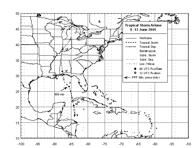
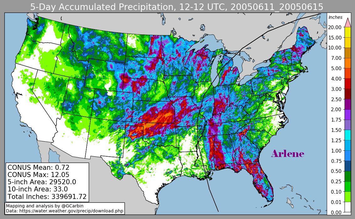
Arlene formed June 8th near the northeastern coast of Honduras and became
 a tropical storm on the 9th about 170 miles west-southwest of Grand Cayman.
Arlene moved slowly northward with steady intensification and crossed
western Cuba near Cabo Corrientes with winds of 50 mph.  The storm continued
northward over the eastern Gulf of Mexico where it reached its peak intensity
of 70 mph.  Thereafter...Arlene weakened and made landfall very near Pensacola
Florida with 60 mph winds. The cyclone continued to weaken as it moved northward
farther inland and was absorbed by a frontal wave on the 14th over southeast
Canada.  One student died in a rip current triggered by Arlene at Miami
Beach, Florida.  Below is the track of this storm.
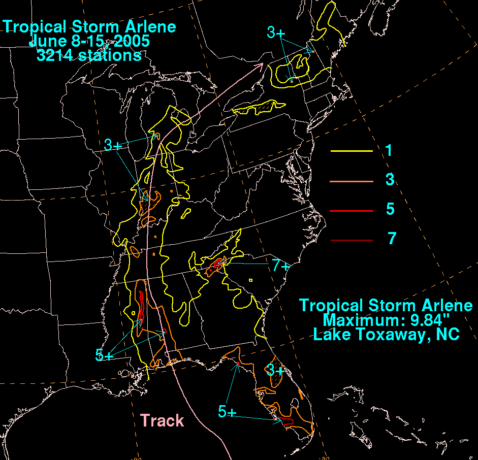
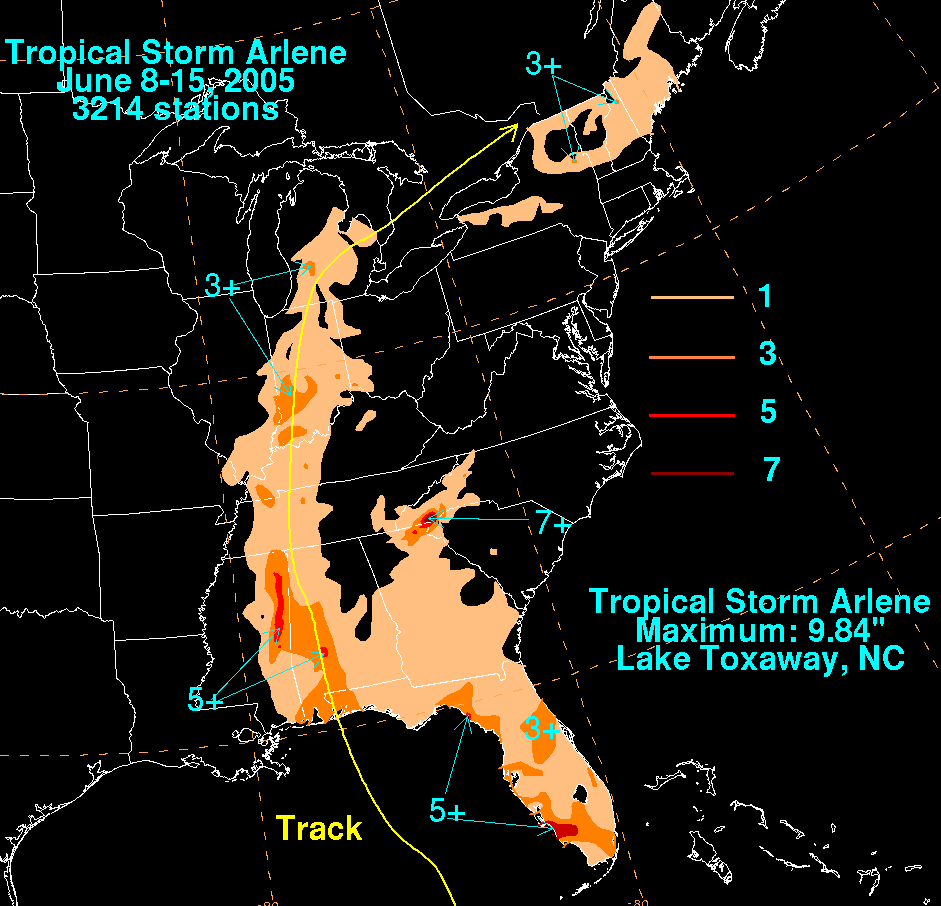
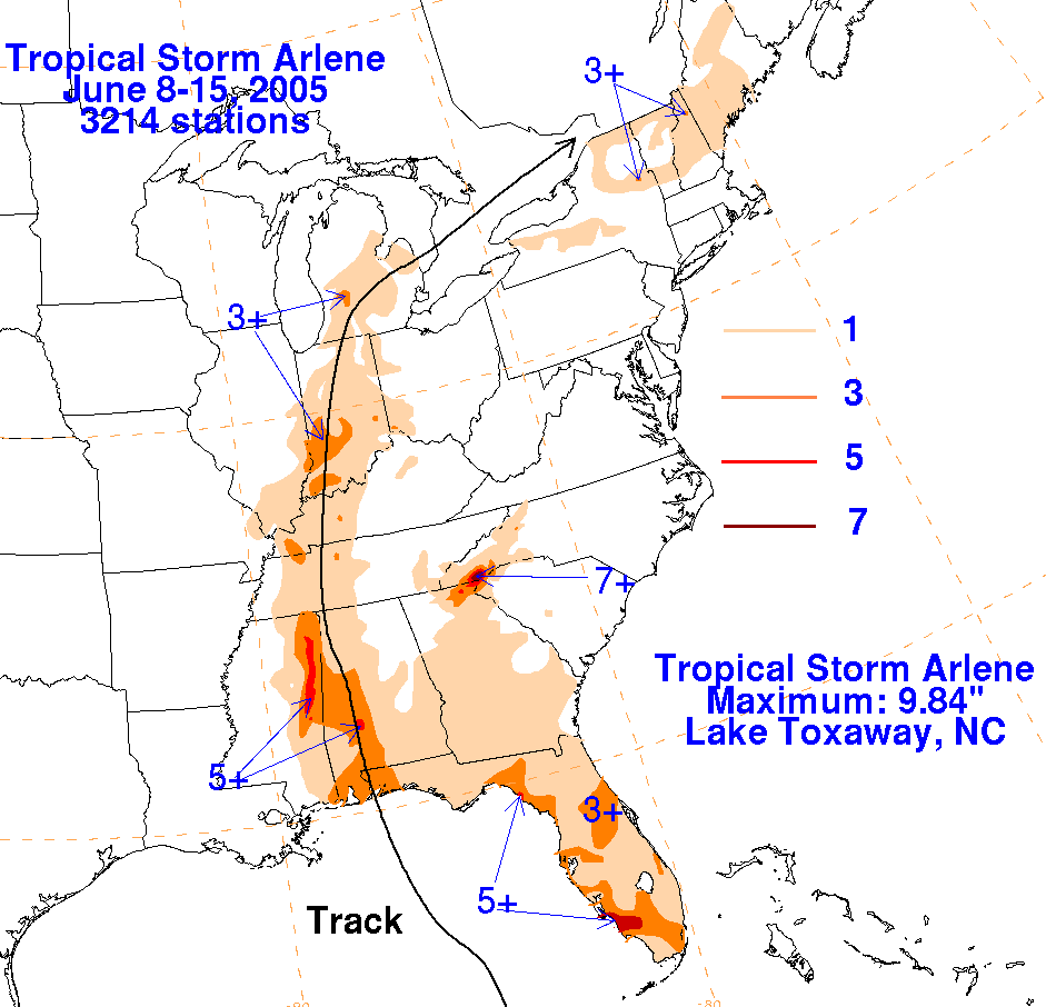
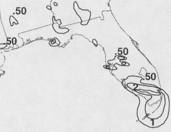
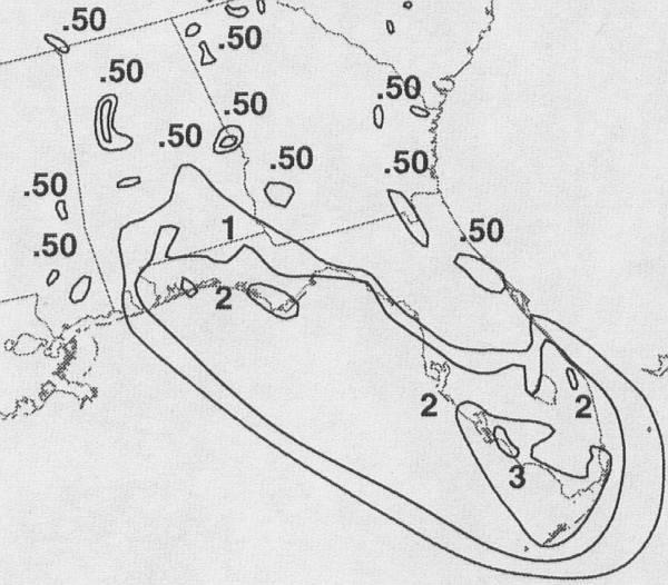
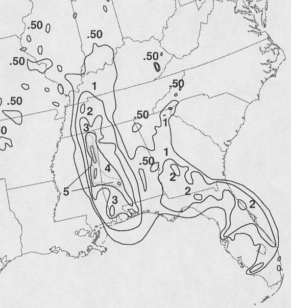
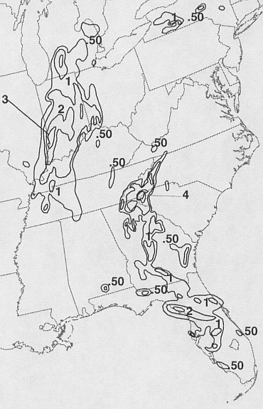
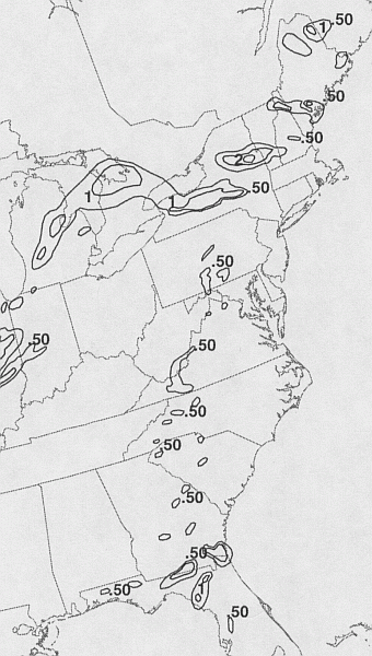
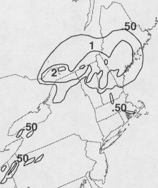
The first three storm total rainfall maps below were constructed using rain guage data
reported by the River Forecast Centers
and the Georgia Agricultural Environmental Mesonet Network. The fourth map used radar-
derived information as well.
 |
 |
 |
 |
Below are the calendar for Daily Precipitation Maps.
Note that
the 24-hour periods end
at 12z that morning.