An upper level low formed over the Gulf of Mexico, causing a disturbed area of weather to form to its east on May 30th. The system
slowly developed, with a surface low forming on the 31st. The convective low moved slowly north-northwest on June 1st, becoming
a tropical depression that day and a tropical storm that night. By early on the 2nd, the upper level low/trough had progressed
eastward, which forced Arlene to double back to the south. By the night of the 2nd, vertical wind shear had taken its toll and
Arlene regained tropical depression status. On the 3rd, it entered the Florida Straits as a low pressure area/post-tropical
cyclone, which moved east and then east-northeast through the Bahamas by the 5th.
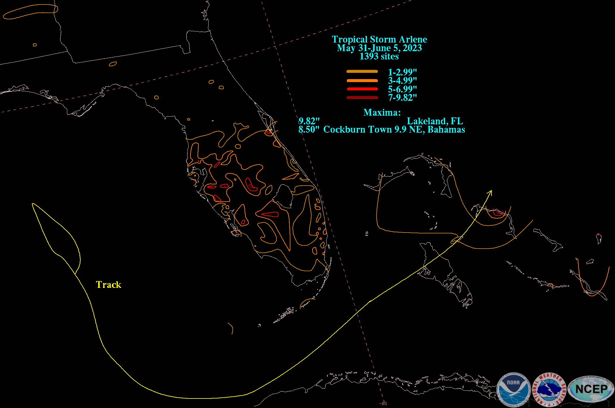
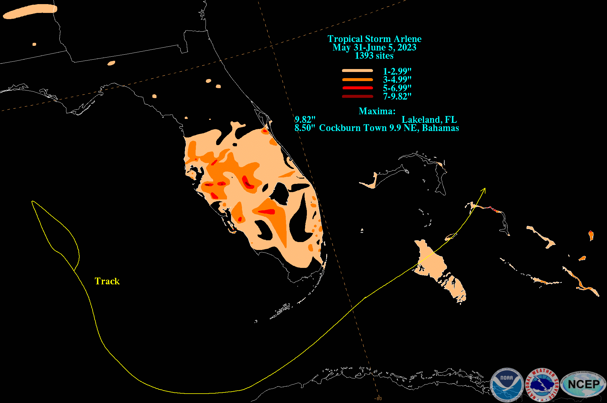
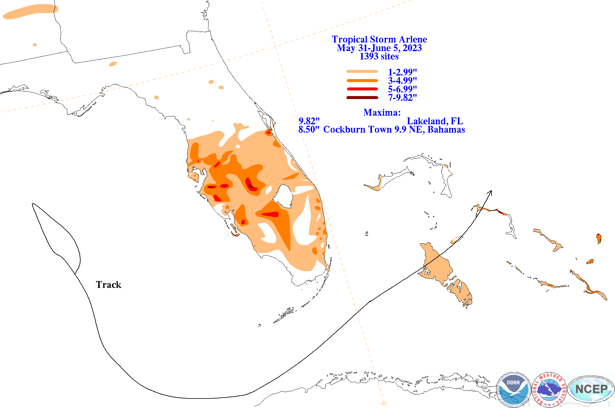
The graphics below show the storm total rainfall for Arlene, which used rain gage information from National Weather Service River Forecast
Centers, xMACIS2, National Weather Service Forecast Offices, and CoCoRAHS.
 |
 |
 |