A cold front stalled over the Florida Straits around May 10, and caused showers and thunderstorms over the next few days.
An upper level disturbance moved into the Gulf of Mexico on the 14th, which enhanced thunderstorm activity on the 14th
over the Florida Straits. By the afternoon of the 15th, an area of low pressure formed, which then moved north-northeast
just offshore southeast Florida on the 16th. By that afternoon, it had gained enough organization to be considered a
tropical depression east of Melbourne, FL. That evening, the depression intensified into a tropical storm east-
northeast of Cape Canaveral, FL. After drifting slightly away from the Gulf Stream on the 17th, it moved back
over it on the 18th while vertical wind shear increased as it moved fairly close to the North Carolina coast.
The storm then moved northeast with a little more strengthening on the 19th before beginning its transition to
an extratropical cyclone, which was complete on the 20th. The low then turned southeast and southward,
moving nearby Bermuda on the 21st.
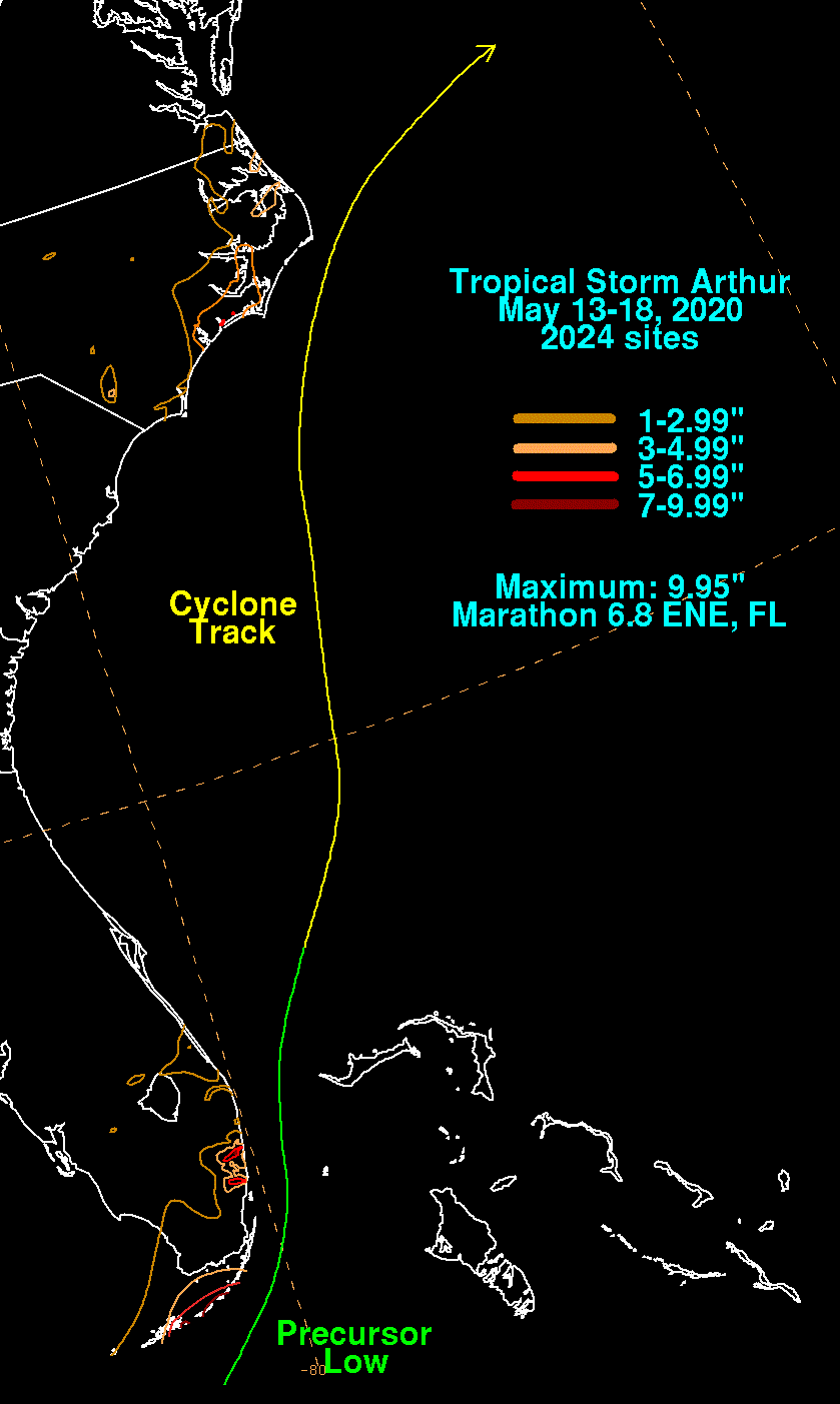
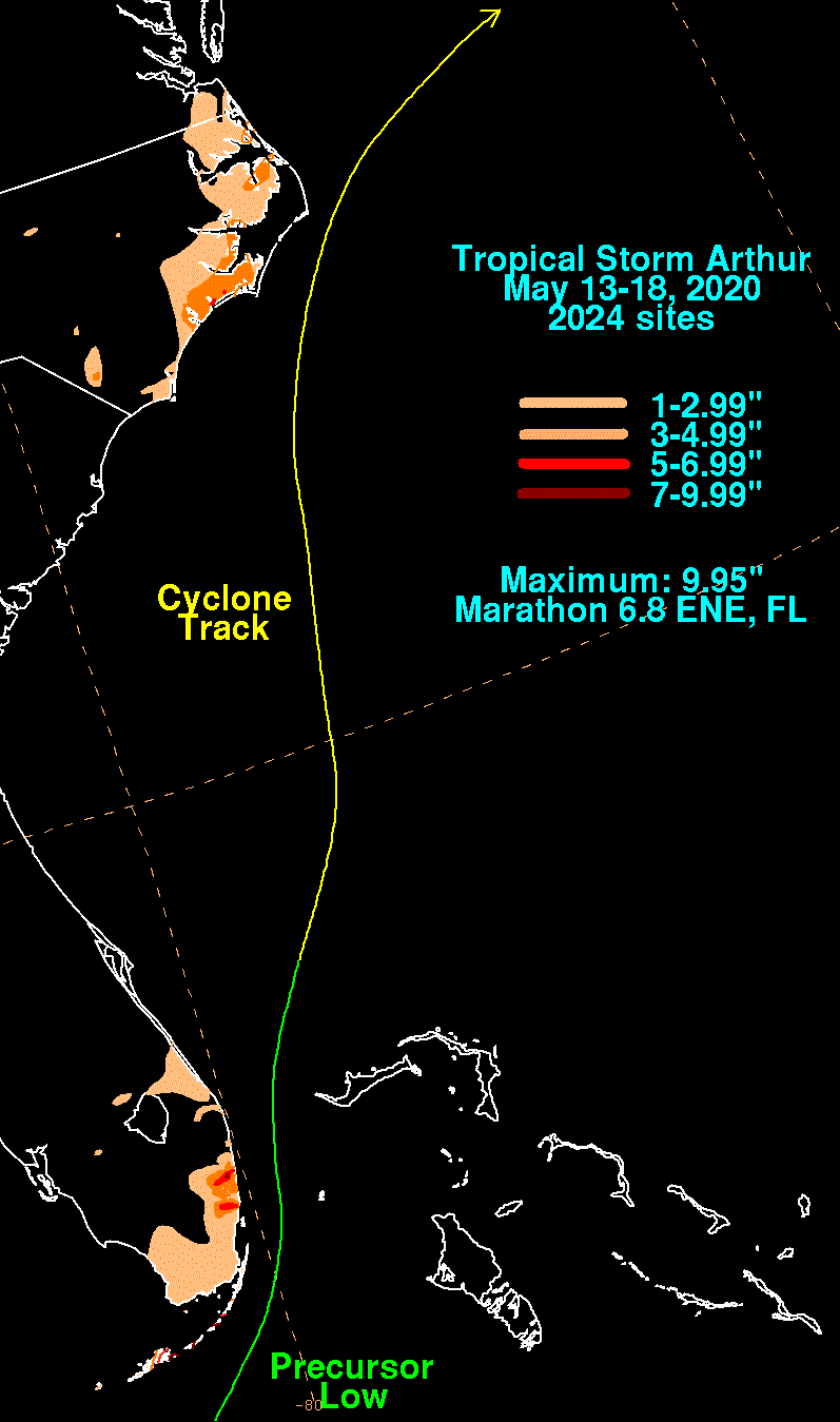
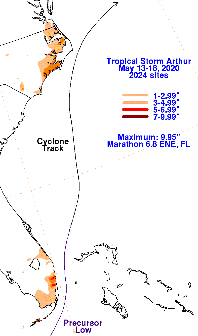
The graphics below show the storm total rainfall for Arthur, which used rain gage information from the National Weather
Service River Forecast Centers, Forecast Offices, and CoCoRAHS.
 |
 |
 |