A tropical wave moved off the coast of Africa on August 23rd. It reached the Gulf of Mexico where it interacted with
an upper cyclone on September 2nd. At that time, a burst of convection covered Florida and the adjacent Atlantic and
Gulf of Mexico. By the 3rd, the upper cyclone dropped southwest into the Gulf of Mexico, and a surface low formed
west of Florida with a cold core. Convection was concentrated in a large band from the central Gulf of Mexico to
the Mississippi Delta. Gales within this band near the coast led to Babe's designation as a tropical storm in real-time.
Its cold core nature led to its subtropical desgination after the fact. On the 4th, maximum sustained winds began
drawing in closer to the center. The flow aloft became increasingly anticyclonic as the upper cyclone continued
retrograding through the Gulf of Mexico. By afternoon, Babe had transitioned into a tropical cyclone.
Large pressure falls along the central Gulf coast led to a change in course, as it led to Babe's turn to the north. The
system moved inland into Louisiana, and its satellite signature actually improved as it moved through the Southeast
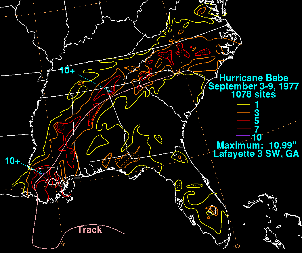
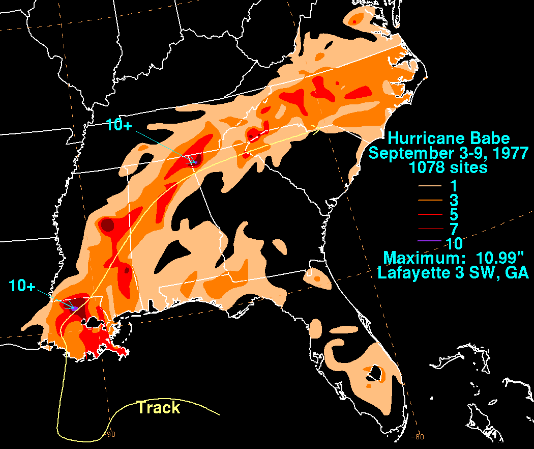
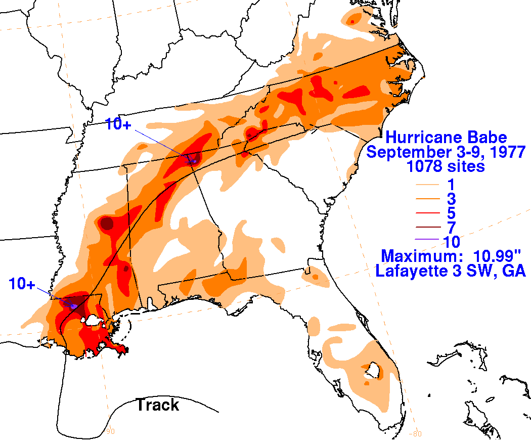
as a tropical depression. The surface circulation of Babe dissipated in North Carolina. The graphics below show
the storm total rainfall for Babe, using data provided by the National Climatic Data Center in Asheville, North
Carolina.
 |
 |
 |