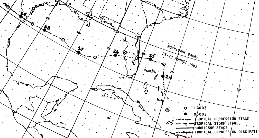
A tropical disturbance moved off the northwest coast of Africa on August 13th. There was little further
development as it crossed the Atlantic Ocean and approached the Bahamas. A weak trough turned the
system more northerly, which allowed the system to organize into a tropical depression on the 23rd. That
night, it quickly became a tropical storm. Shear increased, and Barry weakened into a tropical depression
as it made landfall in the Florida peninsula. After moving west-southwest through the eastern Gulf of
Mexico, upper level winds became more favorable for development and Barry restrengthened into a tropical
storm, and then a hurricane, as it made landfall on the northeast Mexico coast just south of Brownsville,
Texas. The system quickly dissipated across the mountains of northeast Mexico. Below is the track of this
cyclone, constructed from data provided by the National Hurricane Center.
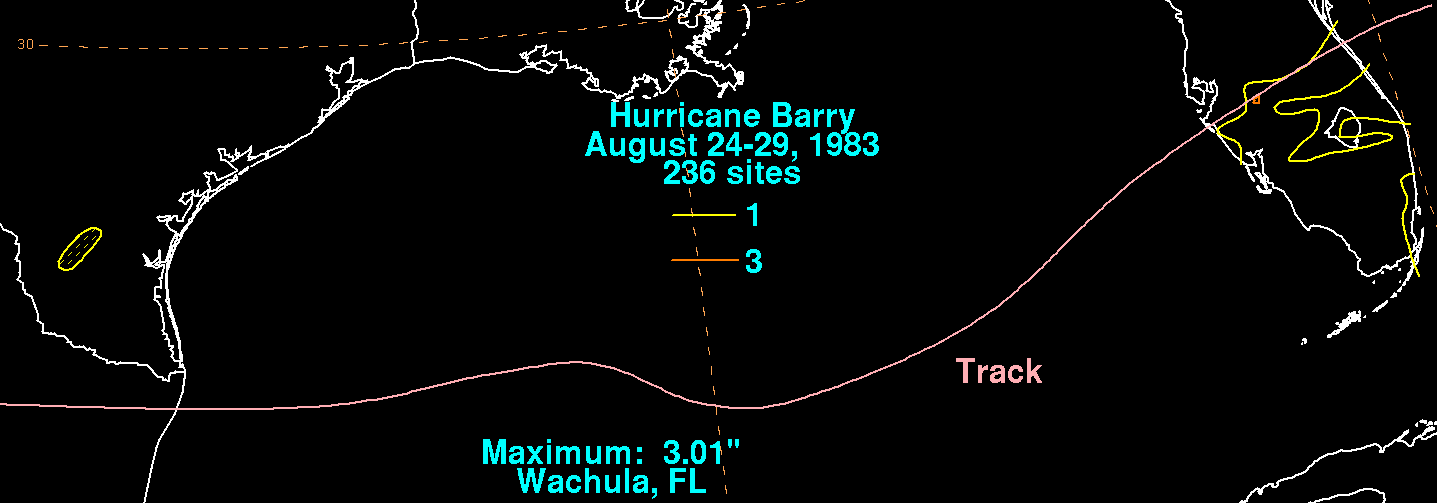
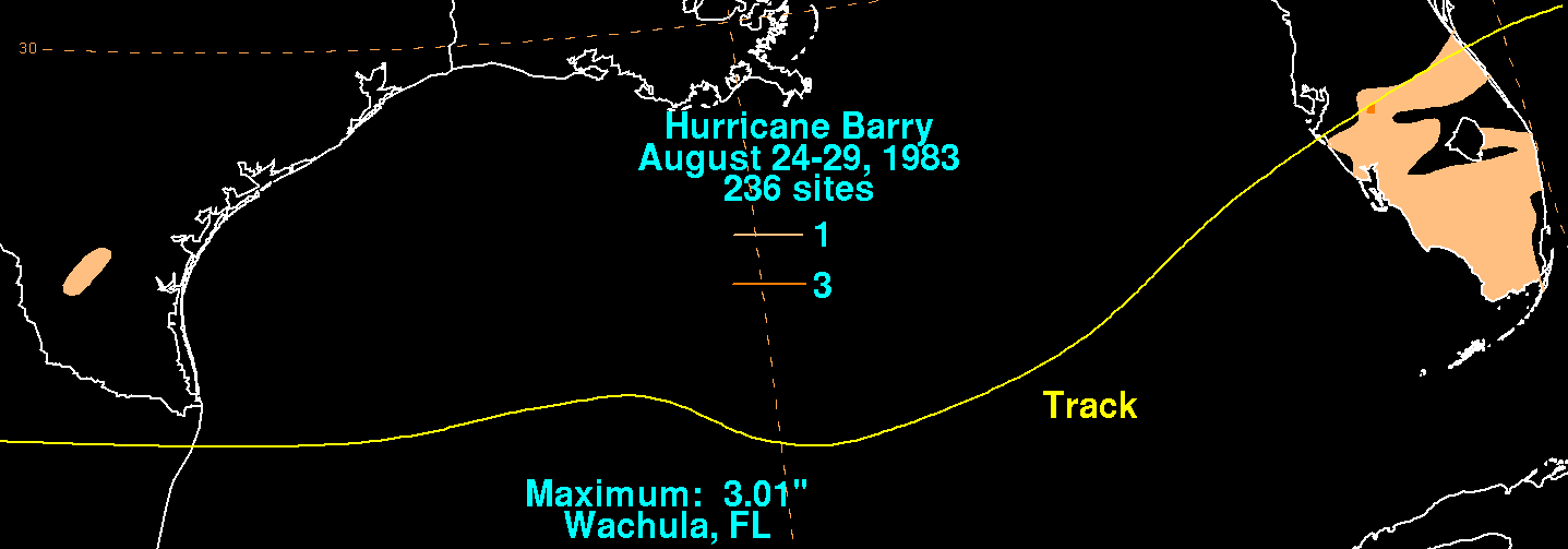
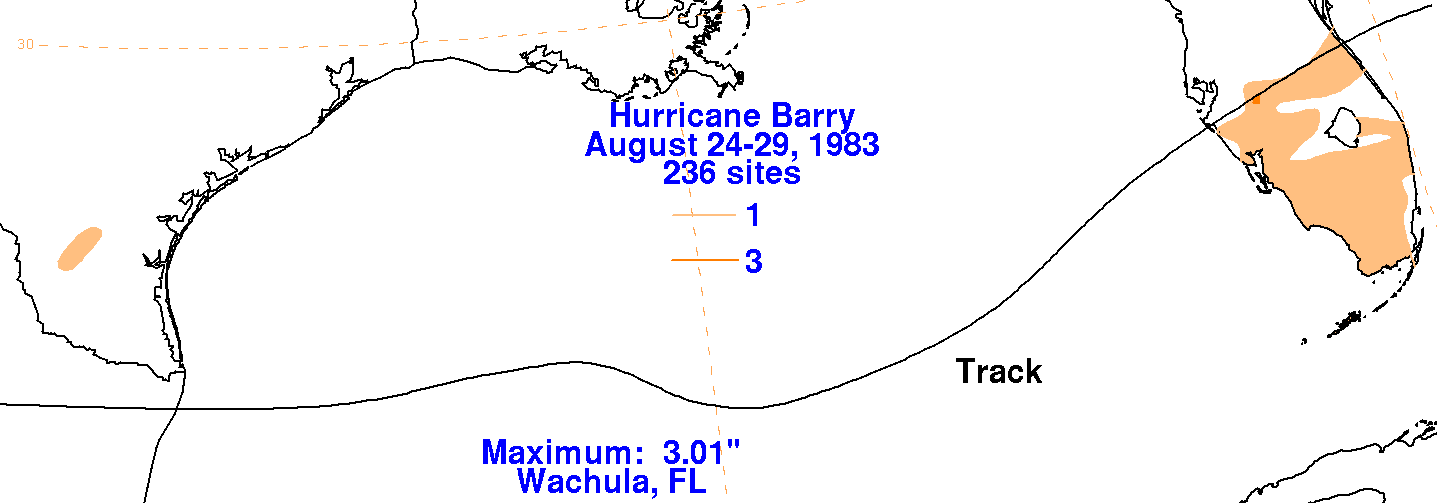
The graphics below show the storm total rainfall for Barry.
Note the maximum lies mainly to the south of the
cyclone's track across Florida, due to the impact of northeasterly
shear on the weak cyclone.
 |
 |
 |