A thunderstorm complex was seen on satellite and radar imagery across southwest Kansas on July 2nd. Its mid-level circulation
moved east, then southeast, into northern Georgia by the 7th when a surface low formed. Occasional thunderstorm development
near the center occurred as it wandered generally southward through Georgia. As it moved into the Florida Panhandle,
additional thunderstorm activity formed near and offshore though activity remained poorly organized. As the system
moved southwest and west-southwest through the northeast Gulf of Mexico, the center of the low became well-defined
and a tropical depression is deemed to have formed on the evening of the 10th about 170 miles south of Mobile, Alabama.
The system strengthened, becoming a tropical storm early on the morning of the 12th as the system tracked westward.
Northely vertical wind shear kept thunderstorm activity constrained to its southern side even as the system strengthened.
Barry turned west-northwest and became a hurricane on the morning of the 13th just prior to landfall to the east-
southeast of Pecan Island, Louisiana.
Thunderstorm activity remained poorly organized as the system moved inland, with Barry regaining tropical storm
status on the afternoon of the 13th and tropical depression status late on the 14th as its center entered
Arkansas. A combination of north to northeast vertical wind shear, sufficient instability, and effective
bulk shear allowed concentrated bands of convection to develop within its southern side which displayed both
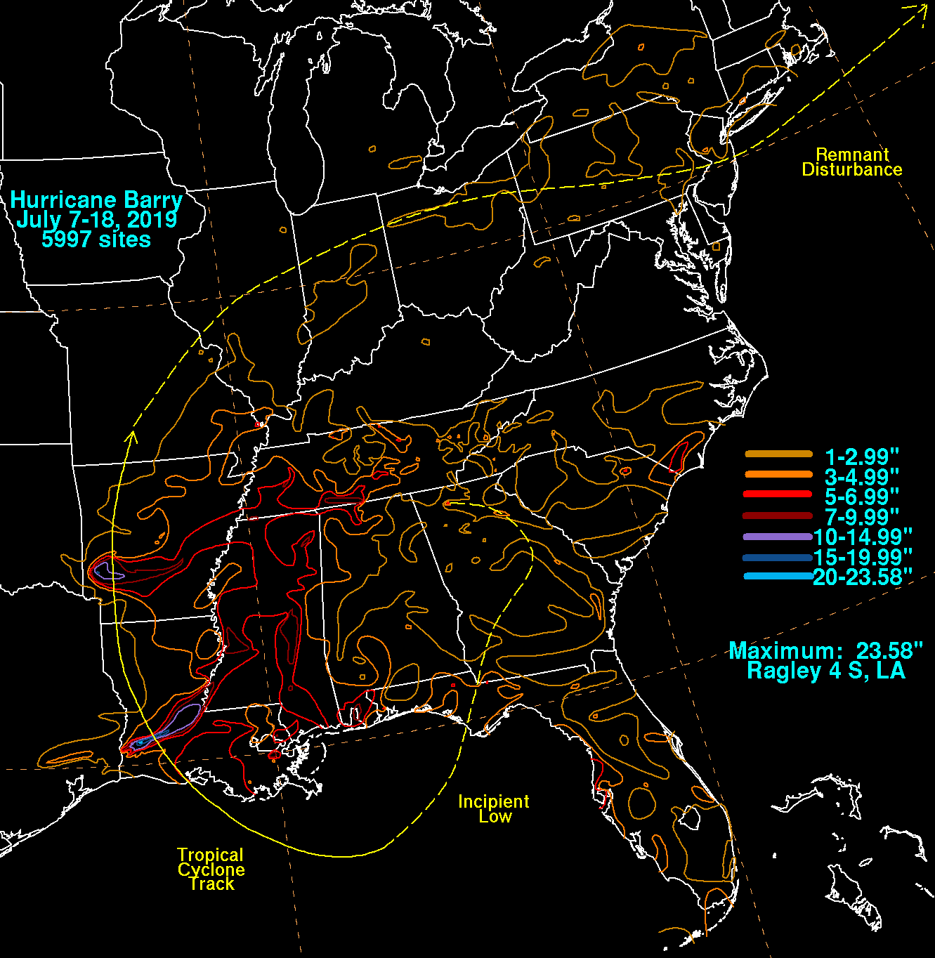
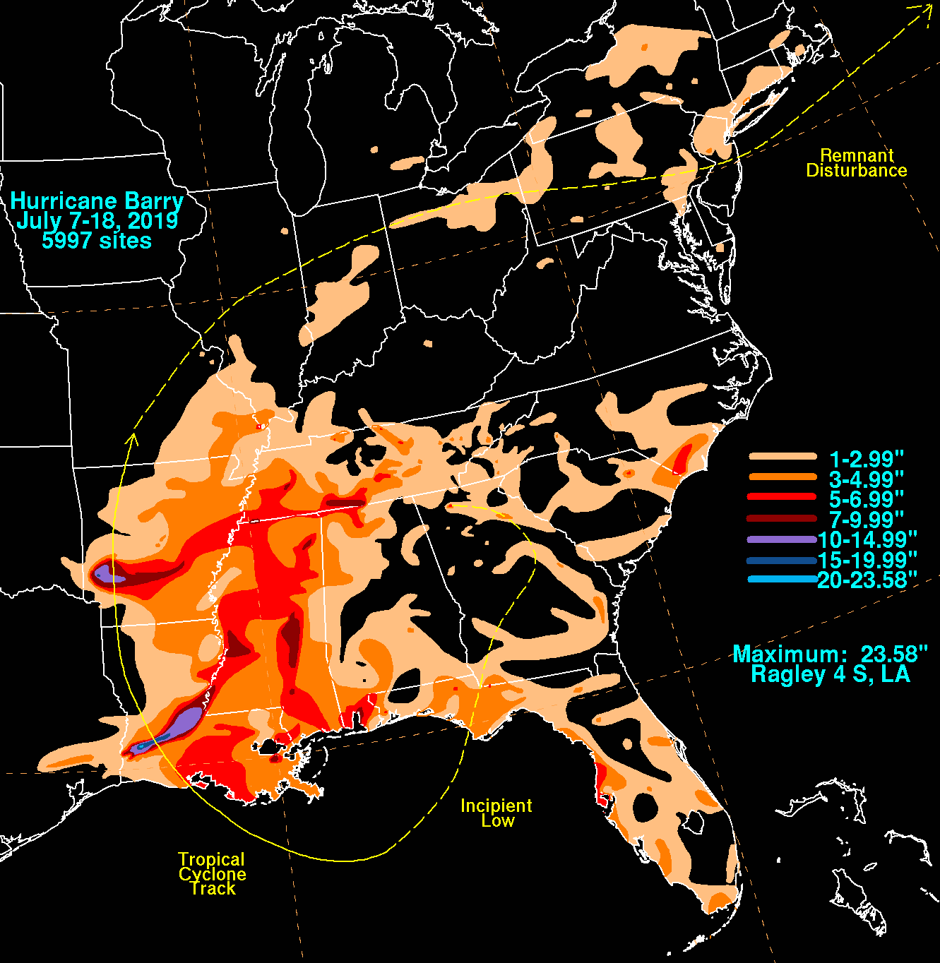
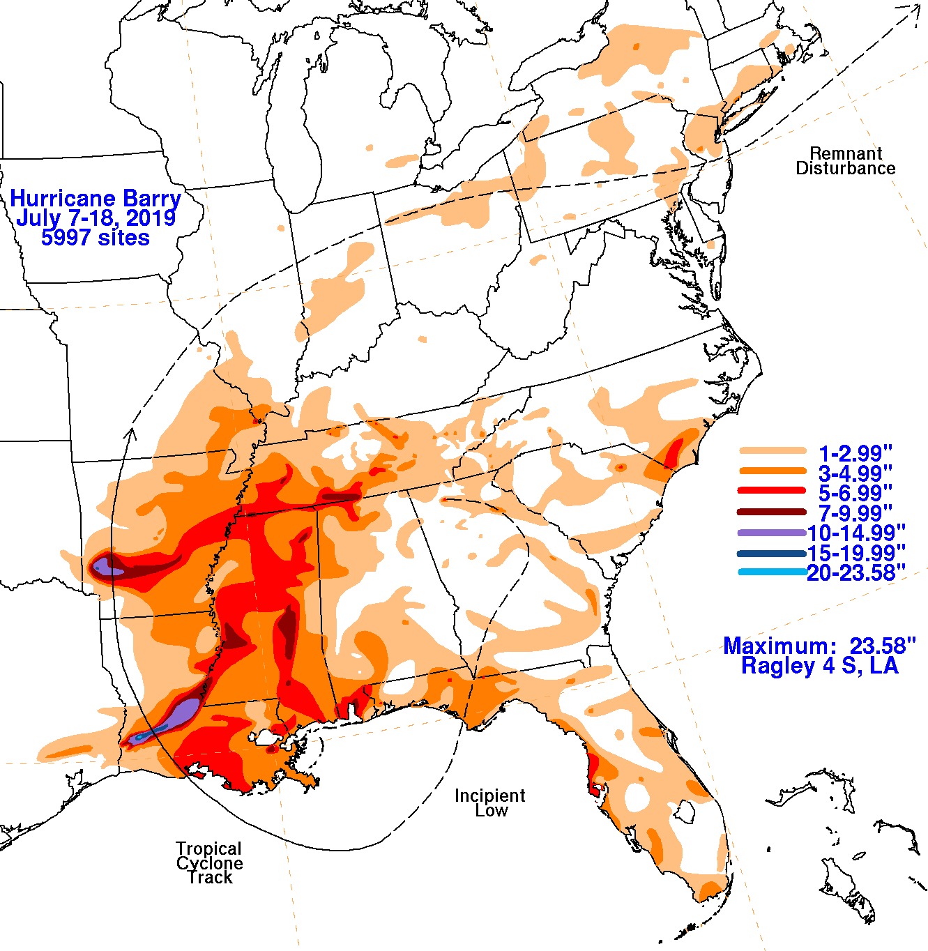
training and backbuilding character which led to prolific rainfall across portions of Louisiana and Arkansas
as Barry continued to weaken while moving into the Midwest. The system became a remnant low on the morning of the
15th which then arced northeast and east ahead of an incoming cold front, moving across Illinois on the afternoon of
the 16th and crossing Ohio on the 17th. By the 18th, Barry's weak area of low pressure linked up with the incoming
cold front as it moved across Pennsylvania and the low moved offshore Long Island late on the 18th before becoming
absorbed by an area of low pressure south of Nova Scotia on the 19th.
The graphics below show the storm total rainfall for Barry, which used rain gage information from the National Weather
Service River Forecast Centers, Forecast Offices, and CoCoRAHS.
 |
 |
 |