A tropical wave moved through the Lesser Antilles on July 16th. Moving westward through the Caribbean
Sea, the wave interacted with a northward surge in the Intertropical Convergence Zone in the western
Caribbean sea to develop a broad area of thunderstorm activity between Swan Island and western Cuba on
the 18th. This was the first system where real-time time-lapse satellite imoves were used for a tropical cyclone
in the Atlantic Basin. The depression moved through the Yucatan Channel while slowly organizing. Becoming
a tropical storm, the system moved between the Bermuda High and an upper low to the west, causing the storm
to move northward. Becky made an attempt to form an eye feature while moving towards the coast, but could
not do so as it approached an upper level low along the U.S. Gulf coast. The system weakened before moving
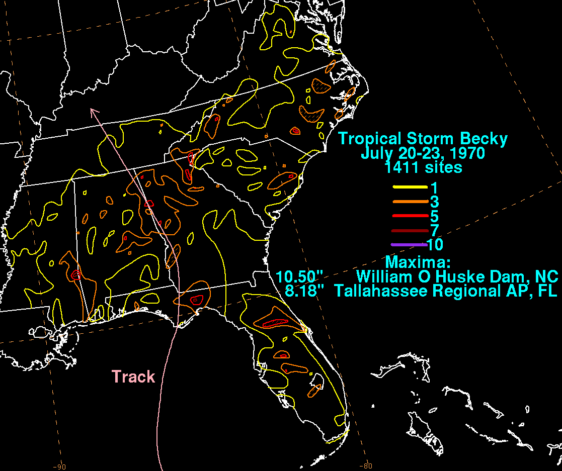
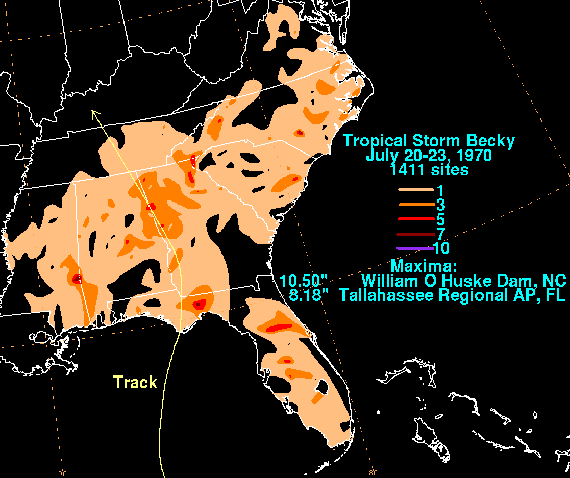
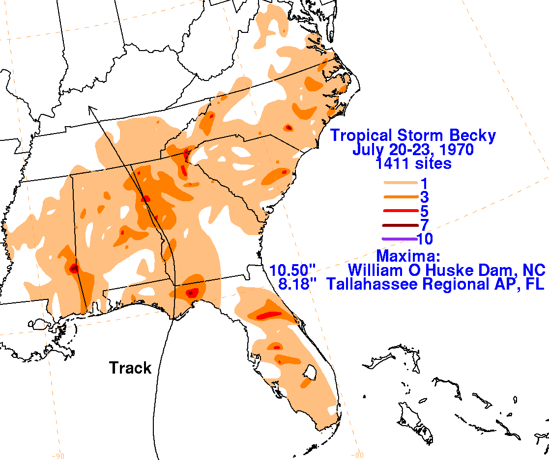
by Tallahassee, where the heaviest rainfall and flooding occurred with the system. As it moved inland, weakening
continued and the low pressure area dissipated as it entered Kentucky. The graphics below show the storm
total rainfall associated with Becky. Data was acquired from the National Climatic Data Center in Asheville,
North Carolina.
 |
 |
 |