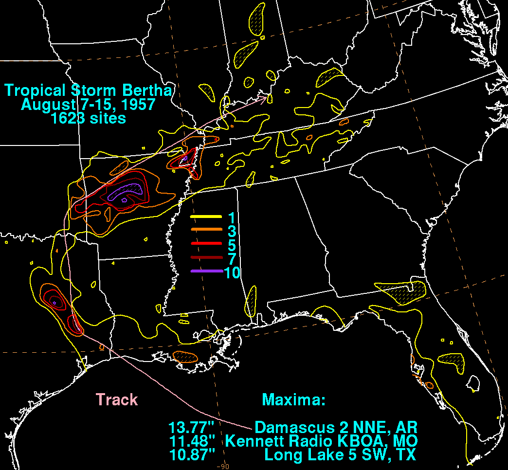
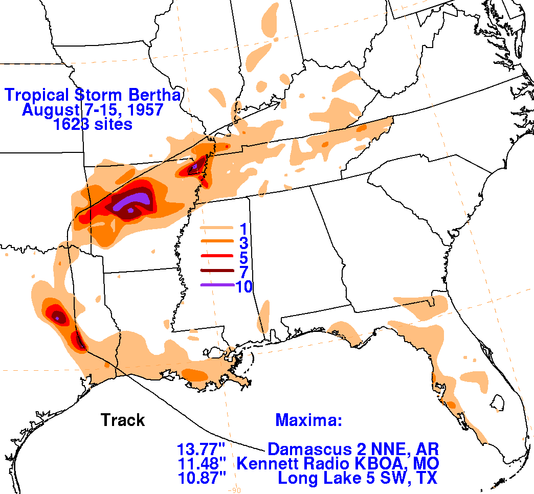
Tropical Storm Bertha - August 7-15, 1957
A weak extratropical low entered the northeast Gulf of Mexico on August 6, and drifted slowly to the west.
Organizing as it moved over the Gulf of Mexico, the system became a tropical storm by the morning of the
8th south of the Mississippi Delta.  The system moved west-northwest, moving ashore the southwest corner
of Louisiana late on the 9th, the same town struck by Audrey only six weeks beforehand.  The weakening
storm moved northward through eastern Texas, dropping heavy rainfall on the Piney Woods before recurving
through Oklahoma into Arkansas as a remnant low.  A second burst of heavy rainfall fell across central Arkansas,
setting a 24-hour rainfall record for Damascus, Arkansas which still stands today, and helping August 1957 become
their wettest month of record.  A third area of heavy rains fell across the Bootheel of Missouri as the system
moved east-northeastward, and the system weakened as it moved across northern Kentucky.  The storm total
rainfall maps below were constructed using data from data archived at the National Climatic Data Center in
Asheville, North Carolina.