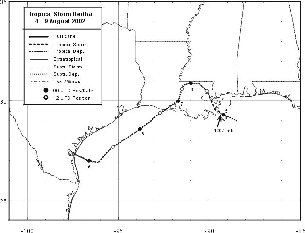
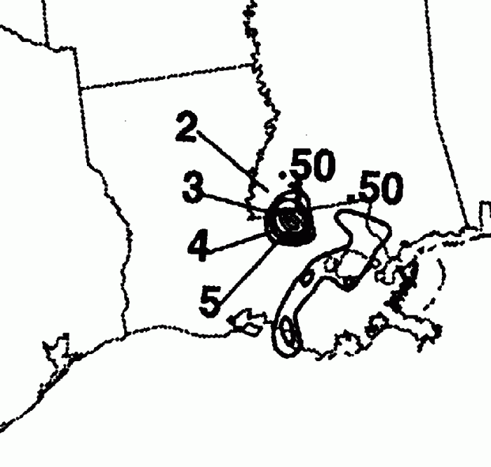
This cyclone originated within an old frontal trough in the Gulf of Mexico on the 3rd. By the afternoon
of the 4th, it had organized into a tropical depression, before heading northwest into Louisiana as a
tropical storm late on the 4th. Once the center headed west of Slidell, a northeast- southwest oriented
high pressure ridge blocked its previous movement, forcing the cyclone west-southwest. It weakened
into a tropical depression, then moved back out into the Gulf of Mexico before striking Texas on the 9th
and dissipating. Below is the track of Bertha, furnished by the National Hurricane Center.
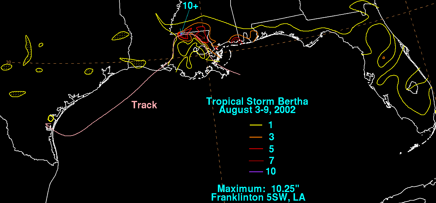
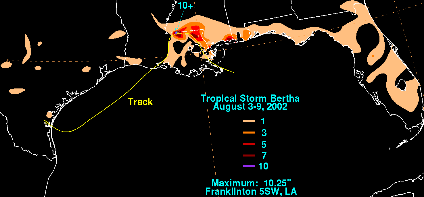
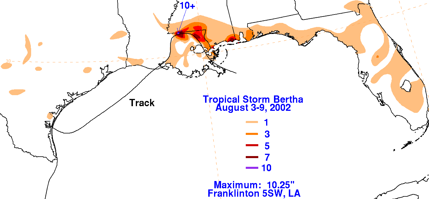
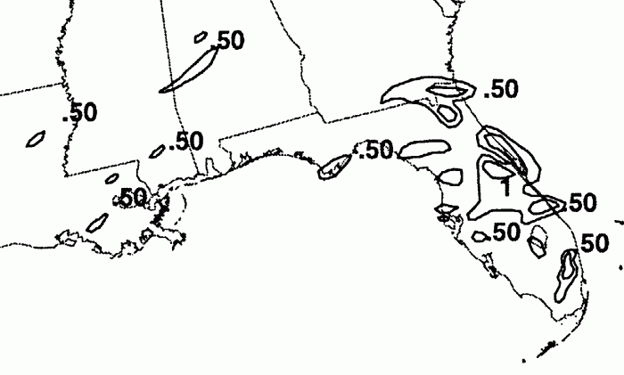
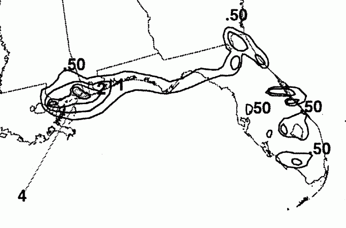
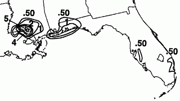
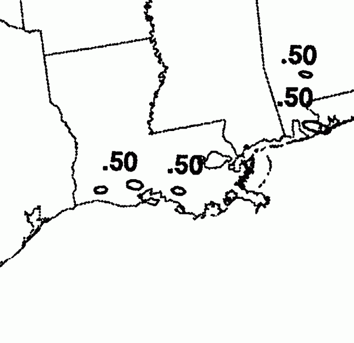
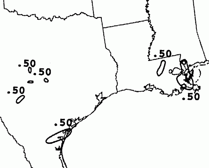
The storm total rainfall maps below were constructed using data from
the
National Climatic Data Center.
 |
 |
 |
Below are the calendar for Daily Precipitation Maps. Note that
the 24-hour periods end
at 12z that morning.