An upper level disturbance and surface trough formed over the southeast Gulf of Mexico late on May 24th. The system
moved northeast, bringing widespready showers and thunderstorms to parts of Florida, the Bahamas, and the adjacent Gulf
of Mexico and western subtropical north Atlantic over the next couple days. By the 26th, a low pressure system
developed over portions of central and northern Florida. Once the system moved near the Georgia and South Carolina
coasts it became well-defined, with the system considered a tropical cyclone -- its small radius of maximum winds
ruled against subtropical cyclone status, despite its hybrid character. Strengthening slightly, Bertha moved ashore
near Charleston, South Carolina on the 27th. The system regained tropical depression status that afternoon and became
post-tropical (extratropical) over West Virginia early on the 28th, dissipating as it entered the Ohio Valley.
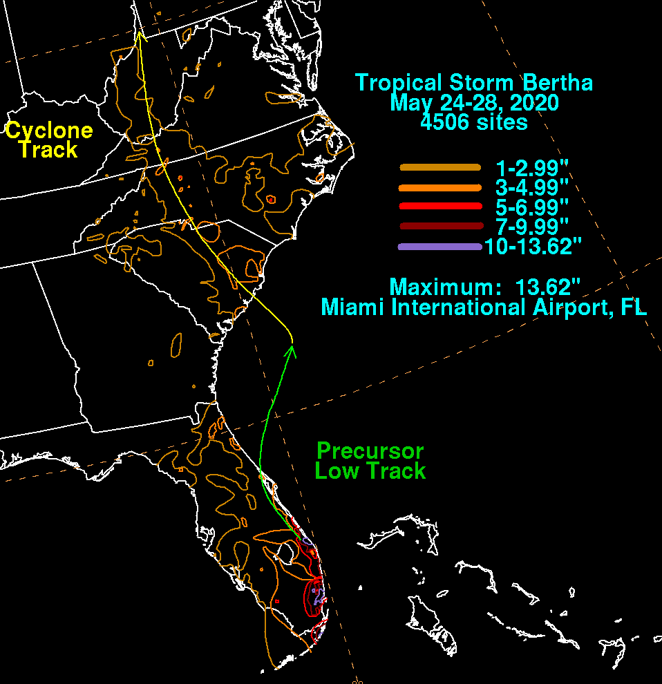
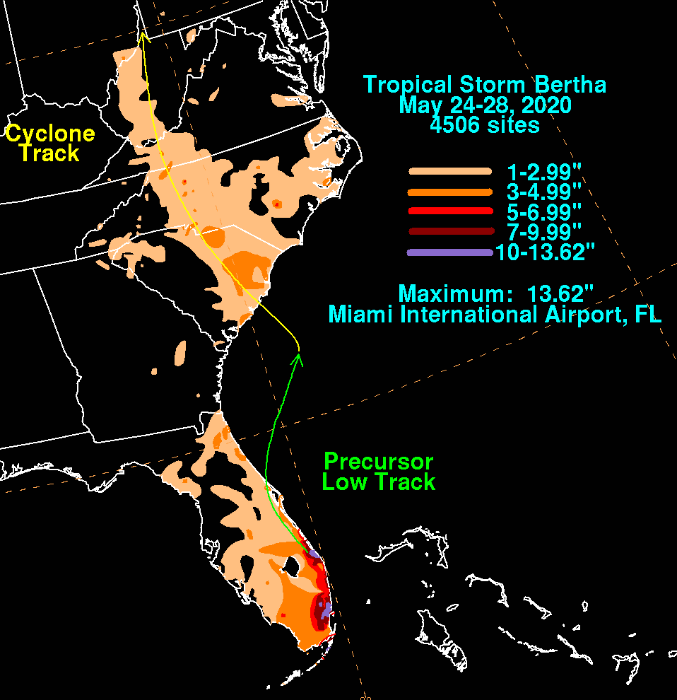
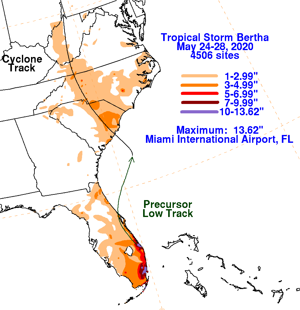
The graphics below show the storm total rainfall for Bertha, which used rain gage information from the National Weather
Service River Forecast Centers, Forecast Offices, and CoCoRAHS.
 |
 |
 |