A weak low pressure area was noted as early as the the evening of
August 3rd offshore the middle
Gulf coast, to the east of an upper low in eastern Texas. The low
remained quasi-stationary for the
next several days. In the meantime, the upper low migrated
southwestward creating a more favorable
upper environment over the weak low. By the evening of the 6th,
the low had drifted northwest into
southeast Louisiana. The next evening, the cyclone drifted back
towards the Mouth of the Mississippi
and had enough convective organization to be desginated a tropical
depression.
By the morning of the 8th, the system futher strengthened into a
tropical storm just west of the
Chandaleur Islands. By that evening, an upper trough digging in
from the northeast destroyed the
upper high over Beryl. As a front approached from the northwest,
Beryl turned back around to the
northwest into Louisiana. By the evening of the 9th, the system
degenerated back into a tropical
depression as it moved through the Teche country. The surface low
slowly spun down, and was
last seen across northeast Texas on the morning of the 12th. The
upper portion of its circulation
was idenifiable for an additional day as it recurved through central
Oklahoma ahead of a shortwave
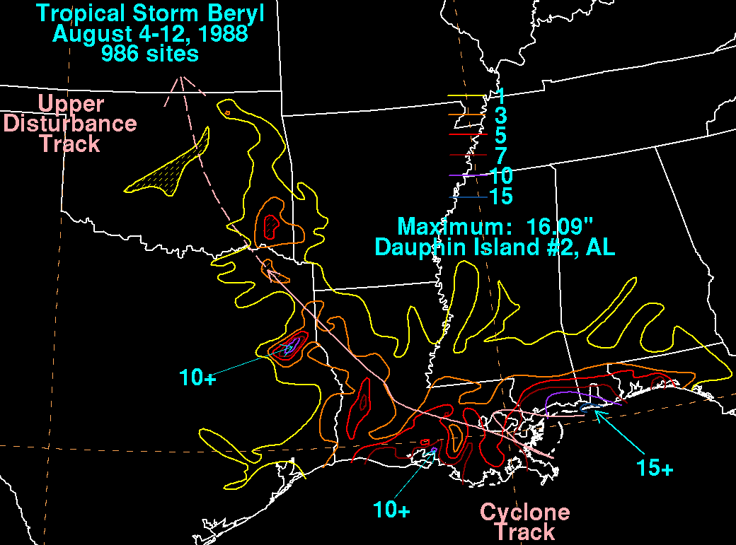
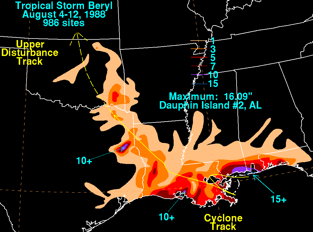
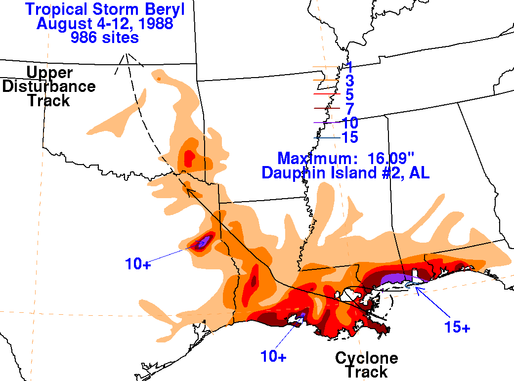
embedded in the westerlies over the Rockies. Below is the track
of this
storm, provided by the
National Hurricane Center.

After final
landfall, the rainfall maximum shifted left of track due to
northeasterly flow
aloft. The
storm total rainfall maps below were constructed using data from
the
National Climatic Data Center.
 |
 |
 |