An elongated area of low pressure formed in the western Caribbean Sea on May 23, under the base of the upper level
trough which spawned Tropical Storm Alberto a few days earlier. The system moved northeast, crossing Cuba and
the Florida Straits on the morning of the 24th. Once the system reached a point a few hundred miles east of the
coast of the Carolinas, the system had developed enough thunderstorm activity near its center to be considered
a subtropical storm on the evening of the 25th, as its wind field was broad and it was co-located with an upper
level low.
The system tracked west-southwest and westward, slowly constricting its wind field and developing stronger
thunderstorm activity near its center, evolving into a tropical storm on the 27th. The system briefly formed an
eye feature early that afternoon, and moved inland near Jacksonville Beach, FL that night. Slowly weakening as it
moved inland, Beryl became a tropical depression on the 28th, moving as far as Valdosta, GA before turning northeast.
Beryl accelerated to the east-northeast and moved along the coast of the Carolinas before transitioning to an extratropical
cyclone on the 30th. The cyclone moved eastward out to sea, moving around the southern periphery of a large extratropical
cyclone well east of Atlantic Canada. The remains of Beryl intensified significantly on June 3rd as it rotated around
the other extratropical cyclone, absorbing the system. After turning back to the west, a new cyclone formed to its
east, absorbing Beryl's remnant on the 5th.
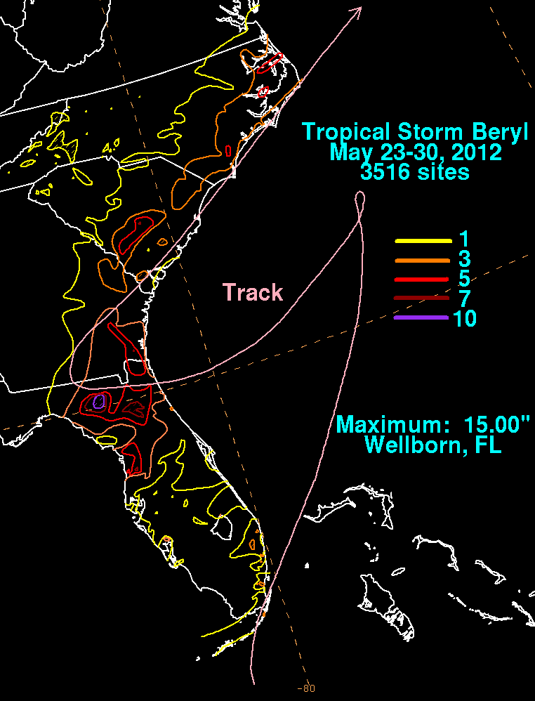
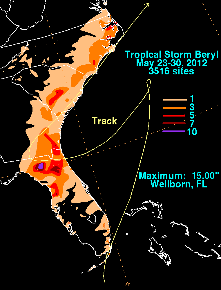
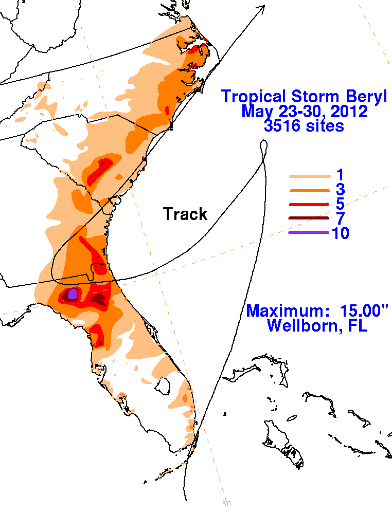
The first three graphics below show the storm total rainfall for Andrea, which used rain guage information from the National
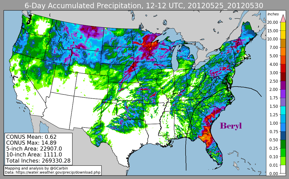
Weather Service River Forecast Centers, Forecast Offices, and CoCoRAHS. The fourth graphic includes radar-derived information.
 |
 |
 |
 |