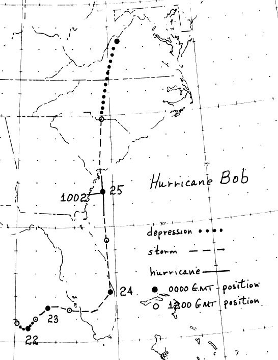
Bob's development was spurred by a tropical wave which entered the eastern Gulf of Mexico on July
20th. On the 21st, a low level circulation formed off southwest Florida, reaching tropical depression
status. By the afternoon of the 22nd, the depression had strengthened into a tropical storm. Moving
eastward, Bob moved across south Florida on the 23rd and turned northward as it neared the Gold
Coast. Intensifying as it was edging offshore Florida, Bob became a hurricane on the afternoon of
the 24th to the east of Jacksonville, and remained a hurricane until landfall in South Carolina on the
night of the 25th. Slowly curving north-northeast, Bob's surface low weakened as it paralleled,
and ultimately absorbed, by a frontal wave to its northwest on the morning of the 26th. Its area
of weather remained separate, moving anticylonically around a ridge to its southeast through southern
New England. Below is the track of this cyclone, constructed from data provided by the National
Hurricane Center.
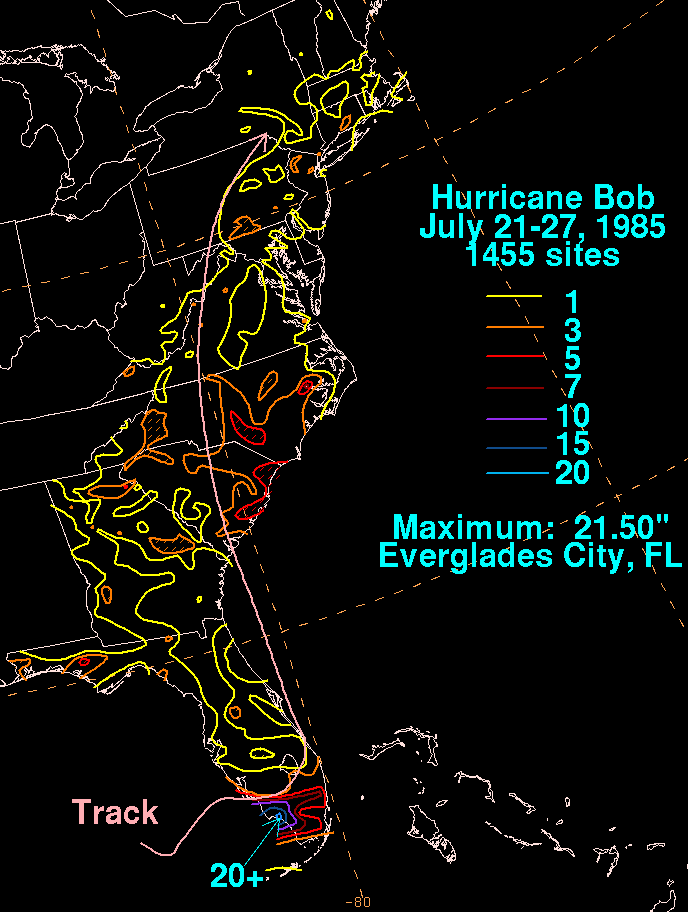
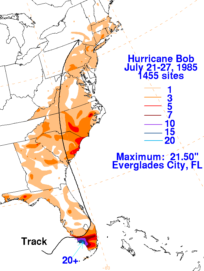
The graphic belows show the storm total rainfall for Bob. Note the maxima lie mainly to the right of the
cyclone's track.
 |
 |
 |