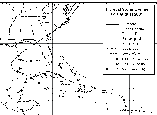
Bonnie developed from a tropical wave that crossed Dakar, Senegal on 29 July, and moved westward
for several days accompanied by cloudiness, thunderstorms and a well-defined cyclonic rotation at the
mid-levels. The shower activity became concentrated and the system developed a few convective bands
as it moved westward. Data from QuikSCAT suggested that a small surface circulation had developed, and
it is estimated that a tropical depression formed during the morning of 3 August when the system was
located about 360 n mi east of Barbados in the Lesser Antilles. The depression moved westward near 23
mph and lost its surface circulation when it entered the eastern Caribbean Sea. As a tropical wave, it
continued moving rapidly to the west and the west-northwest producing intermittent convection. Once
the system reached the western Caribbean Sea, it developed significant convection and regenerated
a surface circulation. It is estimated that the tropical depression re-developed about 100 n mi southeast
of the western tip of Cuba during the morning of 8 August. The depression move toward the west-
northwest across the Yucatan Channel and became Tropical Storm Bonnie near the northeastern tip
of the Yucatan Peninsula. Bonnie moved north and northeast, reaching its maximum intensity of 65
mph and a minimum pressure of 1001 mb early in the afternoon of 11 August. Strong southwesterly
wind shear became established over Bonnie and the cyclone began to weaken. It made landfall near
Saint Vincent and Saint George Islands just south of Apalachicola, Florida as a tropical storm. These
winds were confined to coastal sections to the east of the center. As a depression, Bonnie continued to
move northeastward, across the eastern United States. It finally became a weak frontal wave just south
of Cape Cod on the evening of 13 August. Below is a track of the cyclone provided by the National
Hurricane Center.
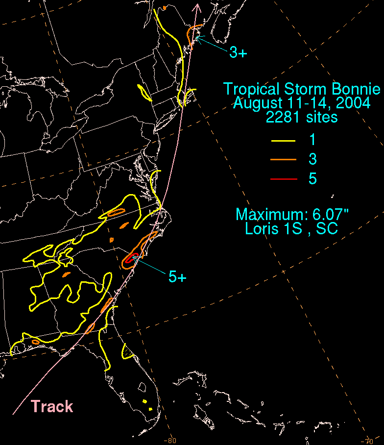
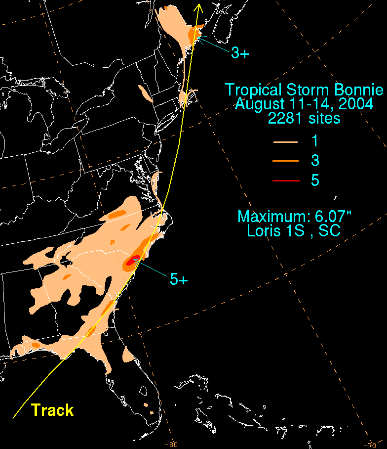
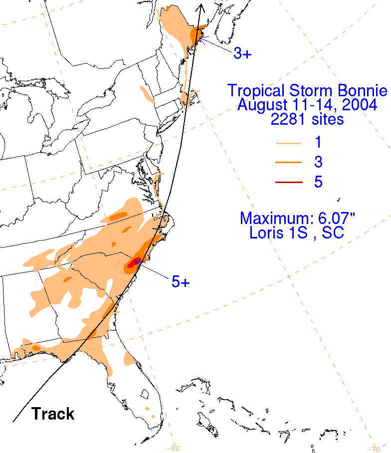
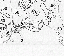
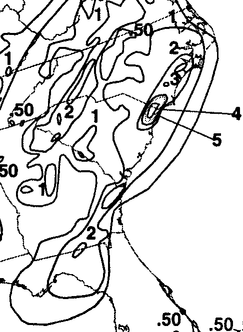
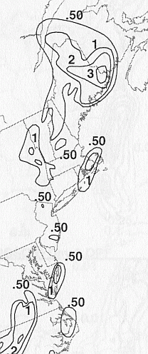
The storm total rainfall map below was constructed using data from
data
provided from NWS River
Forecast Centers, as well as additional reports received
by the
National Hurricane Center.
 |
 |
 |
Below are the calendar for Daily Precipitation Maps. Note that
the 24-hour periods end
at 12z that morning.