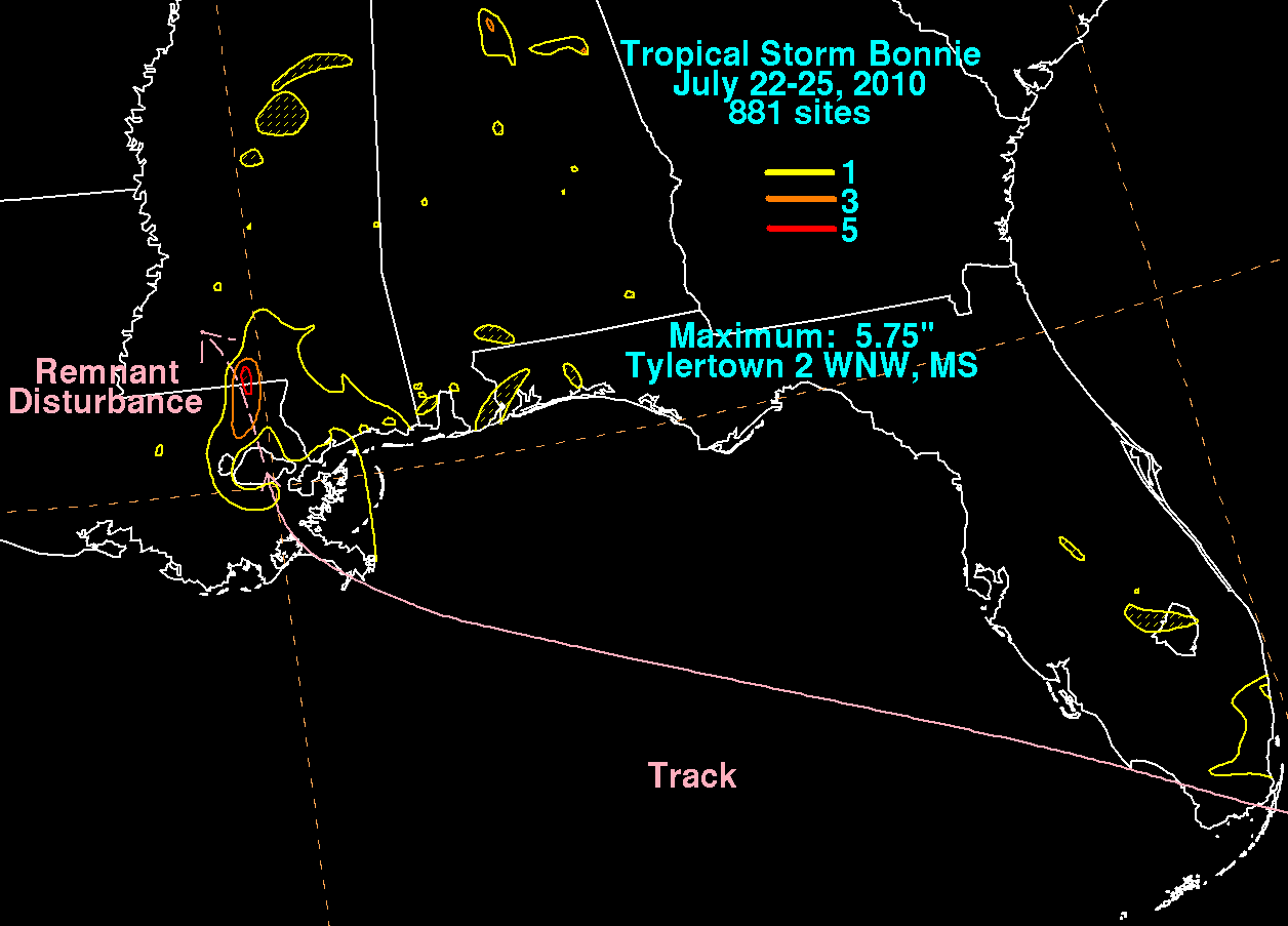
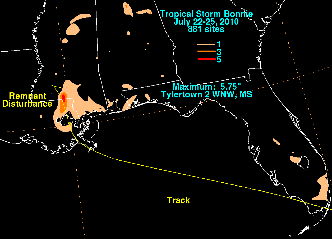
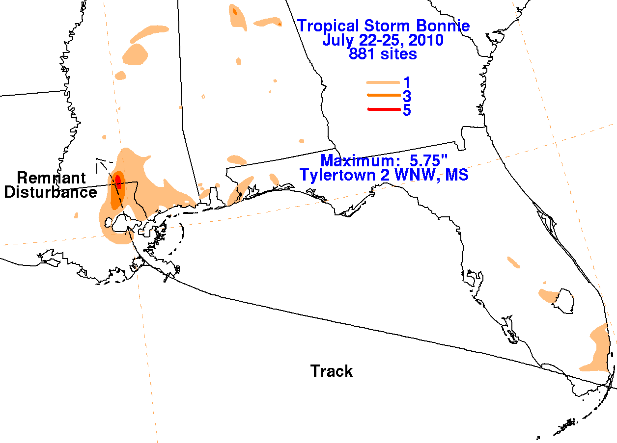
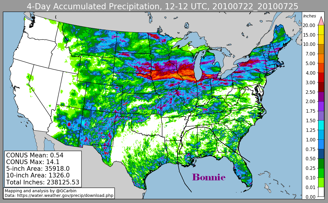
Tropical Storm Bonnie - July 22-25, 2010
A tropical disturbance, accompanied by an area of thunderstorms, developed east of the Leeward Islands, which caused surface pressures
to fall on the 19th.  The disturbance tracked west-northwest to the north of the Leewards without developing a closed wind circulation.  As it
moved into the Bahamas, convective organization increased and an area of low pressure formed between Acklins and Great Inagua.  At this
point, the system was well enough organized to be considered a tropical depression, the third of the season.  The system moved along the
southern fringe of the Bahama Bank, and developed into a tropical storm as it approached Nassau from the southeast.  Its forward motion
increased as it approached Florida, which halted development due to increasingly unfavorable vertical wind shear.  The convection was
deteriorating upon landfall in southernmost Florida, and Bonnie regained tropical depression status during the afternoon of the 23rd.  Showers
and thunderstorms became intermittent around its low pressure center, which continued weakening even after moving into the Gulf of Mexico.
Since the system did not regain persistent central thunderstorms, it became a remnant low 100 miles southeast of the Mouth of the Mississippi
river.  The remnant low moved into southeast Louisiana early on the 25th, drifting northward.  As its surface circulation dissipated near New
Orleans mid-morning, a cluster of thunderstorms formed to its north near the Louisiana/Mississippi border, dropping locally heavy rains.  The
area of thunderstorms dissipated that evening.


Below are the associated rainfall graphics for Bonnie.  The first three use rain guage data provided by the National Weather Service
River Forecast Offices and CoCoRAHS.  The fourth graphic includes radar-derived information.