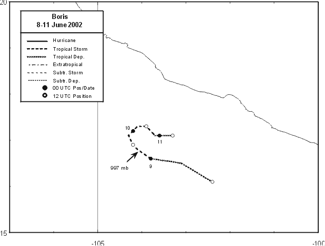
On June 1st, a monsoon trough formed offshore southern Mexico. No change in structure was noted
until the 6th, when thunderstorms became more concentrated 200 miles southwest of Acapulco as a tropical
wave moved into the area. By the 8th, it could be classified as a tropical depression. Moving west-northwest
between 8 and 9 mph, the system strengthened into a tropical storm. Peak intensity was reached very early in the
morning on the 9th as the system became stuck in a col in the upper level pattern, which led to a stalling of the
cyclone. This caused easterly wind shear as the winds well aloft remained out of the east. By the 10th, Boris
moved slowly northeast to east while central convection diminished. By afternoon, the cyclone regained tropical
depression status. By the afternoon of the 11th, the system had degenerated into a non-convective low which
moved southeast before dissipating. Below is its track, supplied by the National Hurricane Center.
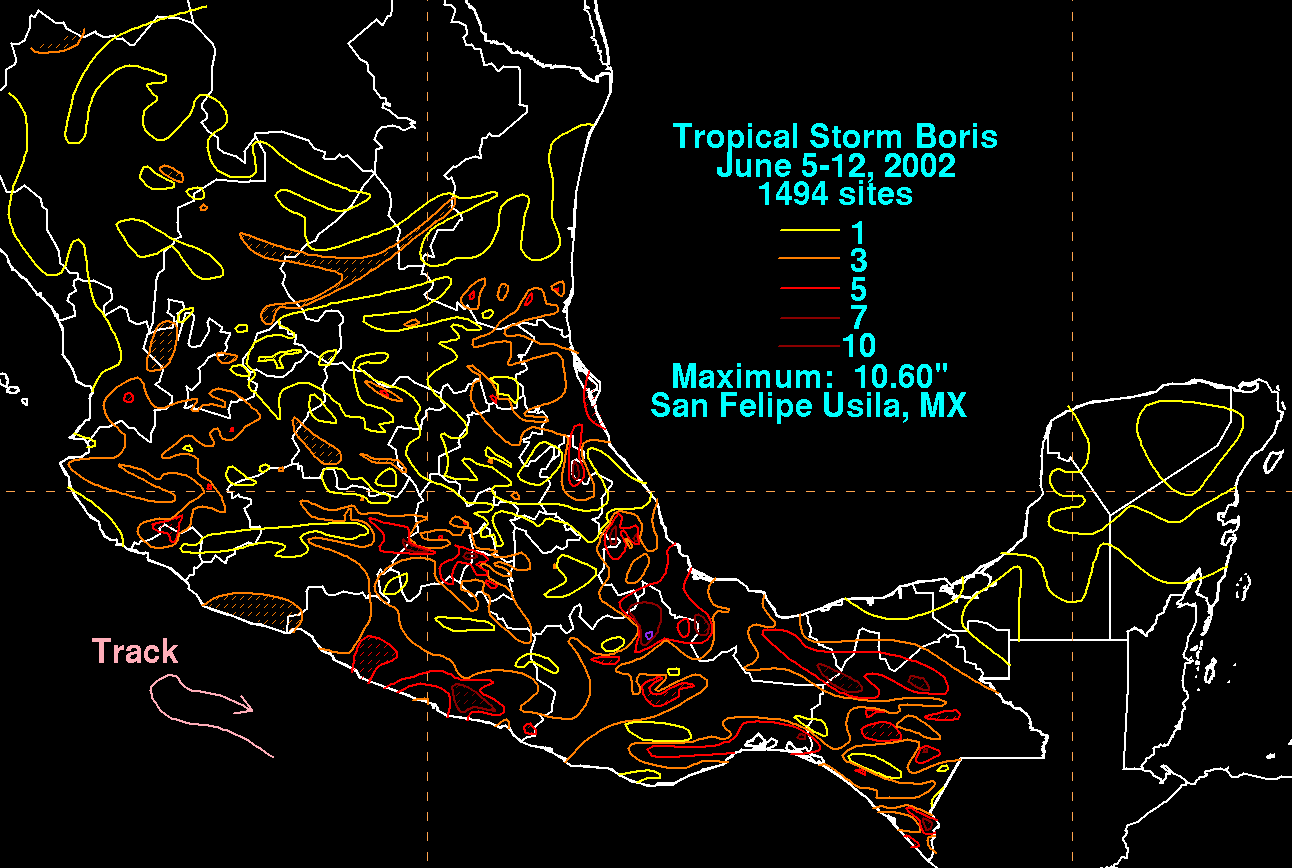
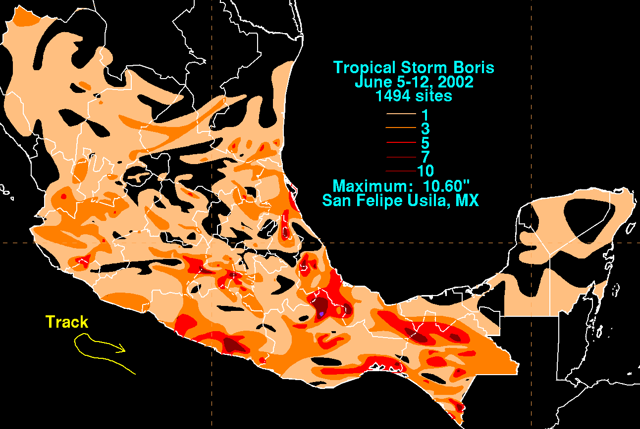
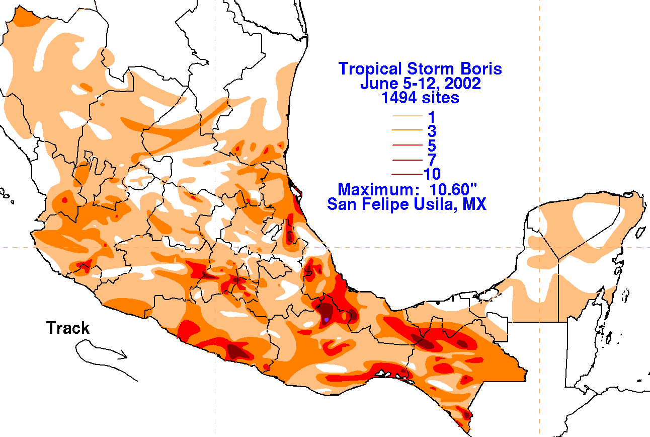
The graphics below show the storm total rainfall for Boris, which used rainfall information from the Comision
Nacional del Agua, which contains Mexico's National Weather Service. The maximum south of the Bay of Campeche
was caused by a persistent band of inflow/feeder band into the Sierra Madre Oriental.
 |
 |
 |