A low pressure system formed along a large frontal band in the western Atlantic on June 28th northwest
of Bermuda and occluded. By the morning of the 29th, substantial convection formed north and west of
the low center, eventually encompassing the entire circulation envelope by evening as the system became
a subtropical storm. Early on the morning of the 30th, the system became well-defined and was moving
westward towards the North Carolina coast. By afternoon, reconnaissance aircraft found the tropical
storm moving west-northwest towards Virginia. The system was very small, with the radius of maximum
winds only 9 miles north of the center. The center crossed the coast of the Maryland's eastern shore and
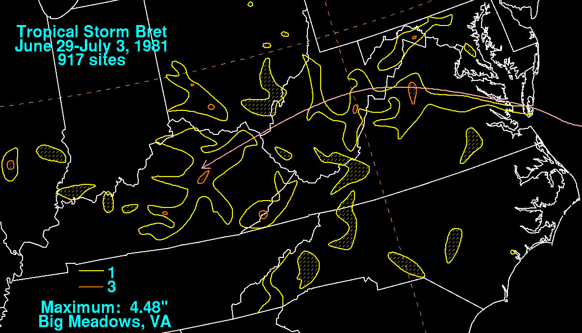
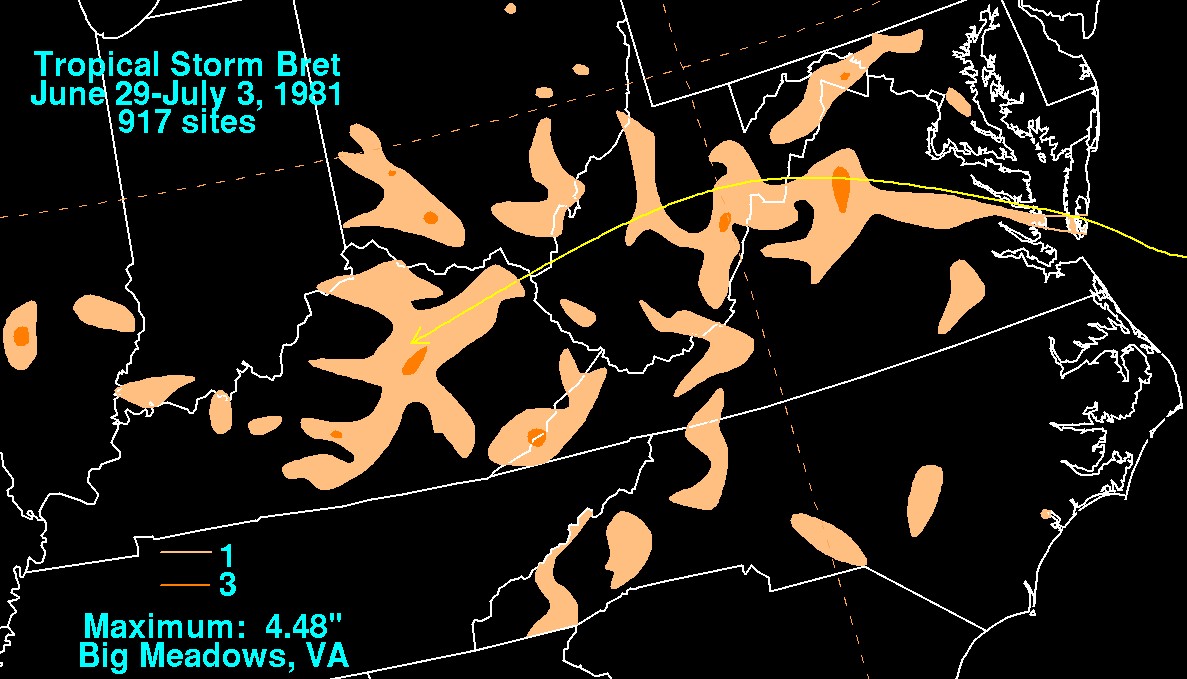
rapidly weakened prior to its mainland Virginia landfall. Below are the rainfall maps for Bret. Rainfall
data was gathered from the National Climatic Data Center in Asheville, NC.
 |
 |
|