An easterly wave moved off the African coast on August 23rd.
A tropical depression formed from this
wave 180 miles east of Guadeloupe on the 29th. The system
intensified gradually, becoming a tropical
storm south of the Mona Passage on the 30th, and a hurricane just south
of Jamaica on the 1st. Moderate
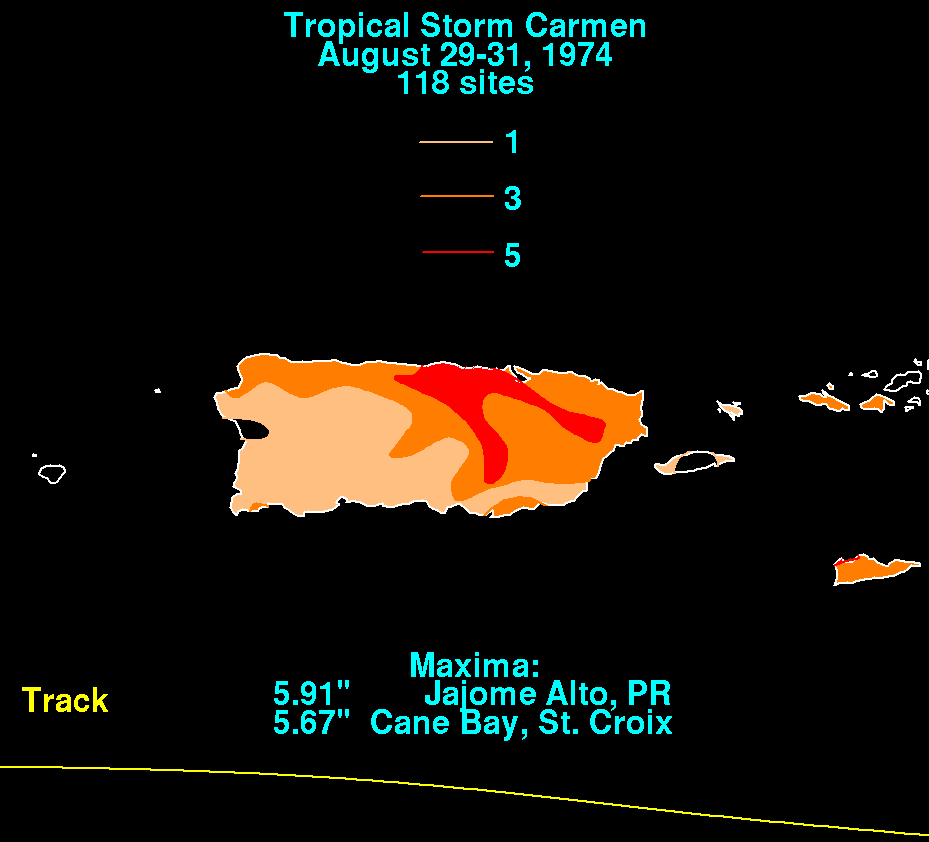
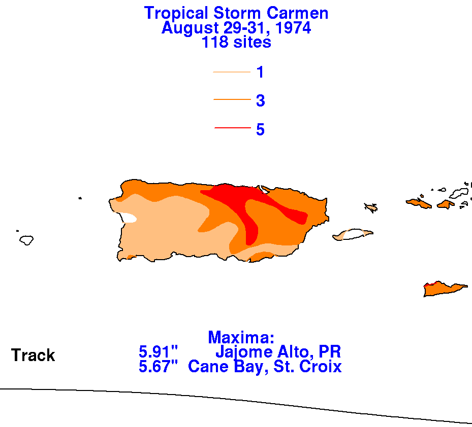
rainfall fell across the northeast Caribbean islands as Carmen passed
by to the south. The storm total
precipitation maps for that region are shown below.
 |
 |
 |
As the cyclone entered the western Caribbean Sea, rapid
intensification
ensued. Carmen struck the
Yucatan peninsula of Mexico as a category 4 hurricane. After
weakening
over land, Carmen regained
hurricane strength on the 5th, and a category 4 again in the northern
Gulf of
Mexico on the 7th.
Weakening occurred prior to landfall as cooler, drier air entered the
system. Carmen moved
westward as it made landfall, eventually becoming absorbed by a deep
cyclone in the
Southern
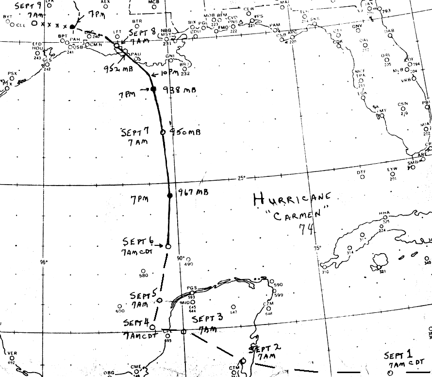
Plains. Below is its track, supplied by the National Hurricane
Center.
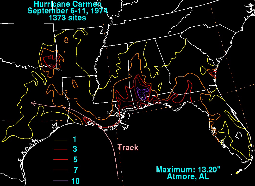
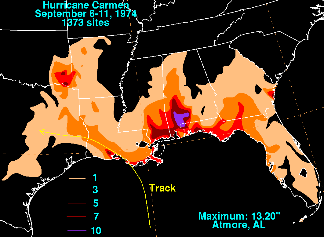
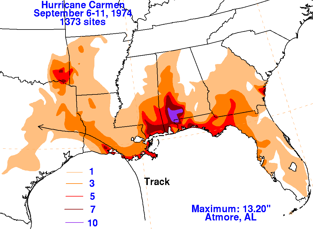
Below is a storm total rainfall map for Carmen.
Note the maximum well
east of the track
in southern Alabama, with a minor secondary maximum along the track of
the storm.
 |
 |
 |