A tropical wave moved offshore the west coast of African in late
August 1953. A tropical depression formed
offshore Cape Verde on the 28th, and moved west-southwestward, becoming
a tropical storm on the 31st.
The storm turned west, then west-northwest, through the tropical
Atlantic over the next several days, strengthening
into a hurricane on September 2nd east of the Leeward Islands.
Moving on a more northwest course, the hurricane
continued to strengthen and reached category 4 status on on the 3rd,
which made Carol the strongest tropical cyclone
of the 1953 Atlantic hurricane season. On the 4th, as Carol
continued to gain latitude, weakening ensued. On the 6th,
the category two hurricane passed southwest of Bermuda. On the
7th, Carol accelerated north-northeast, moving
southeast of Cape Cod as a category one hurricane. Late that day,
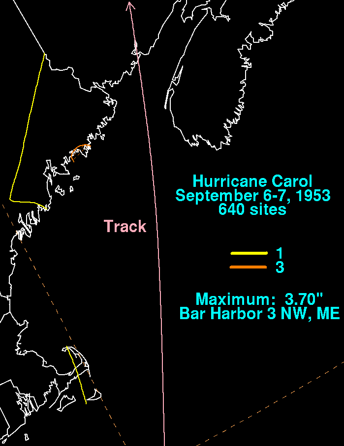
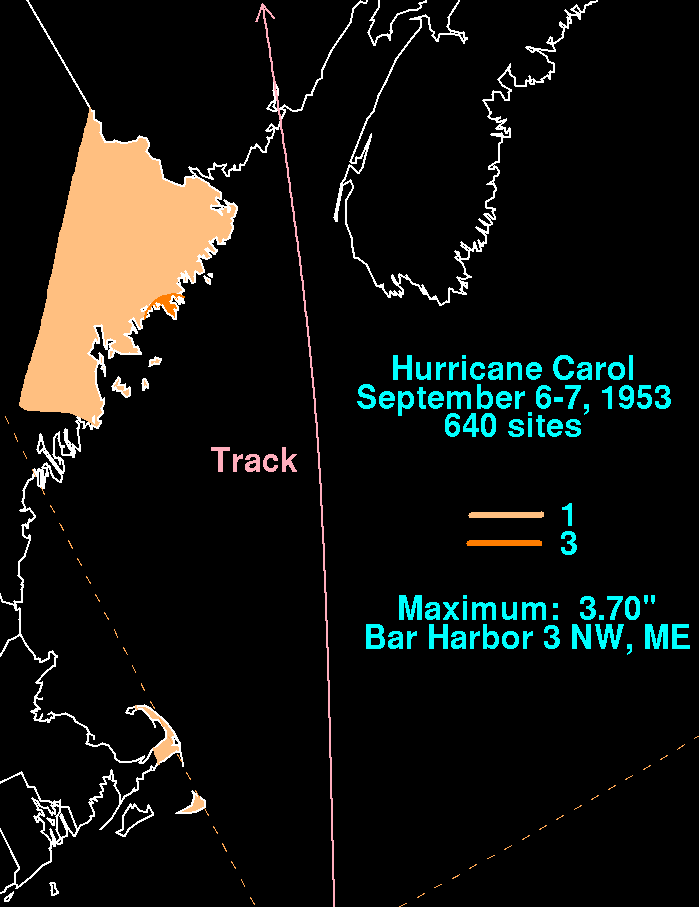
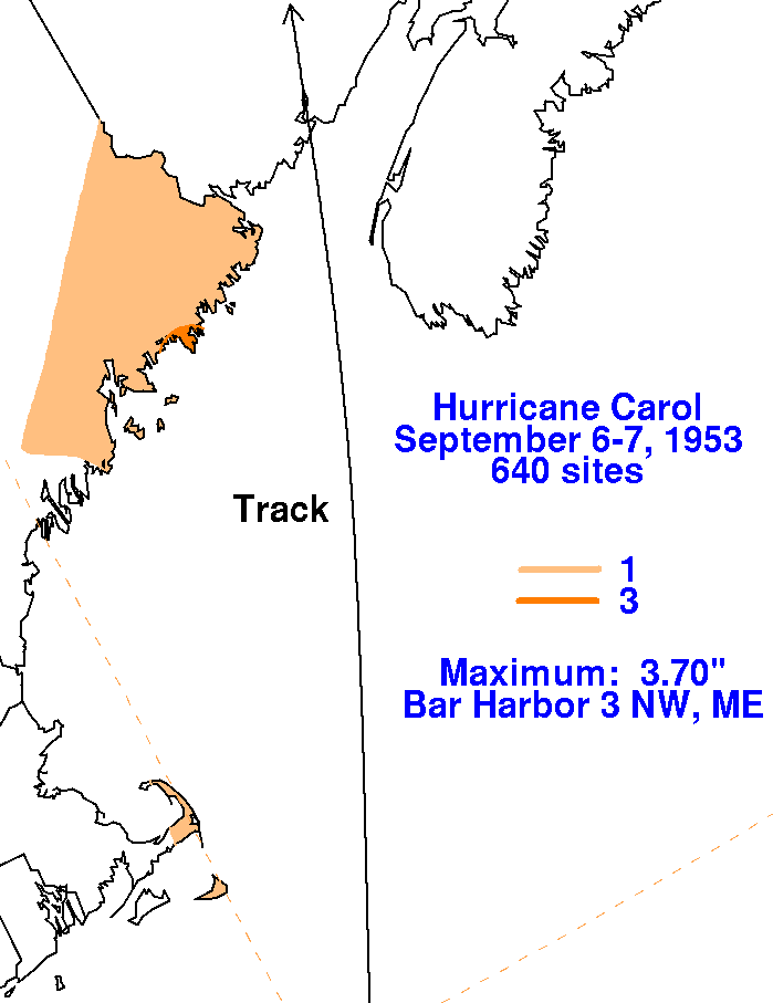
the hurricane made landfall in New Brunswick,
bringing hurricane-force winds and heavy rains to Maine. The
cyclone quickly became an extratropical storm, moving
through eastern Canada on its way to Greenland by the 9th. The
rainfall maps below for Hurricane
Carol were created using rainfall data from the National
Climatic Data
Center in Asheville, North Carolina.
 |
 |
 |