A strong tropical wave moved offshore western Africa on July 4. The mid-level circulation formed in
association with the system's convection, sharpening the surface trough along the axis of the tropical wave.
The system moved south of the Cape Verde Islands as a quick clip, and a tropical storm formed on July 7 as
a well-defined circulation formed. The system moved rapidly westward, while gradually strengthening.
Nearing the Lesser Antilles on July 8 and 9, Chantal began to experience vertical wind shear from the west
due to brisk low-level flow from the east. Chantal slowly weakened after passing Martinique as
convection became more sporadic near the system. The system opened up into an easterly wave south of the
Dominican Republic on July 10. Thereafter, the remnant disturbance moved across eastern Cuba and the Bahamas
before dissipating by July 13.
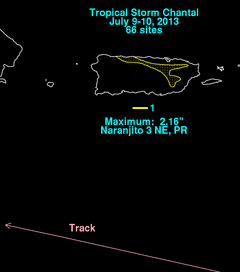
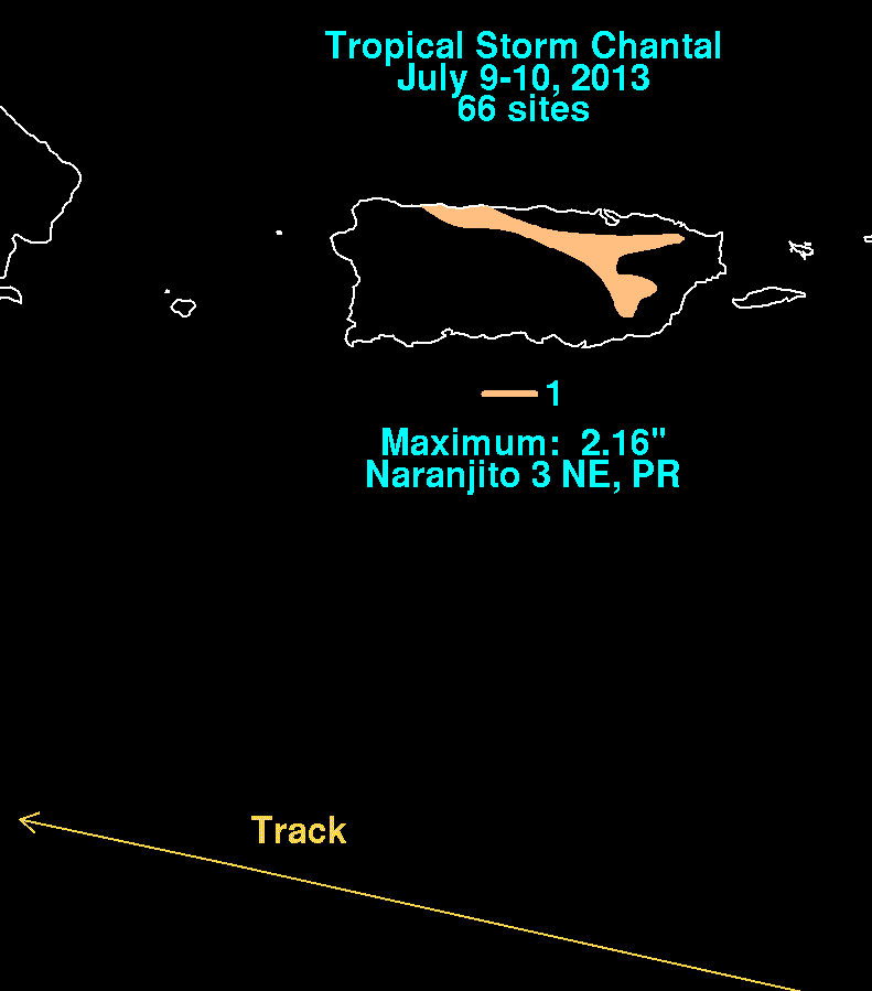
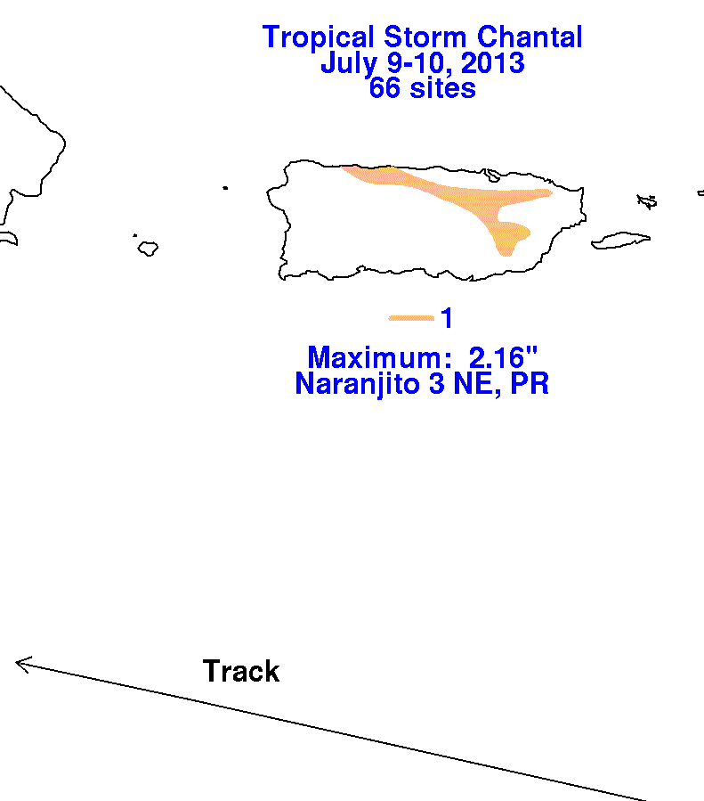
The graphics below show the storm total rainfall for Chantal, which used information from the National Weather
Service River Forecast Centers, Forecast Offices, and CoCoRAHS.
 |
 |
 |