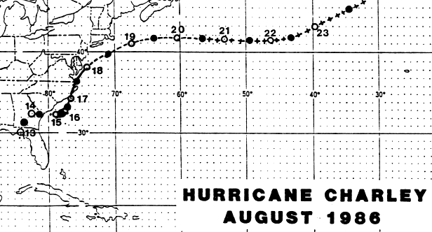
A trough of low pressure persisted over south Florida and the southeast Gulf of Mexico. Showers
and thunderstorms associated with this system first appeared over the Florida peninsula on August
11th. The activity spread into the eastern Gulf of Mexico the next day, when surface observations
indicated a very broad area of low pressure formed. The poorly defined, diffuse system drifted north
on the 12th and 13th and became better organized over the Florida panhandle and Georgia as it
merged into a decaying frontal trough. Continuing to improve in organization, the low emerged
off the Georgia/South Carolina coast during the morning of the 15th, when it became a tropical
depression. By mid-afternoon, the depression strengthened into a tropical storm.
A weak ridge north of the storm led to a slow east to northeast drift. A trough amplified west of
the storm over the eastern United States, resulting in a more northerly motion on the 17th and 18th.
Charley recurved more to the eastward by the 19th and weakened as it merged with a frontal zone.
By the 21st, as an extratropical low, Charley significantly deepened and became a large, strong
storm which migrated to Europe, and eventually dissipated in the North Sea. Below is the track
of this cyclone provided by the National Hurricane Center.
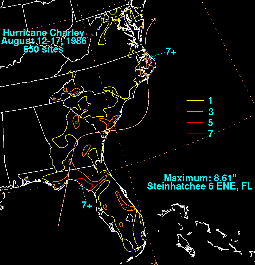
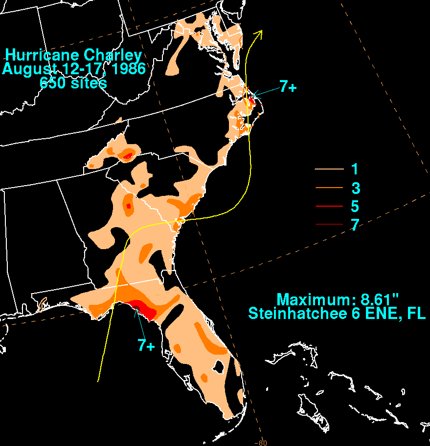
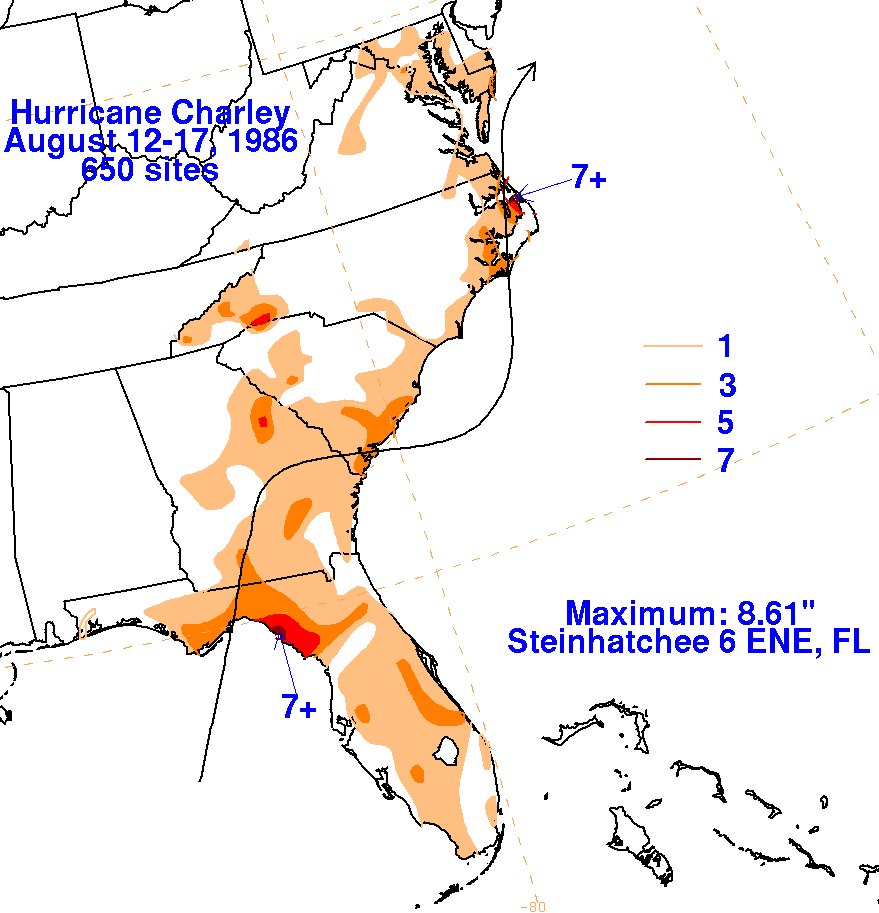
The graphic below show the storm total rainfall for Charley.
The maxima are near and to the east of its
track. Rainfall data was obtained from the National Climatic Data
Center in Asheville, North Carolina.
 |
 |
 |