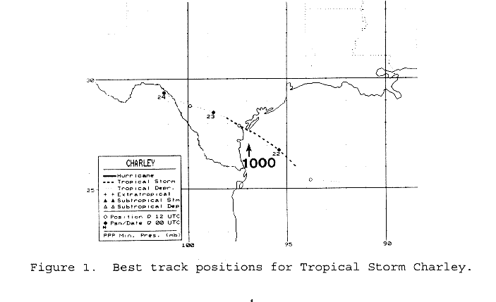
A large swirl of low clouds left the coast of Africa on the 9th, and
westward through the tropical
Atlantic. On the 15th, a small area of deep convection developed with
the system a few hundred
miles northeast of the Leeward Islands. Moving north of due west,
the convection flared diurnally
until the 19th. By then, the cyclonic circulation had moved into the
southeastern Gulf of Mexico. On
the morning of the 21st, reconnaisance aircraft were able to close
off a low level circulation, which
initiated advisories on the tropical depression. Tropical storm force
was reached by afternoon.
By early on the 22nd, Charley was at the threshold of hurricane
strength,
which is when it peaked
in intensity. The center crossed the Texas coast near Port
Aransas
during the early morning hours
of the 22nd. Weakening after landfall, the low level circulation
dissipated near Del Rio early on
the 24th. However, its circulation aloft produced heavy rains
near Del Rio from the 23rd until
late on the 25th, when it finally moved into northeast Mexico and lost
its surface circulation. Its
circulation aloft moved across northern Mexico and into southern
Arizona before dissipating on
the 29th. Below is the track of Charley, prepared by the National
Hurricane Center.
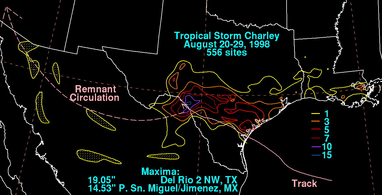
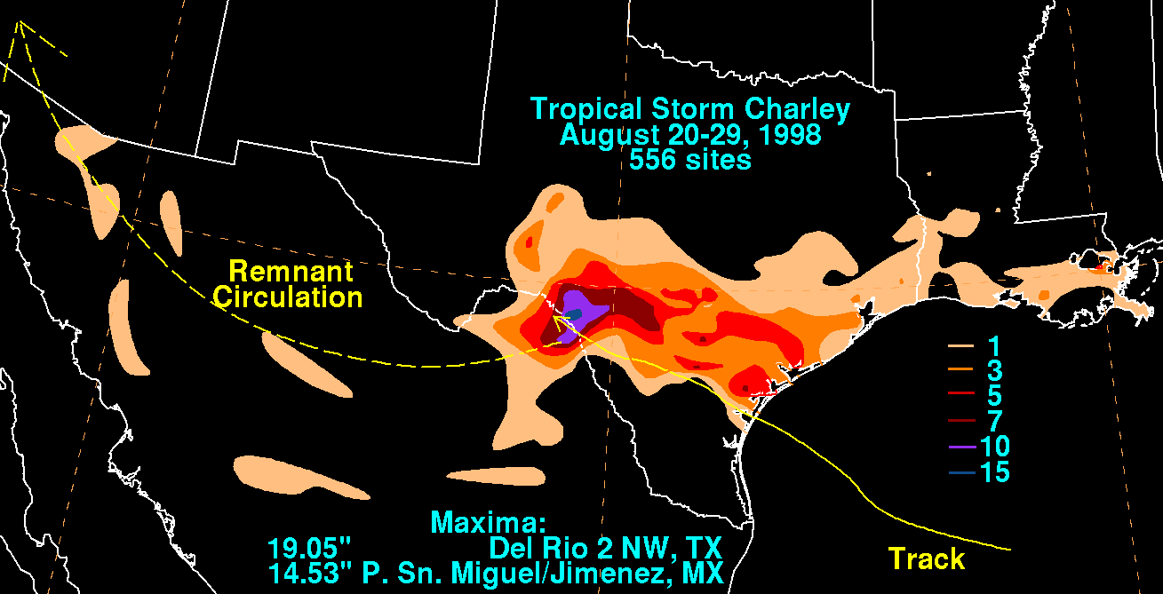
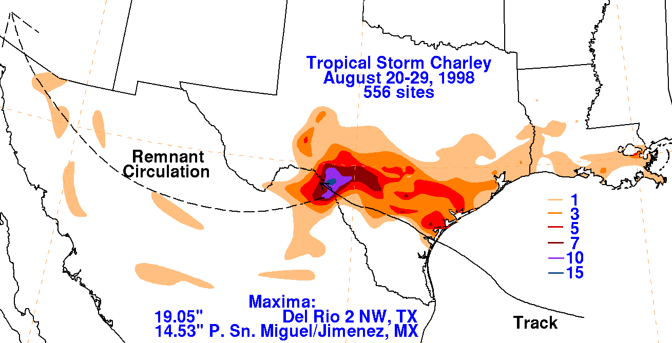
Below is the storm total rainfall map for Charley. Note the
maximum
in the initial inflow band across
southeast Louisiana, while the major maximum is located well inland
of the point of landfall near Del
Rio. Data used to construct the storm total map was gathered
from the National Climatic Data Center
for the United States, and from the Comision Nacional del Agua for
Mexico.
 |
 |
 |
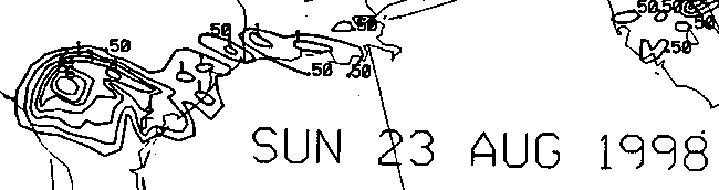
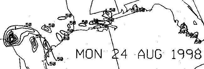
Below is the calendar for Daily Precipitation Maps. Note that
the 24-hour periods end
at 12z that morning.