The disturbance that led to this hurricane was noted a bit to the
east of the Windward Islands. By the 18th,
the cyclone was encountered 900 miles east of Puerto Rico as a tropical
storm. The system recurved towards
the north, and moved within 150 miles of Bermuda as a hurricane.
The cyclone turned back towards the west-
northwest at a slower speed, passing east of Cape Hatteras. The
center passed over Norfolk, Virginia at 9:20 am
on the 23rd, moving onward to Washington, D.C. that evening, and then
moved through central Pennsylvania
and down the St. Lawrence Valley. This hurricane was one of the
most severe tropical cyclones to impact
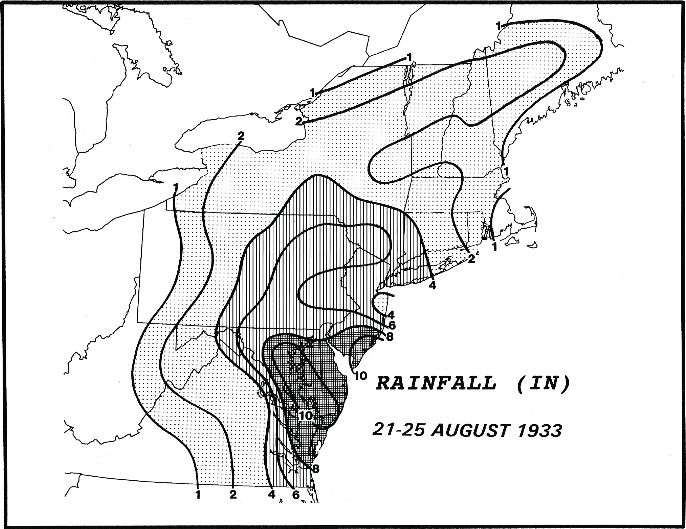
the Mid-Atlantic states. The rainfall map below for the
Chesapeake-Potomac Hurricane was
created by Paul Kocin.
