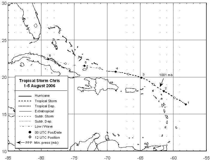
A tropical wave moved offshore the coast of western Africa on July 26th. After a couple days in the tropical
Atlantic, its related convection weakened. On the 30th, thunderstorm activity redeveloped on the northern side
of the sharp tropical wave 550 miles east of the Leeward Islands. Turning west-northwest, organization of the
system improved, and it was deemed a tropical depression on the evening of the 31st. Westerly wind shear
slowed the systems progression down to 12 mph, and its intensification. The depression became a tropical storm
on the 1st, reaching its peak intensity on the 2nd just east-northeast of Anguilla. As the subtropical high to its
north increased, Chris turned more westward and the vertical wind shear increased, weakening the tropical cyclone.
Moving north of Puerto Rico and Hispaniola, Chris became a tropical depression 195 miles east-southeast of
Grank Turk Island in the Bahamas. By early on the 4th, what remained of Chris was a remnant low pressure area
which continued westward, skirting the northern coast of Cuba on the 6th. Below is its track, provided by the
National Hurricane Center.
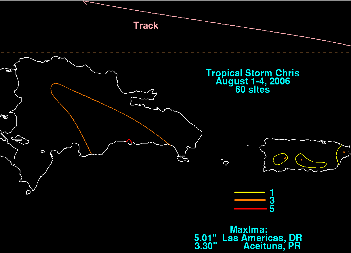
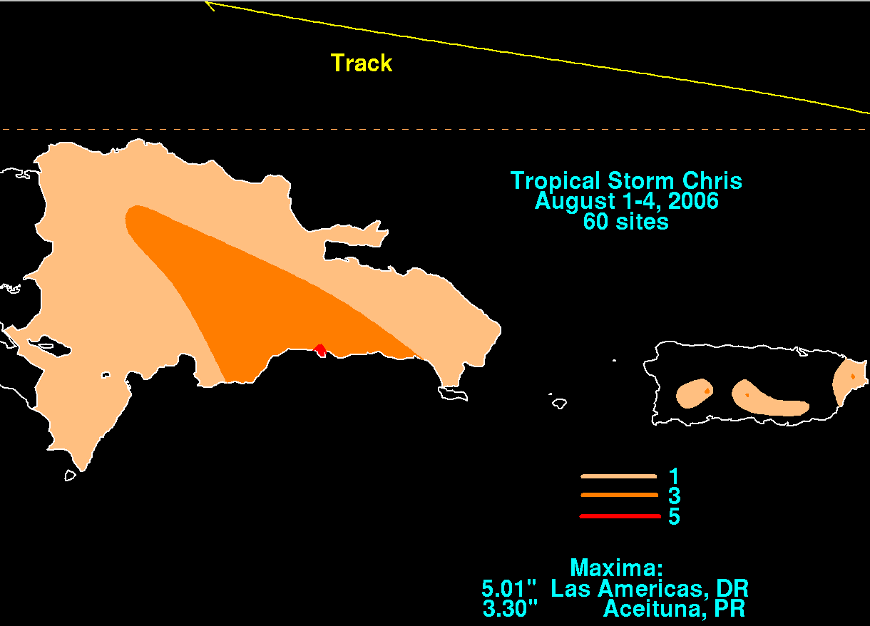
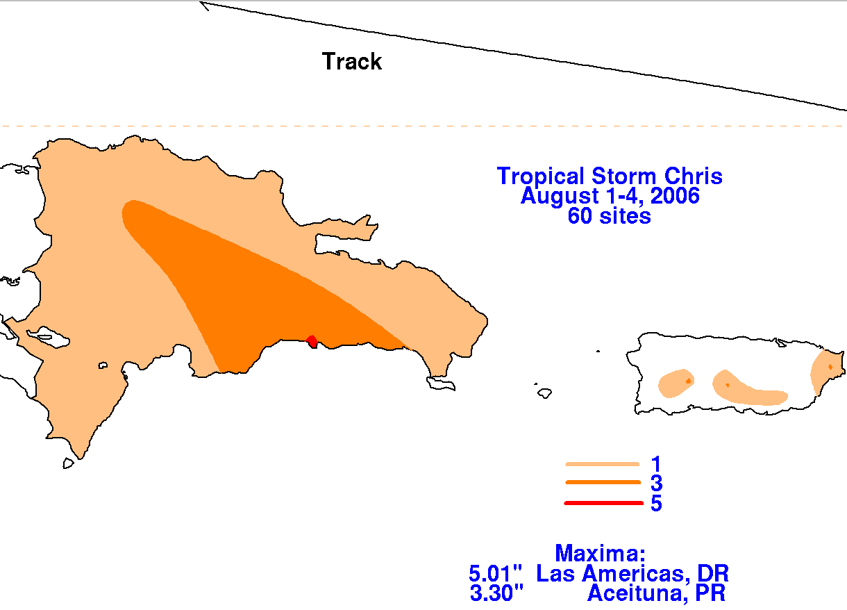
The graphics below show the storm total rainfall for Chris. Data was provided by the National Climatic
Data Center in Asheville, North Carolina and ONAMET, the Dominican Republic's national weather service.
 |
 |
 |