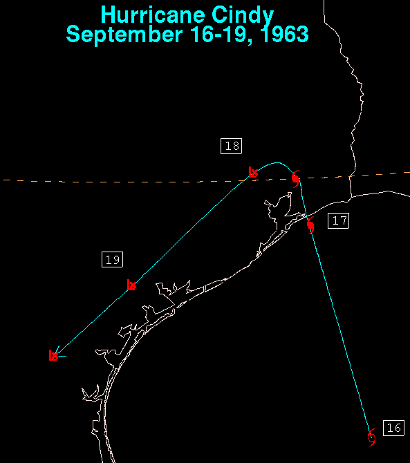
This cyclone formed within 200 nm of the Texas coastline on the 16th
of September. Rapidly becoming a small hurricane, despite a poor radar
signature, it made landfall in the Beaumont/Port Arthur/Orange Golden
Triangle on the 17th, before turning to the left and paralleling the coast
to the southwest. Below is the track of this cyclone, which used data
provided by the National Hurricane Center.
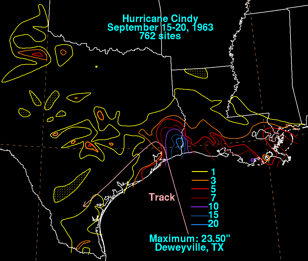
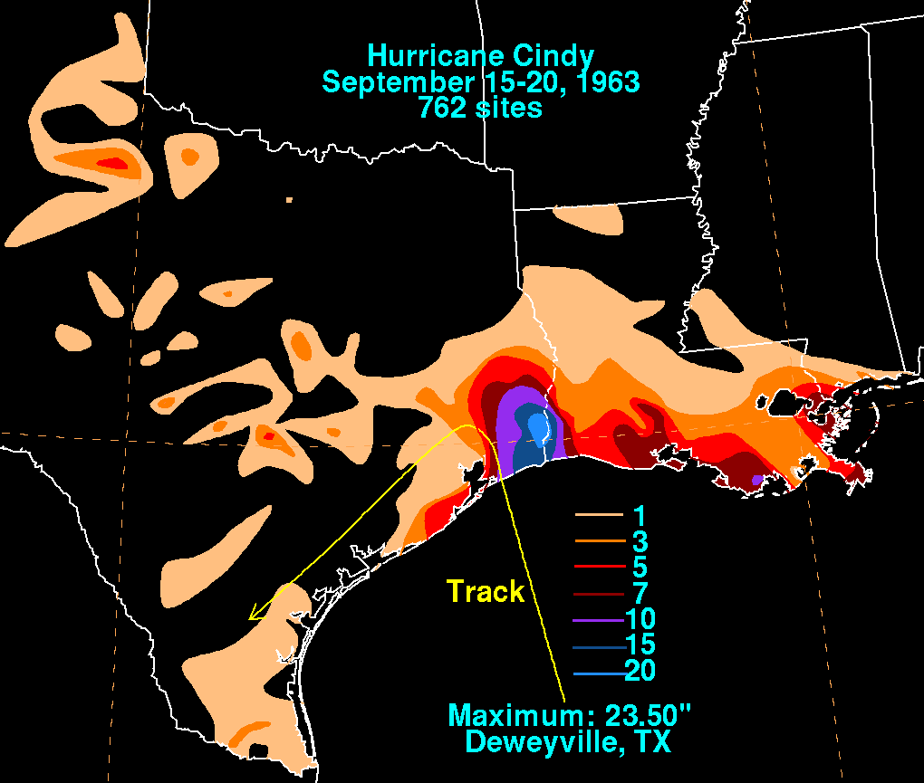
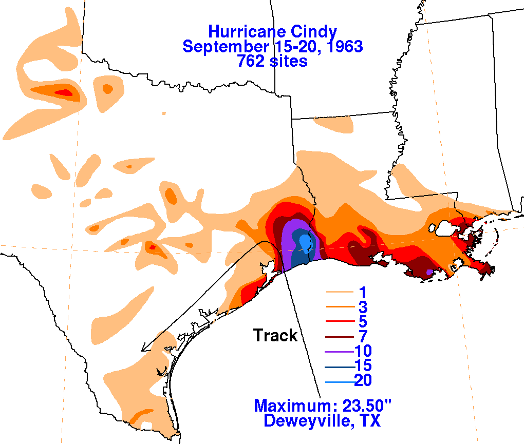
The graphics below show the storm total rainfall for Cindy.
Note
the maximum across
Southeast Texas, just to the right of where the track changes
from northerly to south-
westerly. Data was retrieved from the National Climatic Data
Center in Asheville,
North Caorlina.
|
|
|
|