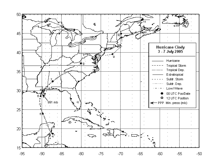
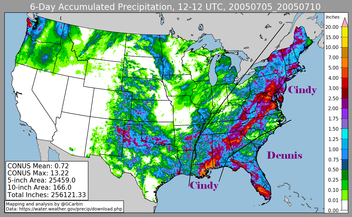
 Tropical Storm Cindy formed on July 3rd in the extreme western Caribbean Sea just
east of the Yucatan-Belize border.  The cyclone moved northwest across the Yucatan
Peninsula before emerging over the south-central Gulf of Mexico on the 4th.  Once
over the warm Gulf waters, the depression strengthened into a tropical storm early
on the 5th as the cyclone turned northward.  Despite the very warm water ahead of
Cindy, only slow intensification occurred due to the moderate southerly wind shear
until just prior to landfall when the shear weakened and significant intensification
occurred.  Cindy made landfall just below hurricane strength early on the 6th over
southeast Louisiana just southwest of Grand Isle.  The cyclone turned northeastward
moving over New Orleans before becoming a frontal wave across northwest Gerogia on
the morning of the 7th.  The frontal wave was absorbed by a stronger low offshore
New England on the morning of the 9th...but its moisture helped provide additional
rainfall across New England in its comma head through the 10th. Below is the track
of this storm.
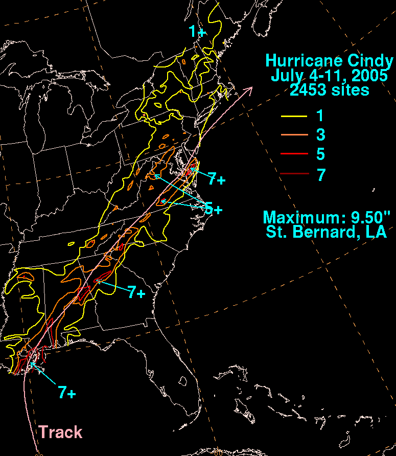
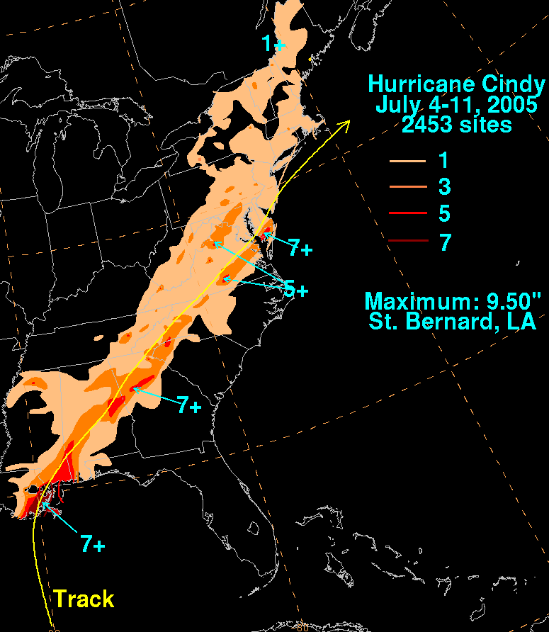
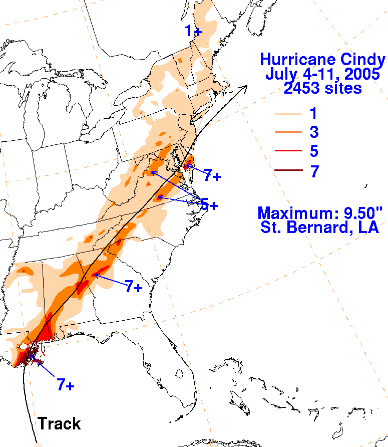
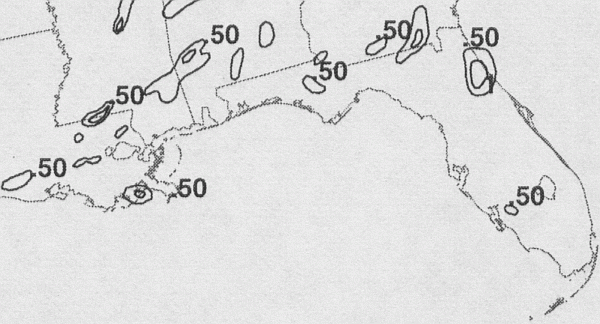
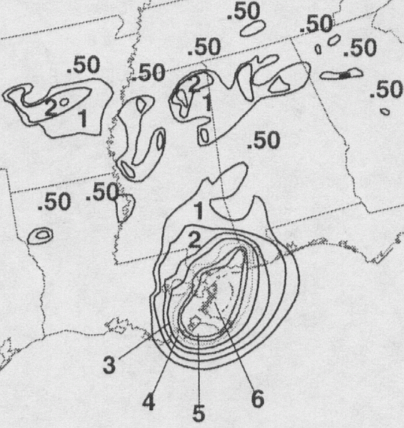
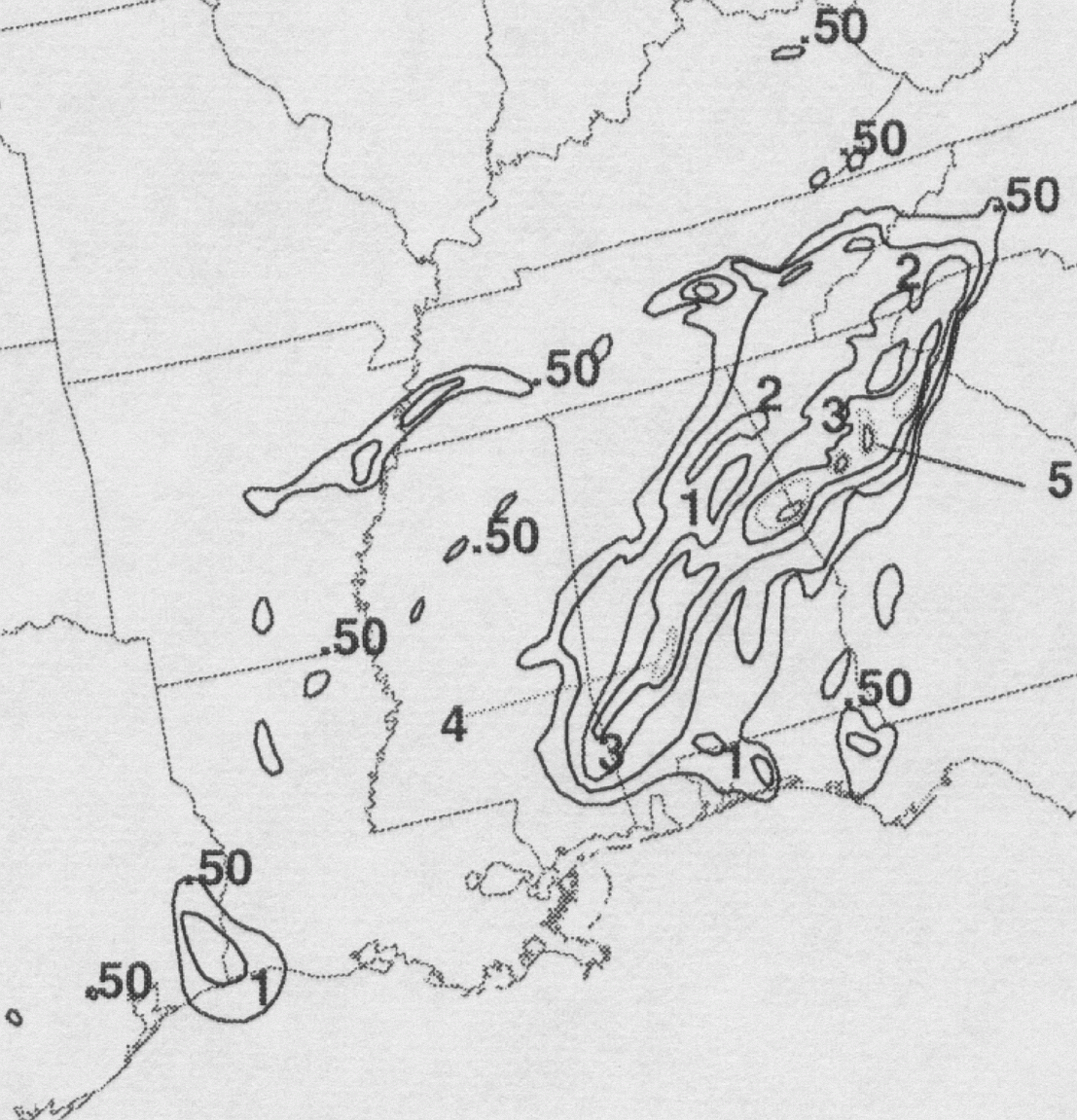
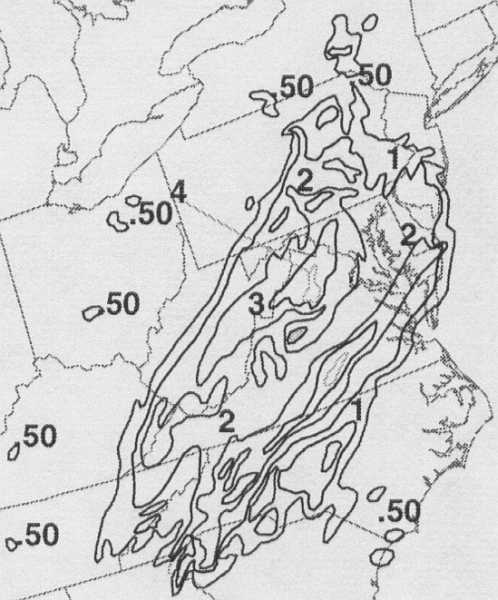
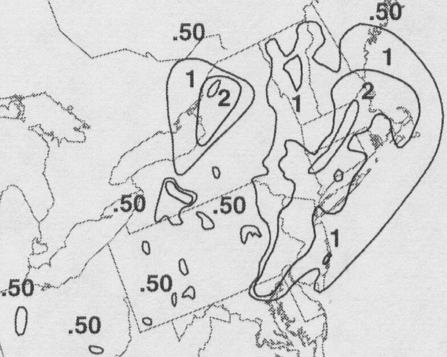
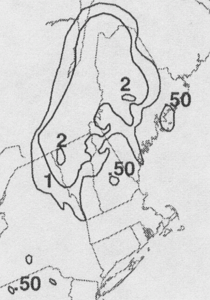
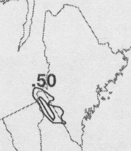
The first three storm total rainfall maps below were constructed using rain guage data
reported by the River Forecast Centers. The fourth image used radar-derived information.
 |
 |
 |
 |
Below are the calendar for Daily Precipitation Maps. Note that the 24-hour periods end
at 12z that morning.