A tropical wave crossed the tropical Atlantic during early to mid August. By early on the 14th, an upper
level low began to interact with the wave, increasing convection. By the 15th, a mid-level circulation
formed in association with the convective mass, which crossed the Florida Keys into the eastern Gulf of
Mexico, eventually spawning a surface low by early on the 16th, when it was classified as a tropical
depression. A reconnaissance aircraft on its way out to Ana flew through the depression, which led to its
upgrade to a tropical storm later that morning. As Claudette reached the Gulf coast, vertical wind shear
displaced the bulk of its thunderstorm activity to the south of the center, similar to Tropical Storm Gabrielle's
approach to North Carolina in 2007. The circulation quickly generated after it made landfall on the 17th,
completely dissipating within 24 hours.
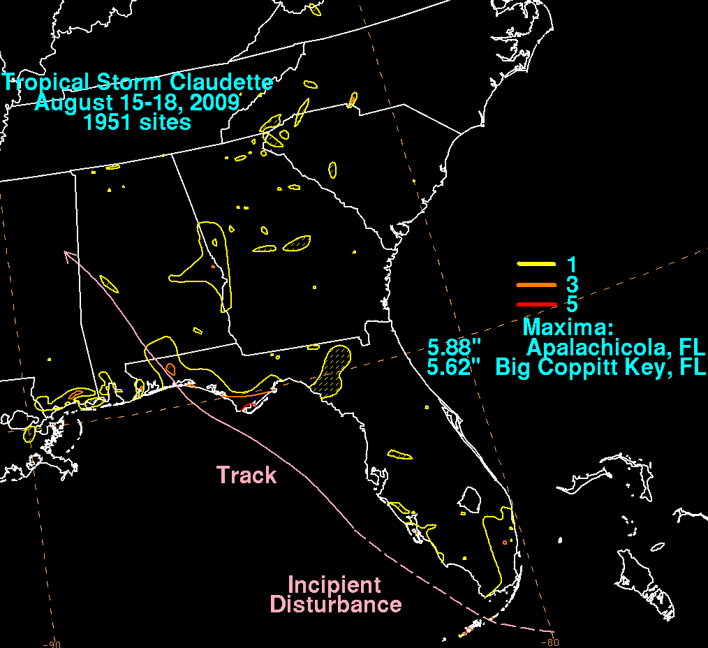
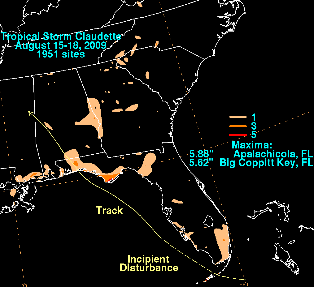
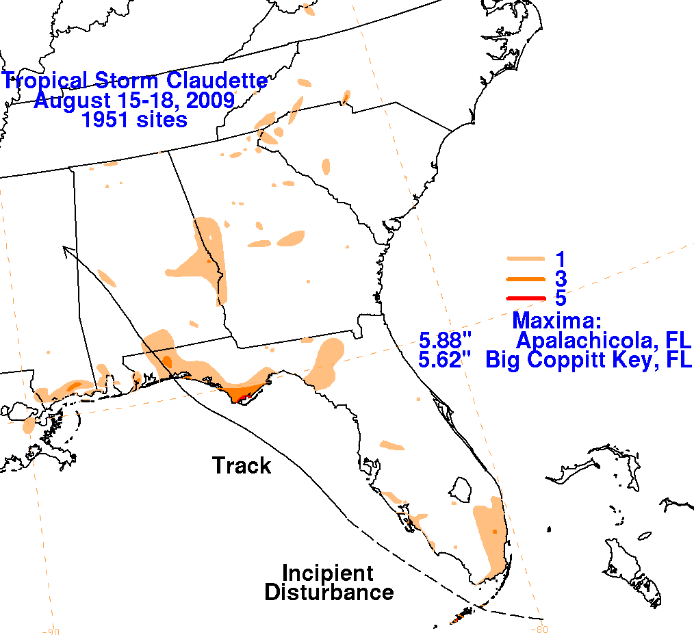
Below are the storm total graphics for Claudette. Data was compiled from the National Weather Service
River Forecast Centers and CoCoRaHS. It should be noted that one-quarter of the rainfall at Apalachicola,
Florida occurred due to non-related thunderstorms moving across the town early on the 16th.
 |
 |
 |