A tropical disturbance moved off the coast of Africa south of Dakar
as a low pressure area with convection
on August 15th. The system moved westward through the far eastern
tropical Atlantic, turning west-northwest
as it moved through the central tropical Atlantic. On the night
of the 19th, ship reports indicated a surface circulation
existed. By the afternoon of the 20th, reconnaissance aircraft
found a tropical depression. Rapid strengthening
ensued, and Cleo became a hurricane by the 21st while moving rapidly
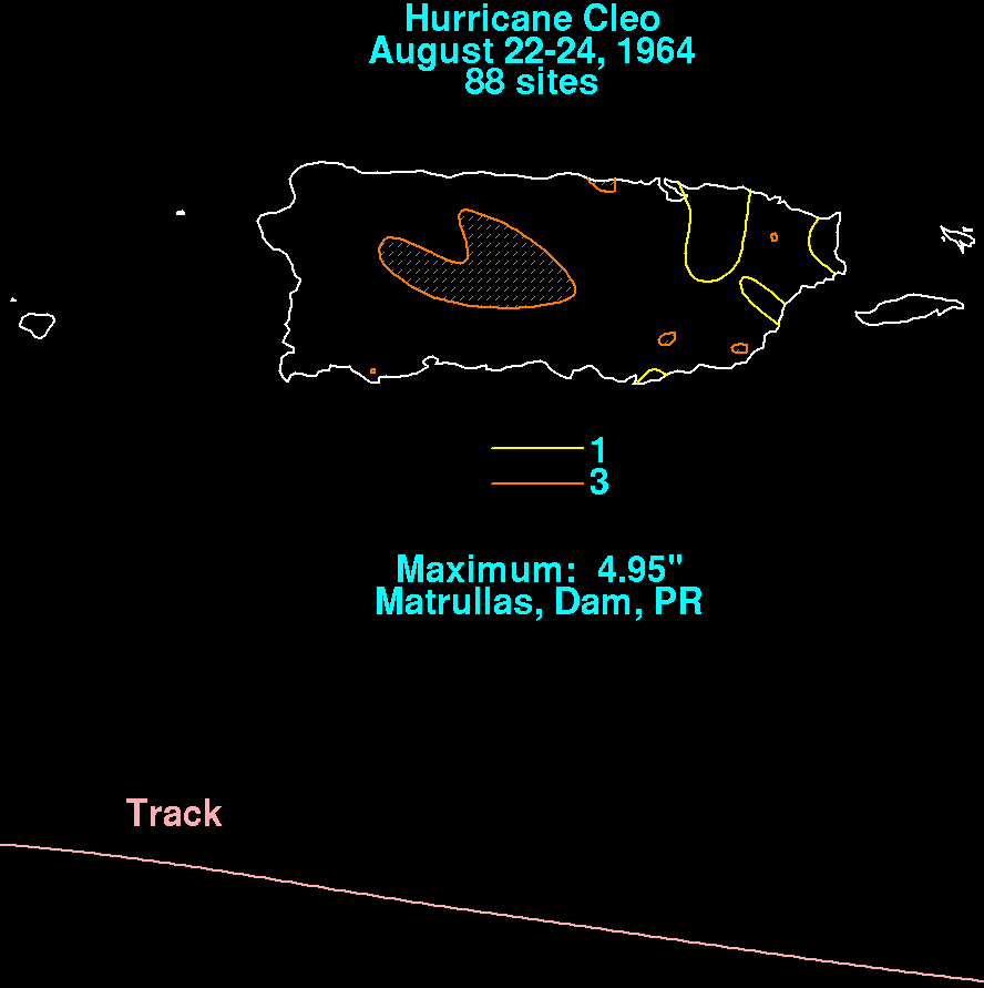
west-northwest. Cleo moved over Guadeloupe
on the 22nd, passing south of St. Croix at midnight, and south of
Puerto Rico on the 23rd as a category 4 hurricane.
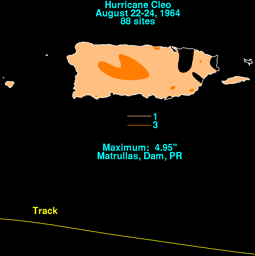
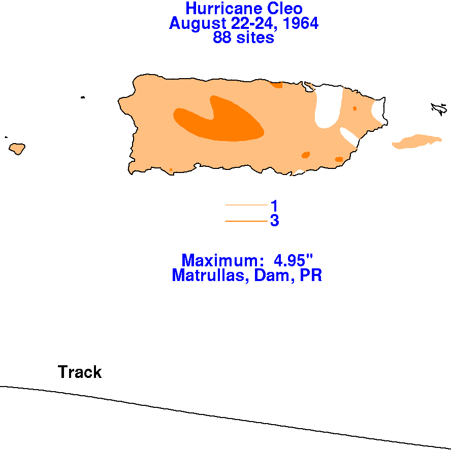
Below are the rainfall graphics for Puerto Rico for Cleo, using data
provided by the National Climatic Data Center in
Asheville, North Carolina.
 |
 |
 |
On the 24th, the center of Cleo moved just south of the
Barahona Peninsula of the Dominican Republic, and made
landfall in southwest Haiti. With the center of circulation
significantly disrupted by the terrain of Haiti, it emerged
west of Haiti into the Caribbean Sea. Cleo, as a minimal
hurricane, crossed eastern Cuba during the night of the
26th while weakening to a tropical storm. By early on the 27th,
Cleo regained hurricane intensity before making
landfall onto Key Biscayne as a small-sized storm, becoming the first
hurricane strike for Miami in 14 years.
Moving generally northward, Cleo slowly weakened as it passed
inland along the east coast past Melbourne.
Continuing to weaken, the cyclone moved through the interior of the Carolinas before moving back out to sea off
the Outer Banks of North Carolina.
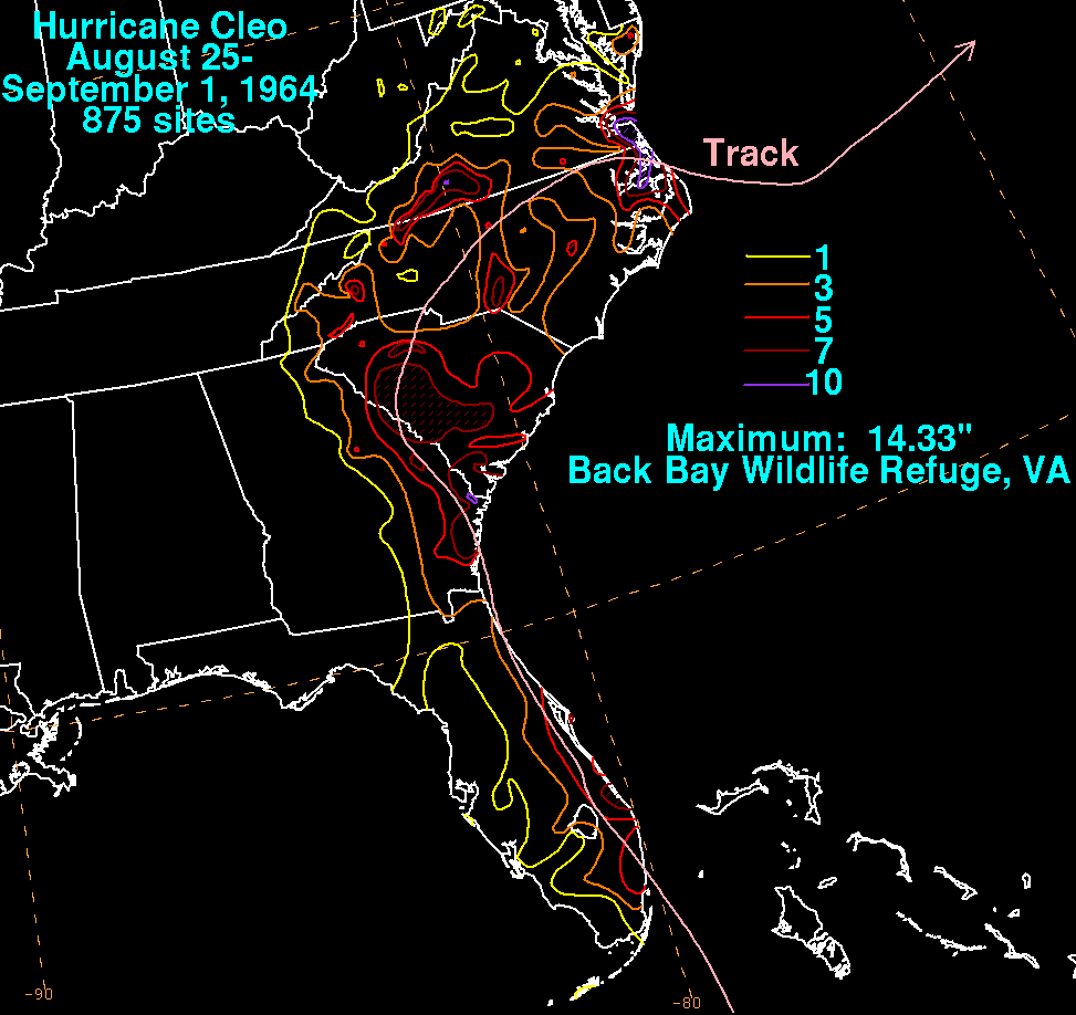
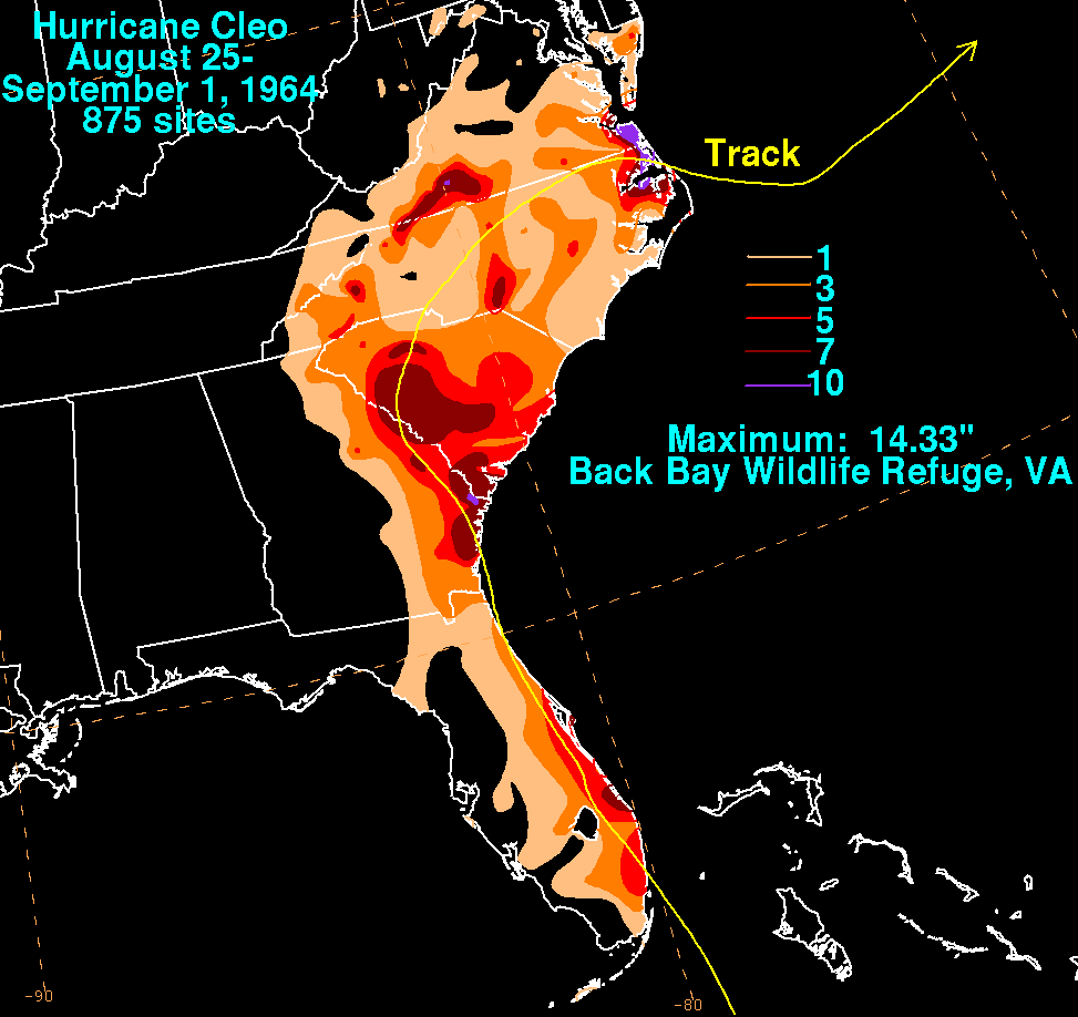
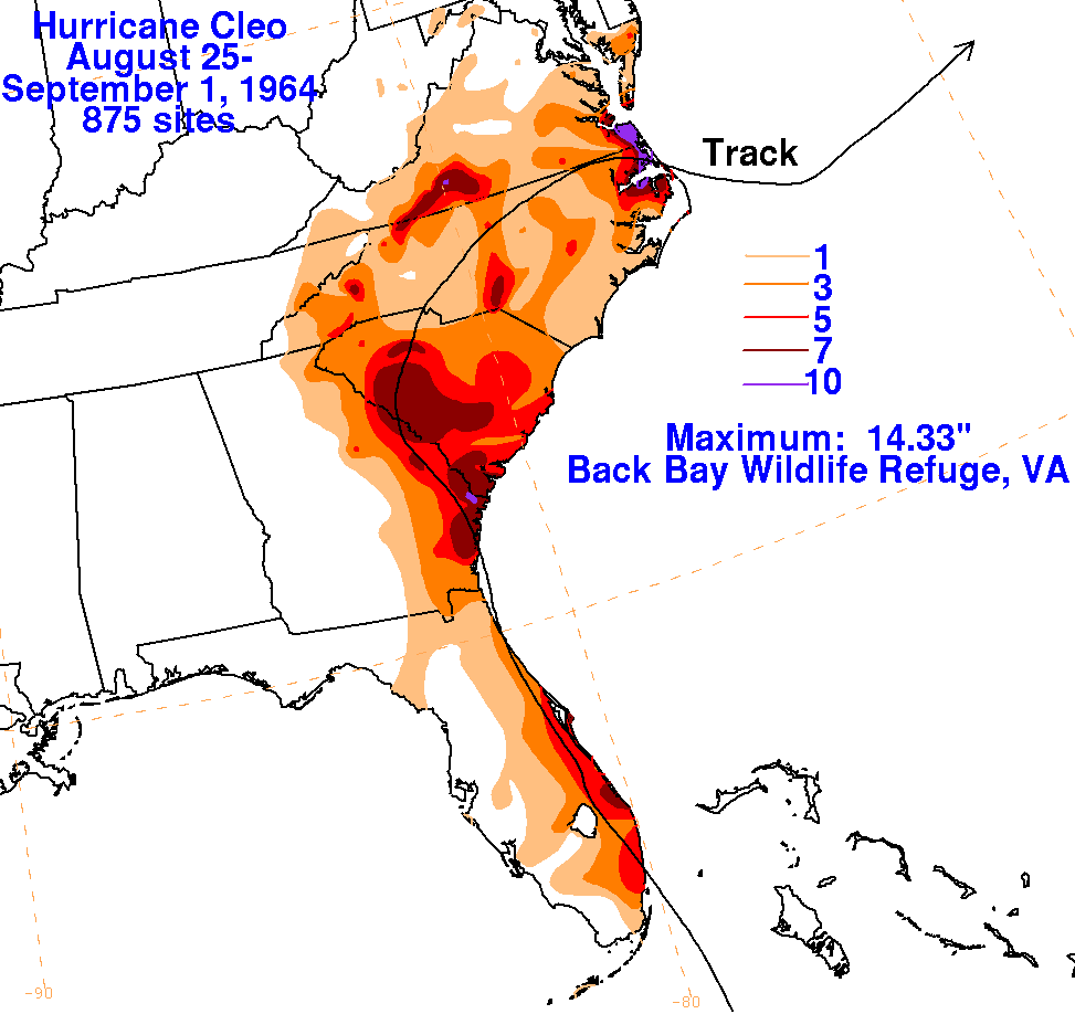
The graphics below is the storm total rainfall for Cleo using data
obtained from the National Climatic Data Center
in Asheville, North Carolina. The maxima occurred near and
to the right of its track through South Carolina,
before shifting to the left of its track across eastern North Carolina
and Virginia. The highest maximum fell along
a frontal boundary to the north of Cleo in southeast Virginia.
|
|
|
|