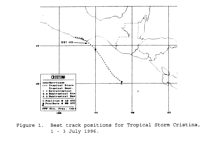
Thunderstorm activity increased south of Central America on June
30th associated with a tropical
wave which crossed Panama on the 29th. The convection moved
west-northwest and became more
concentrated, organizing into a tropical depression on the morning of
July 1st south of El Salvador.
Moving more northwesterly, the system strengthened into a tropical
storm late that afternoon south of
Guatemala. Early on the morning of the 3rd, Cristina made
landfall near Puerto Angel in Mexico as
a strong tropical storm. While its center dissipated across
southeast Mexico on the 3rd, its residual
cloud pattern remained over the region into the 6th. Its track
lies
below, supplied by the National
Hurricane Center.
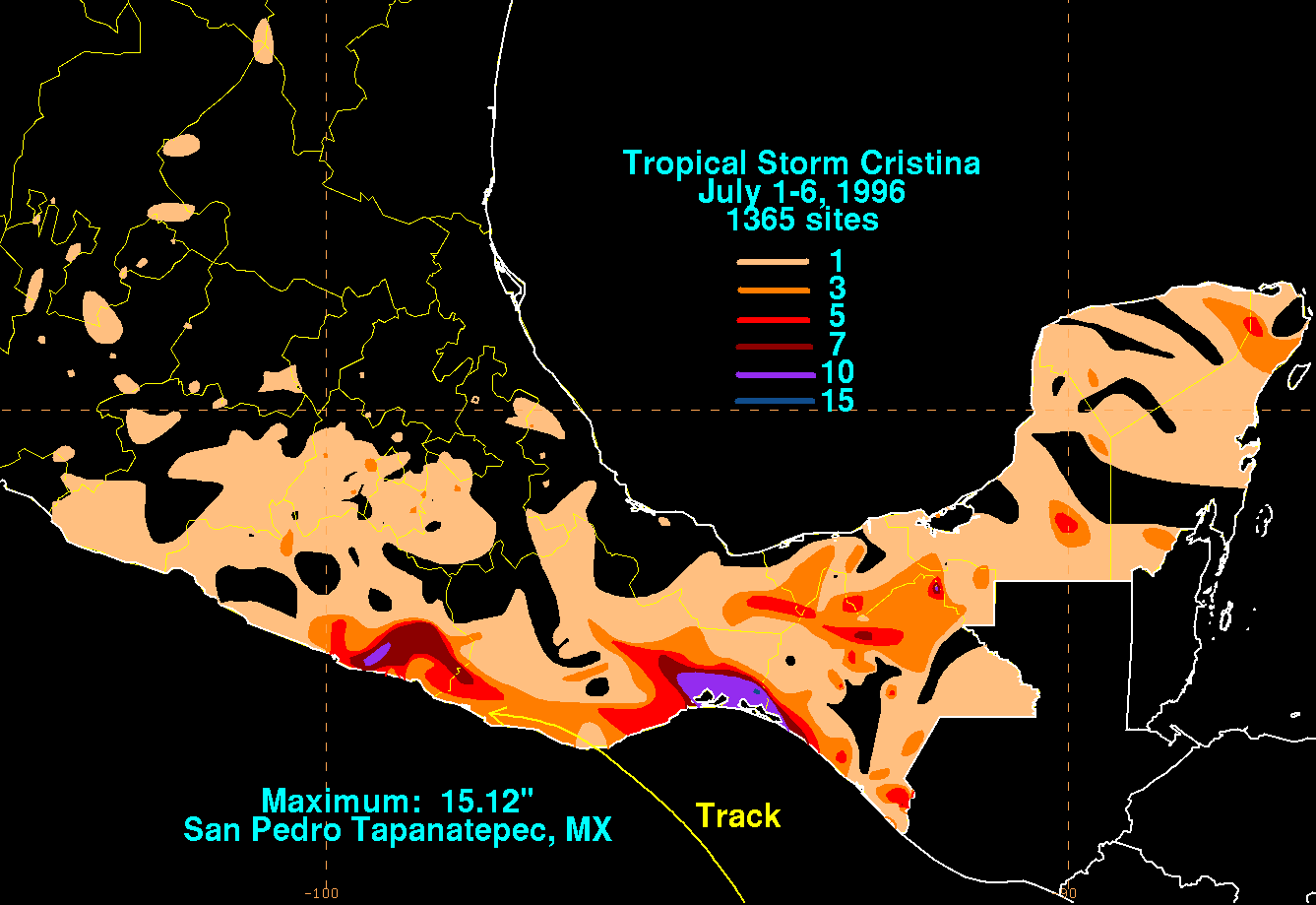
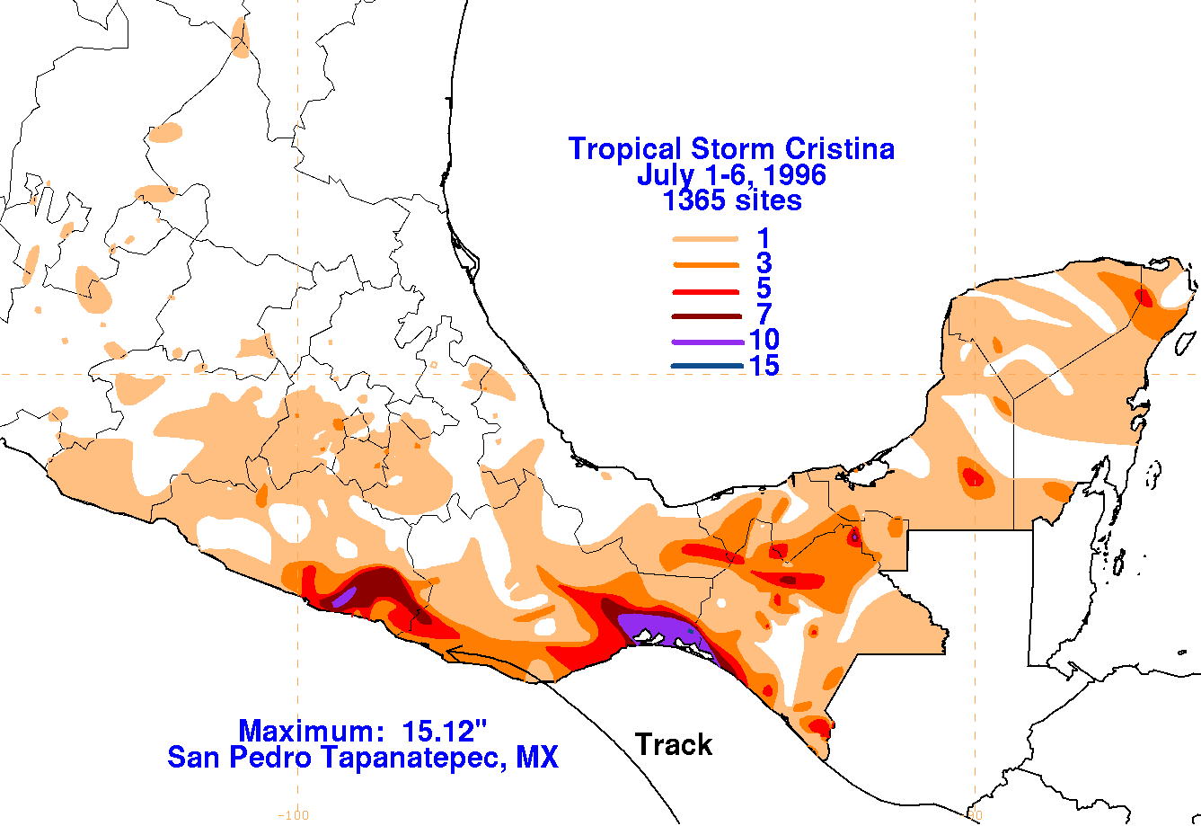
The storm total map is shown below. Rainfall information was
provided by the Comision
Nacional del Agua, the parent agency of Mexico's national weather
service.
 |
 |
 |