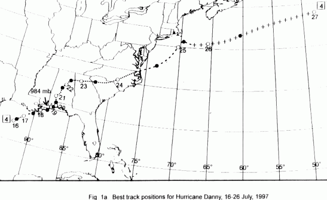
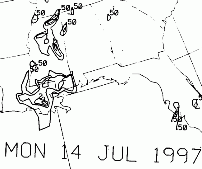
The origin of Danny was a cluster of strong to severe thunderstorms
that swept through the Lower
Mississippi valley on the 13th. The convective mass drifted
southward
into the Gulf of Mexico,
and formed a surface low south of the Bayou State on the 14th.
Initially drifting westward, the
cyclone increased its areal extent, but surface winds remained
weak.
It wasn't until the 16th,
when the system started tracking northeast that the tropical cyclone
gained organization. Upper
level southwesterlies hindered development, but Danny persisited,
becoming
a tropical storm
early on the 17th and a hurricane that night. Danny continued
its east-northeast track, against
the forecast models consensus opinion mainly because the models has
a poor handle on the
upper level environment in the Gulf of Mexico.
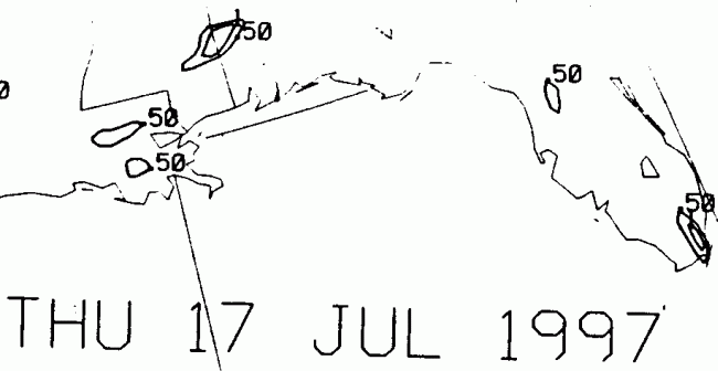
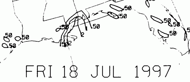
Danny made landfall near Empire and Buras, Louisiana early on the
18th.
As it was a small
system, effects were minimal across Louisiana. It peaked in
intensity
south of the Mississippi
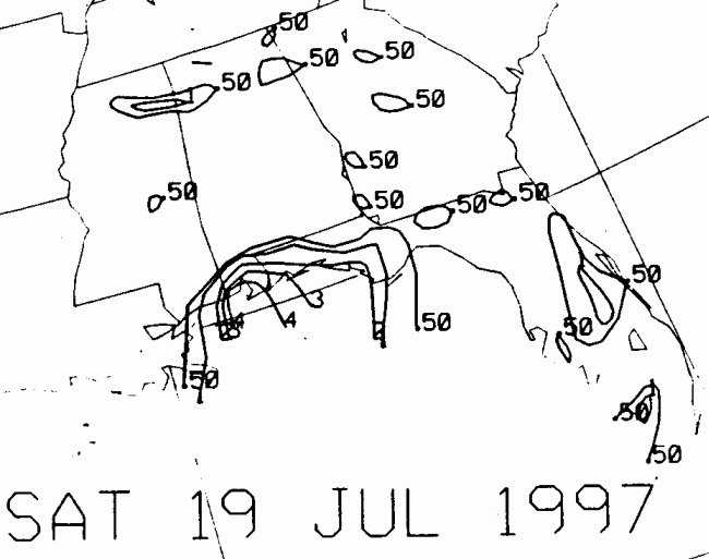
coast later that day, before stalling in Mobile Bay on the 19th.
Danny moved slowly along the
coast until the morning of the 20th, when it finally moved well inland
of Pensacola. Thereafter,
its organization remained very good as upper level winds were ideal
for its maintenance,
despite its location over land. Danny crawled northward across
Alabama on the 22nd,
before resuming its east-northeast course across the Carolinas ahead
of a stalled frontal
boundary.
Restrengthening over North Carolina, Danny acquired tropical storm
force
winds over land
as it was becoming a nontropical cyclone. The extratropical transition
was complete on the
25th, but the cyclone remained rather close to the coast of New
England.
Occluding that day
while it nearly stalled south of Cape Cod, the storm finally moved
out to sea, moving well
southeast of the Canadian maritimes. Its track lies below,
provided
by the National Hurricane
Center.
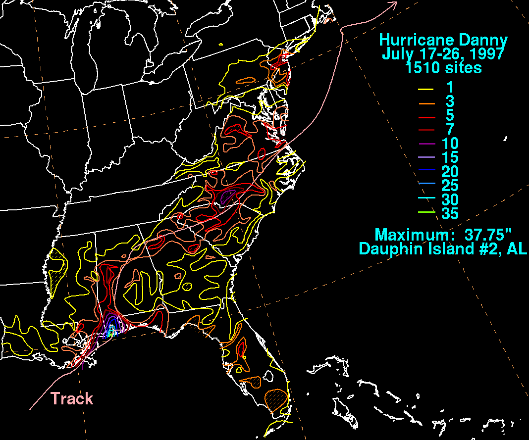
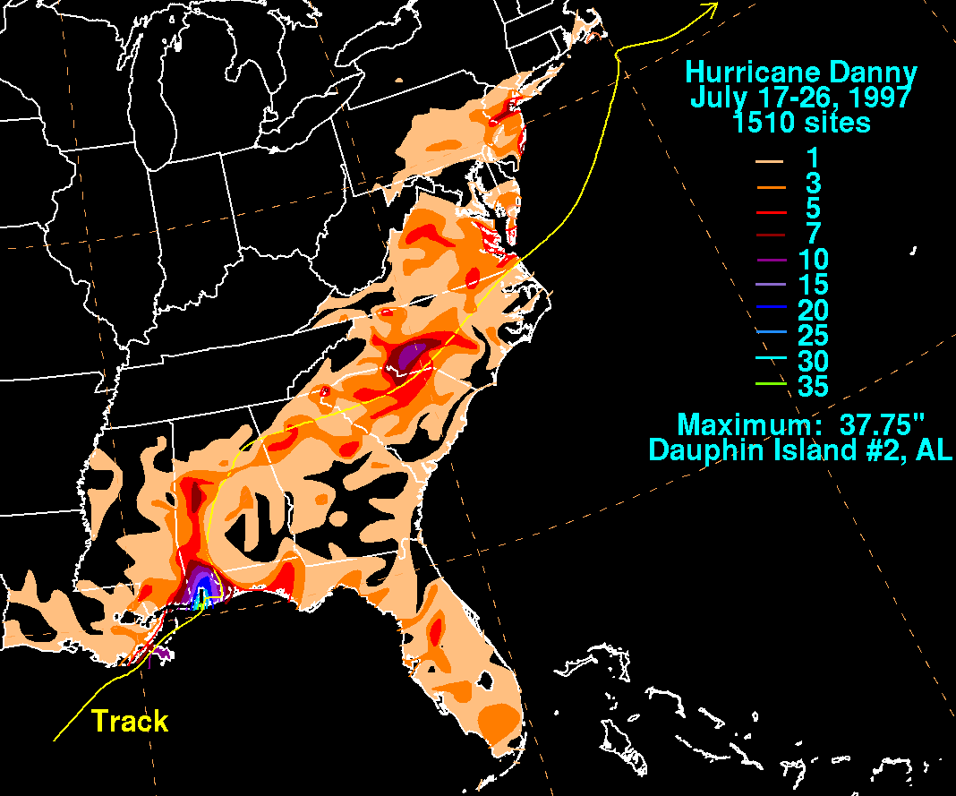
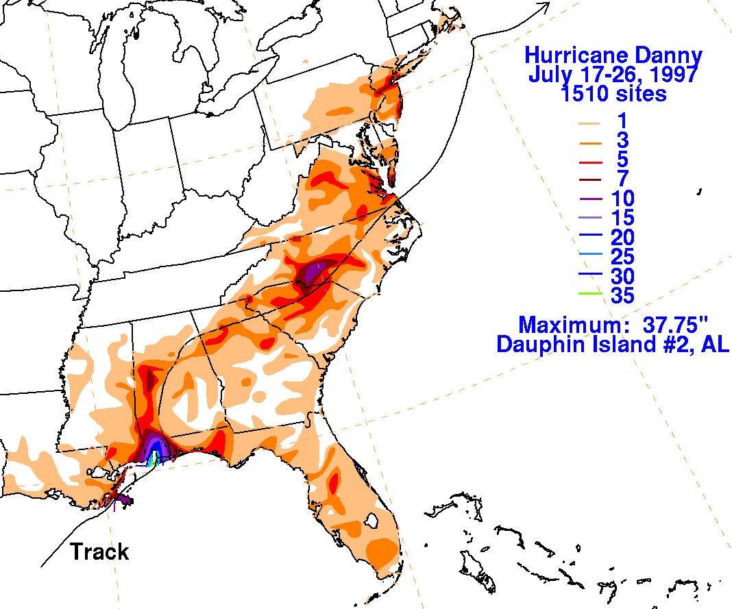
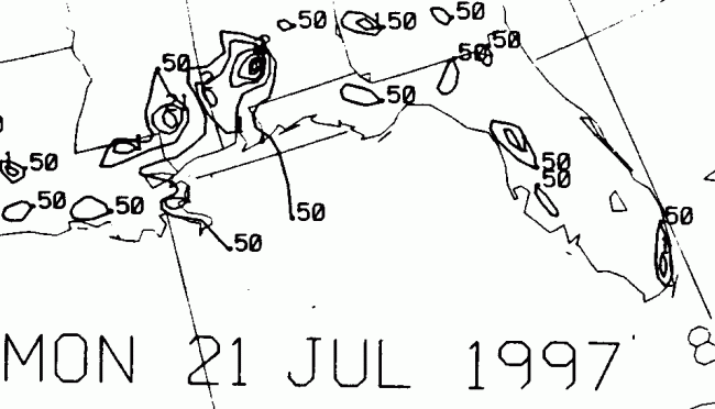
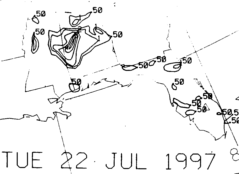
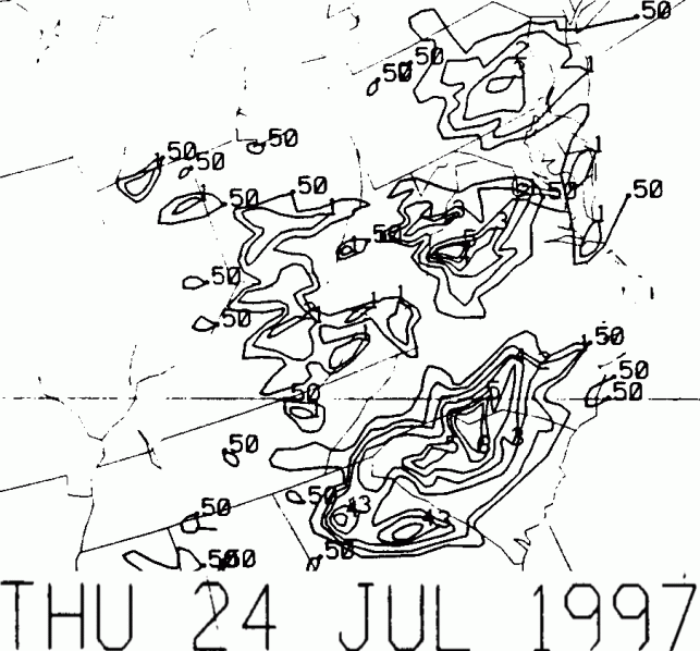
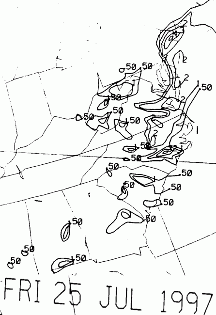
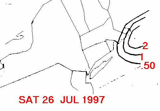
Below is a storm total rainfall map for Danny. Note the
primary
maximum in southern Alabama, where
Danny initially stalled on the 19th and 20th, and maxima farther along
the track where the precipitation
intensified each morning, in western Alabama (21st), eastern Alabama
(22nd), northern Georgia (23rd),
the central Carolinas (24th), northern New Jersey (25th), and Cape
Cod (26th).
 |
 |
 |
Below is the calendar for Daily Precipitation Maps. Note that
the 24-hour periods end
at 12z that morning.