An upper level trough in the subtropical stream of the Westerlies cut off on June 22nd and moved southwest over the western
subtropical North Atlantic ocean. Shower and thunderstorm activity increased, which caused a surface trough around the upper
low to sharpen, which helped spur additional convection. The overall system moved west over the next several days while the
upper low weakened. By early on the 27th, a well defined low formed. As thunderstorm activity increased in organization, a
tropical depression was deemed to have formed mid afternoon about 400 miles east- southeast of Charleston, SC. Convection
ebbed, with the center becoming partially exposed. The depression moved quickly to the west-northwest. By early on the 28th,
winds of tropical storm force were seen near the center shortly before a convective burst occurred. Now a tropical storm,
Danny continued to show flux in thunderstorm activity near its center before landfall that evening near Pritchard Island, SC.
Weakening into a tropical depression soon afterward, a pronounced burst of convection occurred near the South Carolina/Georgia
border as a center continued moving west-northwest. Its surface center dissipated across eastern Georgia very early on the
29th, but radar imagery showed its low- to mid-level circulation persisted for a bit longer while crossing central Gerogia
and northern Alabama before becoming dissipating on its way towards northwest Mississippi.
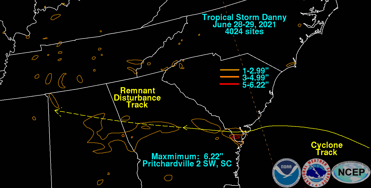
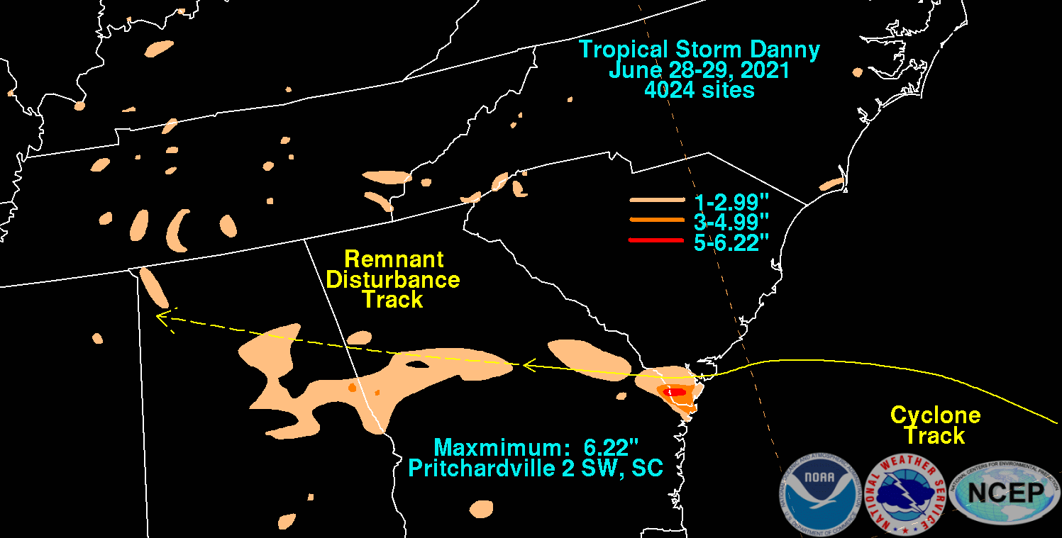
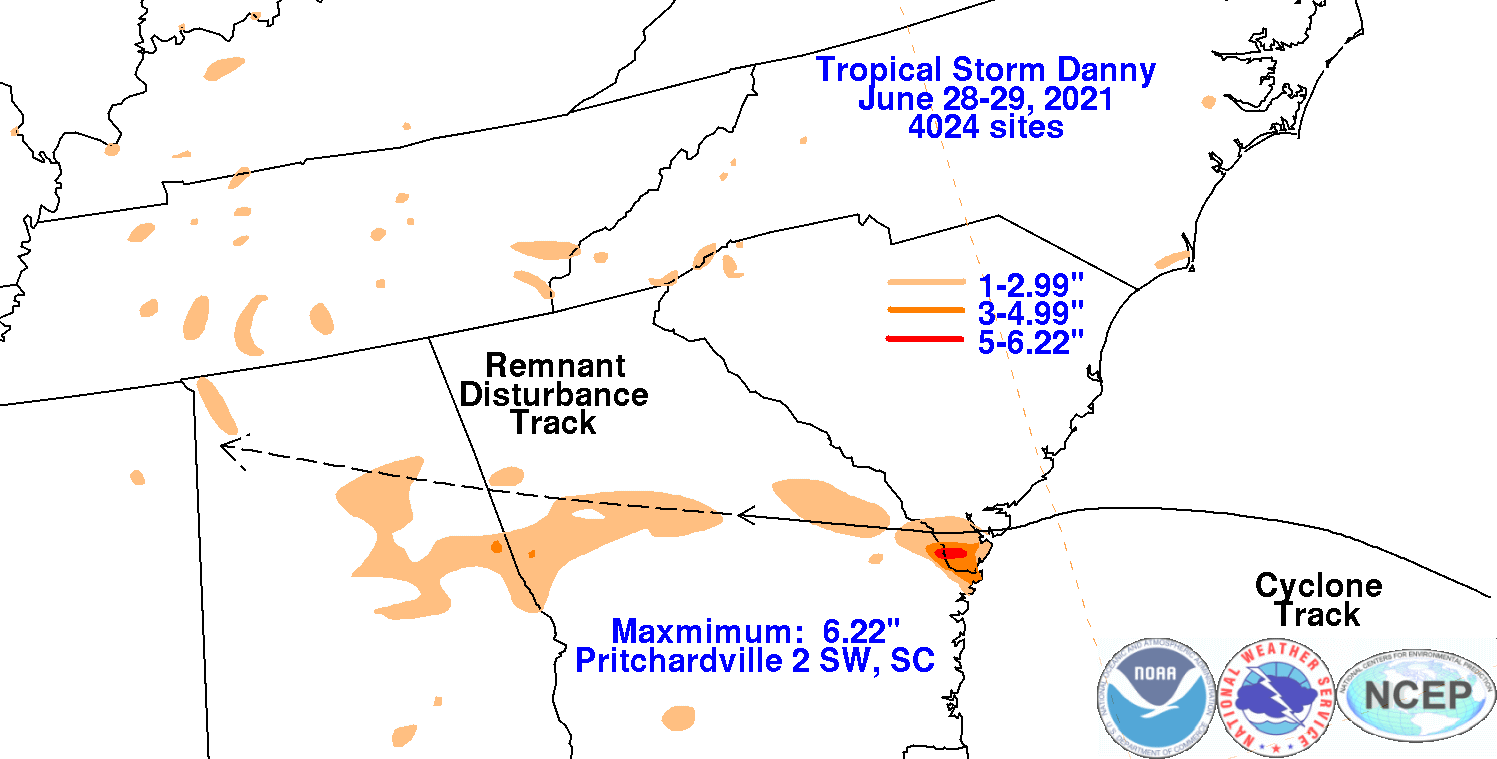
The graphics below show the storm total rainfall for Danny, which used rain gage information from the National Weather
Service River Forecast Centers, Forecast Offices, and CoCoRAHS.
 |
 |
 |