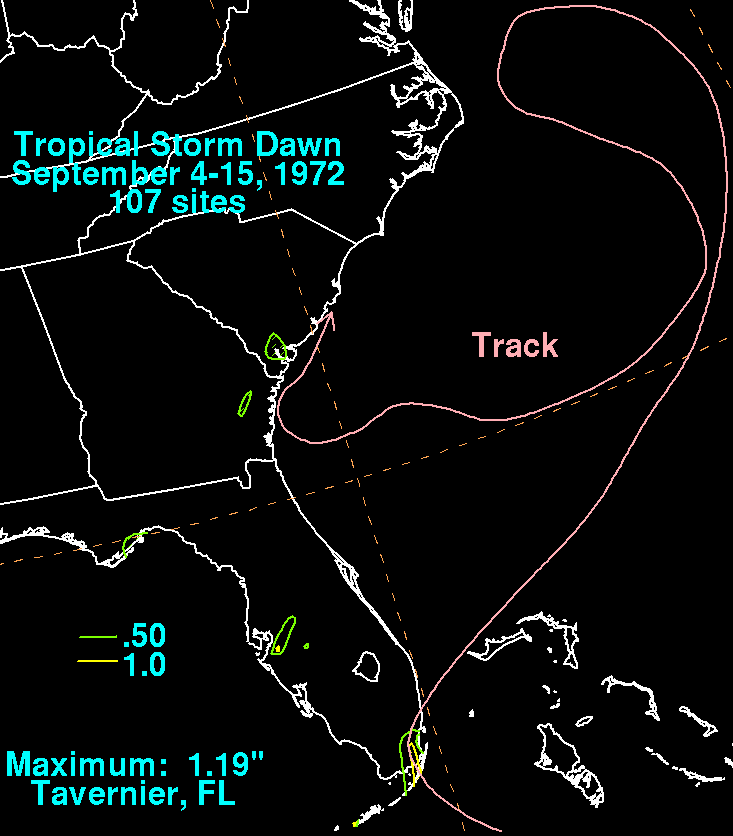
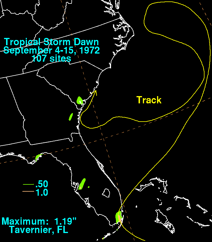
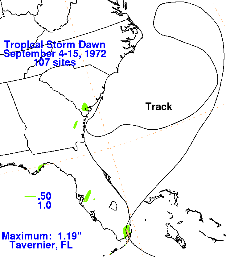
A strong tropical wave moved off the coast of Africa on August 28th, weakening as it crossed the tropical ocean.
During September 1st and 2nd, it interacted with an upper level trough which slowed movement. Moving near
the Greater Antilles, it became stationary near Florida's Gold coast on the 4th and convection increased within
its circulation. The tropical depression recurved on the 5th, intensifying as it moved northeast away from Florida.
As it moved well offshore the Southeast, a cold cyclone formed near Cape Hatteras, which swung Dawn around
to the west after briefly attaining hurricane force on the 7th. Slowly weakening, the system meandered southward
until turning west towards the Southeast coast. Its increasingly shrinking circulation and thunderstorm area moved
just offshore the coasts of Georgia and South Carolina before dissipating. Below is the storm total rainfall graphic and
track relating to Dawn. Rainfall data was provided by the National Climatic Data Center in Asheville, North Carolina.
Note how little rain fell near this dissipating tropical cyclone as at attempted landfall in the Southeast.
 |
 |
 |