An elongated area of low pressure formed in the western Caribbean Sea in mid-June, under the base of the upper
level trough which spawned Tropical Storm Chris on the 17th. The system drifted northwest, slowly organizing as it
approached the Yucatan peninsula of Mexico. A surface low formed on the 21st, and drifted north-northeast into
the Gulf of Mexico on the 23rd. Vertical wind shear from the southwest and west plagued Debby from the start,
and never relented, keeping its deep thunderstorm activity north and east of its center through its life cycle. By
the afternoon of the 23rd, the system had become sufficiently organized and was declared a tropical storm.
Debby then moved slowly northeastward across the eastern Gulf of Mexico, despite most of the numerical guidance
indicating it would turn westward into southern Texas. This was due to the models unrealistically coupling the tropical
cyclone with the upper low expected to form and exist across the western Gulf of Mexico. Debby edged towards
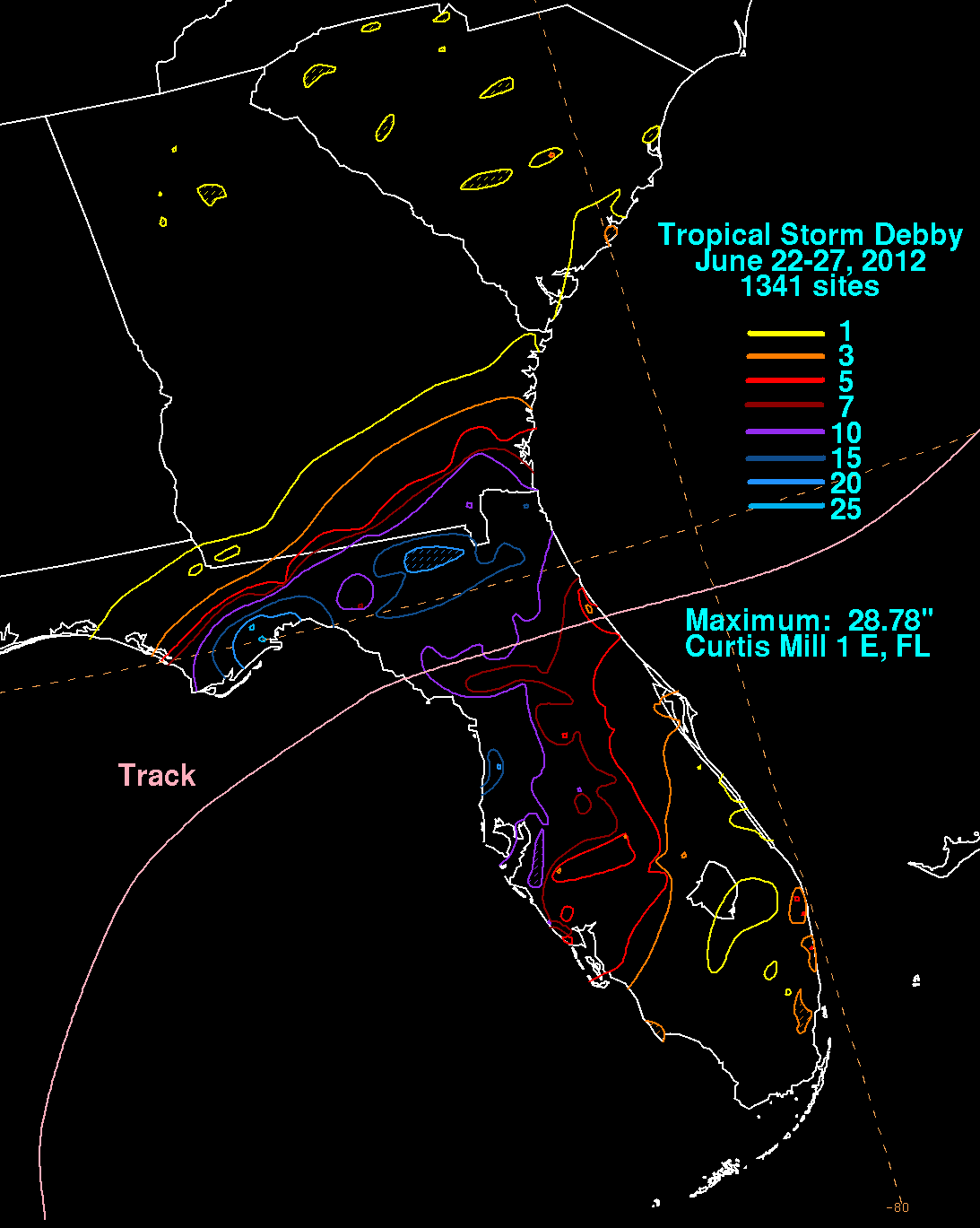
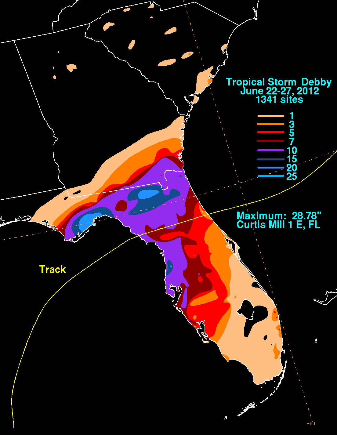
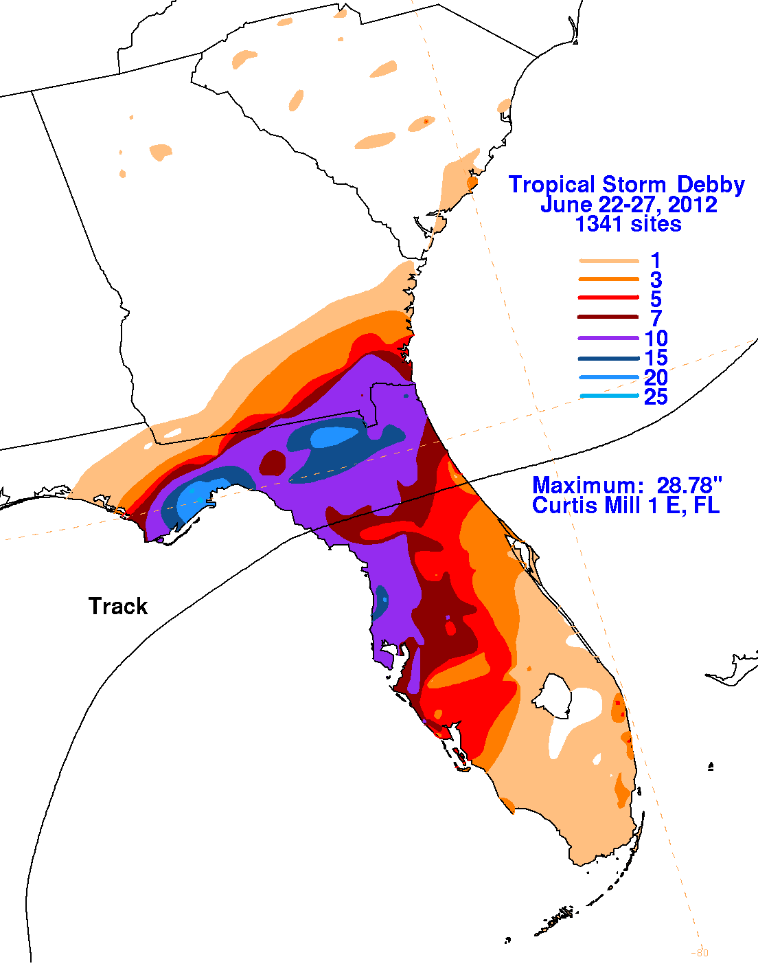
Florida, dropping its heaviest rains north of Tampa primarily on the 23rd, across the eastern Florida panhandle on
the 24th, and across northeast Florida on the 25th, mainly along its coastal front northeast of its center. As
a cold front dropped into its coastal front, Debby began the transition into an extratropical cyclone. Debby moved
across Florida on the 26th as a tropical depression, and completed its extratropical transition on the 27th, becoming
a gale center across the western subtropical Atlantic.
The first three graphics below show the storm total rainfall for Debby, which used rain guage information from the National Weather
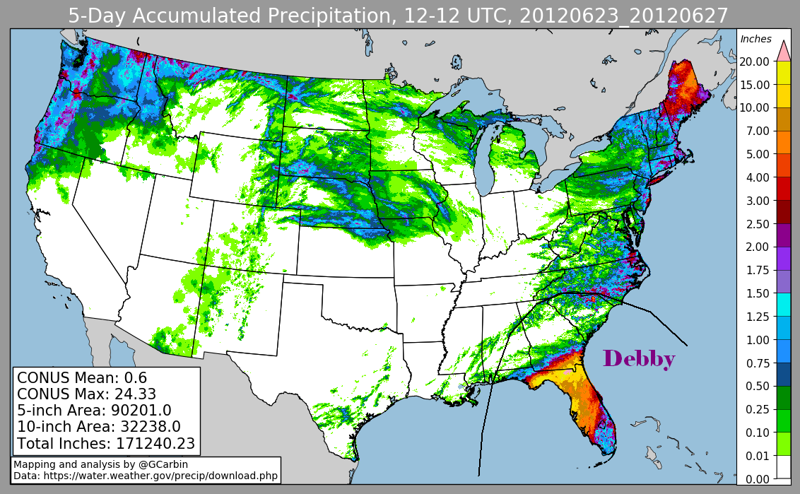
Service River Forecast Centers, Forecast Offices, and CoCoRAHS. The fourth image includes radar-derived information.
 |
 |
 |
 |