An upper level cold low formed over south Florida on the evening of August 24th. The low moved southwest
through the morning of the 26th, moving to just north of the Yucatan peninsula while developing a surface reflection.
Meanwhile, a tropical wave moved into the region, which led to the formation of a tropical depression on the morning
of the 26th. Initially moving westward to the south of the subtropical ridge, the western portion of the high eroded,
turning the system onto a more northerly course. The cyclone briefly became a tropical storm before making landfall
near Cameron, Louisiana with maximum sustained winds near 60 mph. The system weakened slowly as it moved
inland, and the cyclone became a frontal wave on the 29th which moved east-northeast through the Ohio Valley.
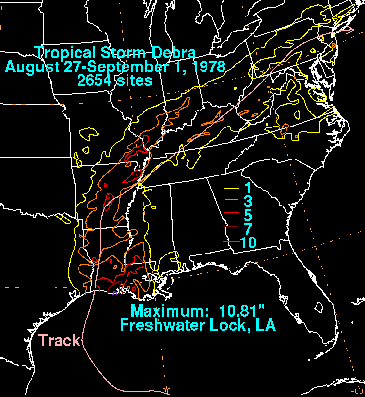
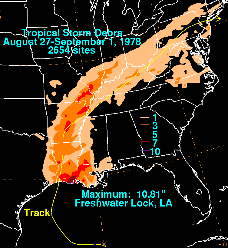
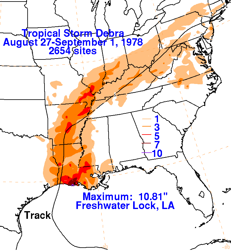
The storm total graphics lie below for Debra. Rainfall data was gathered from the National Climatic Data Center
in Asheville, NC.
 |
 |
 |