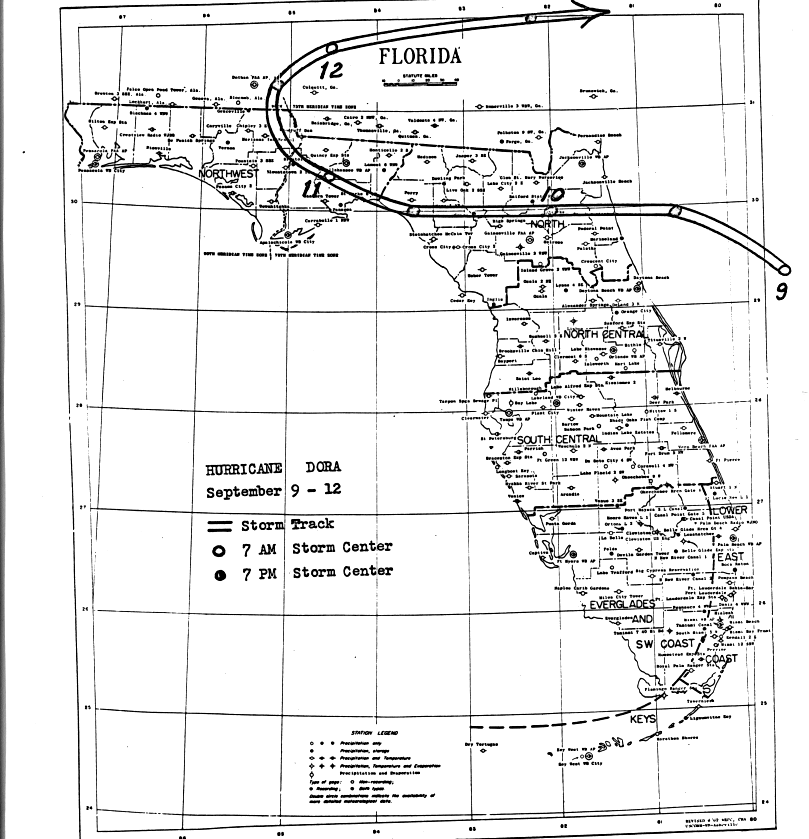
Dora was the first hurricane to impact northeast Florida in at
least 79 years. It began as a low pressure area that
passed through the Cape Verde islands on the 28th of August.
By the time reconaissance aircraft investigated the
system on the 1st, it had developed into a full-fledged tropical storm
well east of the Lesser Antilles. It developed
into a hurricane on the 2nd as it began to move northwest. As
it passed 300 miles south of Bermuda, it tracked
on a more westerly course, missing the trough developed from the
extratropical
cyclone formerly known as Cleo.
This is when Ethel formed to its east. As Dora approached the
north Florida coast, its movement slowed, allowing
a populace not used to hurricane evacuation the time to do just
that.
Tides peaked at 12 feet at Anastasia Island.
The heaviest of the rain fell during the 11th and the 12th and the
storm doubled back to the east. Below is the
track of this cyclone, provided by the National Hurricane Center.
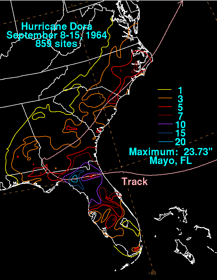
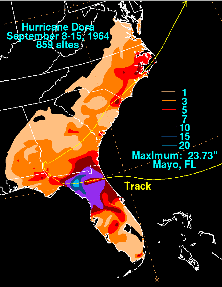
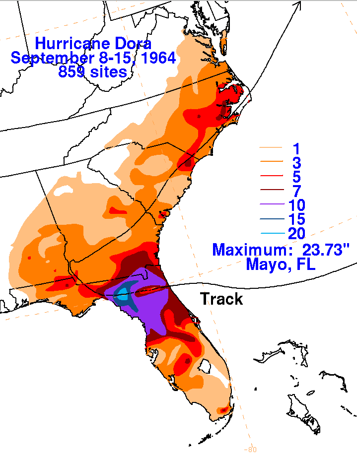
The graphics below is the storm total rainfall for Dora using data
obtained from the National Climatic Data Center
in Asheville, North Carolina. Note
the maximum across northwest Florida...the
highest amount was 23.73" at Mayo,
just prior to the center's closest approach to the Florida Gulf
coast.
|
|
|
|
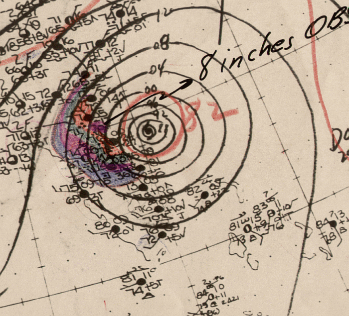
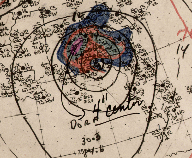
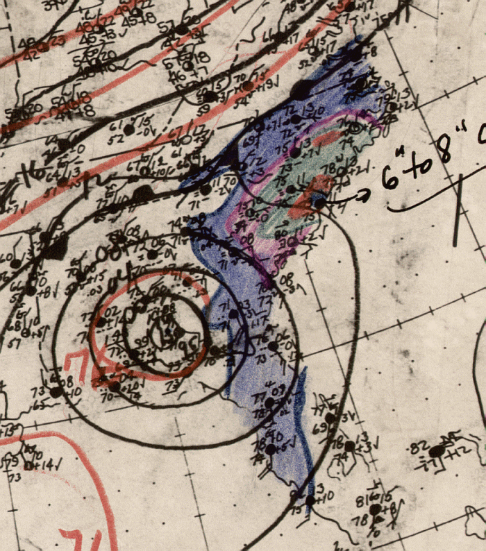
Below is the daily calendar of rainfall, with 24 hour amounts ending
at 12z in
the morning that day. Surface analyses
are from the start of the rainfall period (i.e. surface map from 17th
at 12z will underlay the precipitation which
falls between the 17th and 18th at 12z). The time 12z corresponds
to 8 am EDT, or 7 am CDT.
| Sun. |
Mon. |
Tue. |
Wed. |
Thu. |
Fri. |
Sat. |
| 10 |
11 |
12 |
||||
| 13 |
14 |