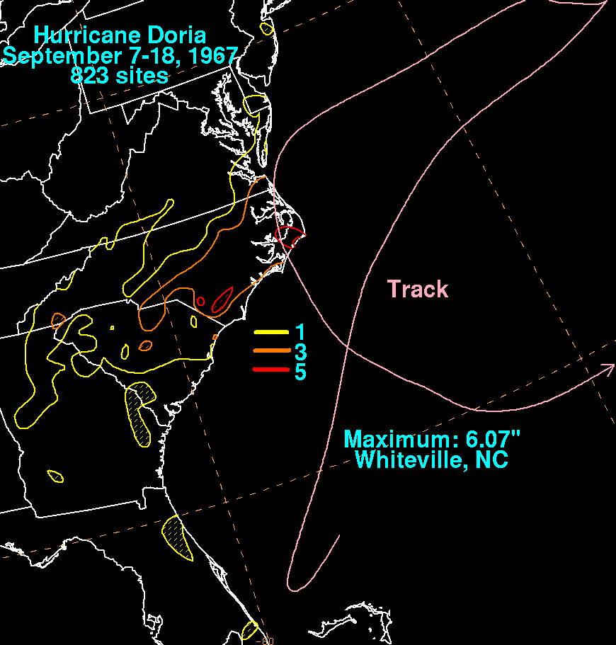
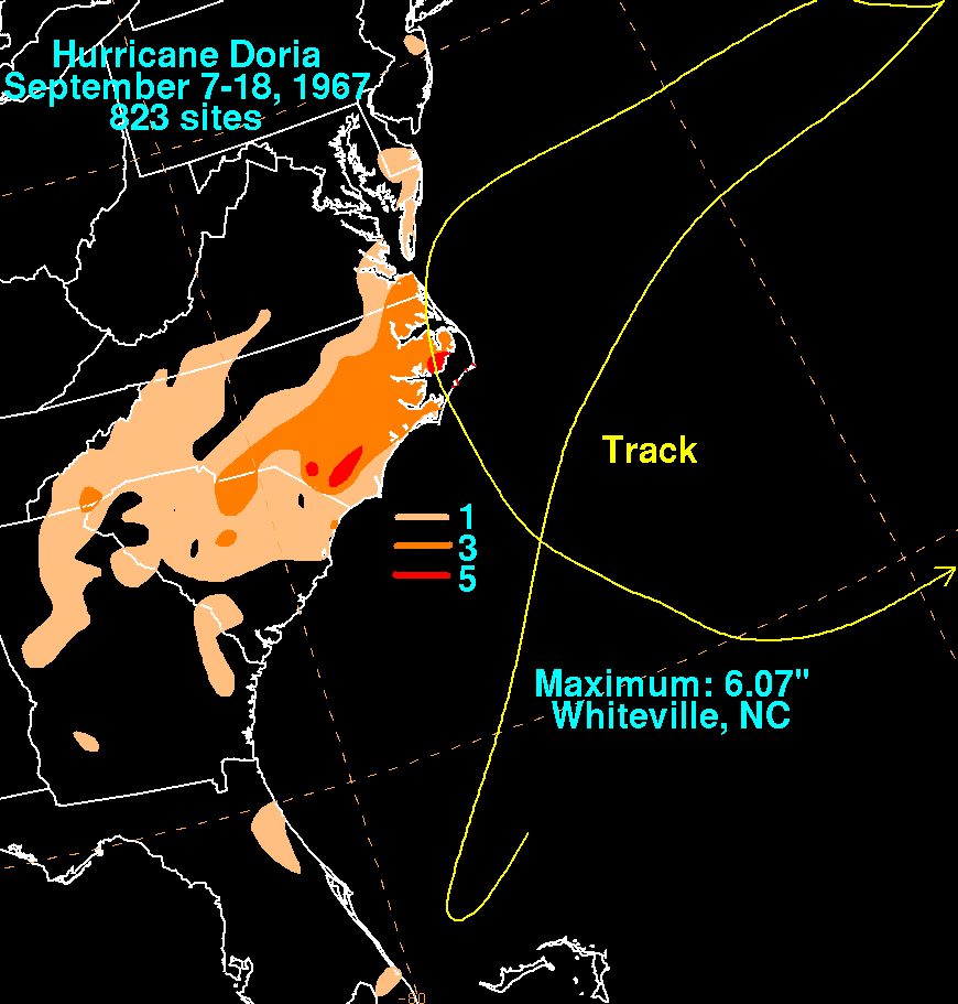
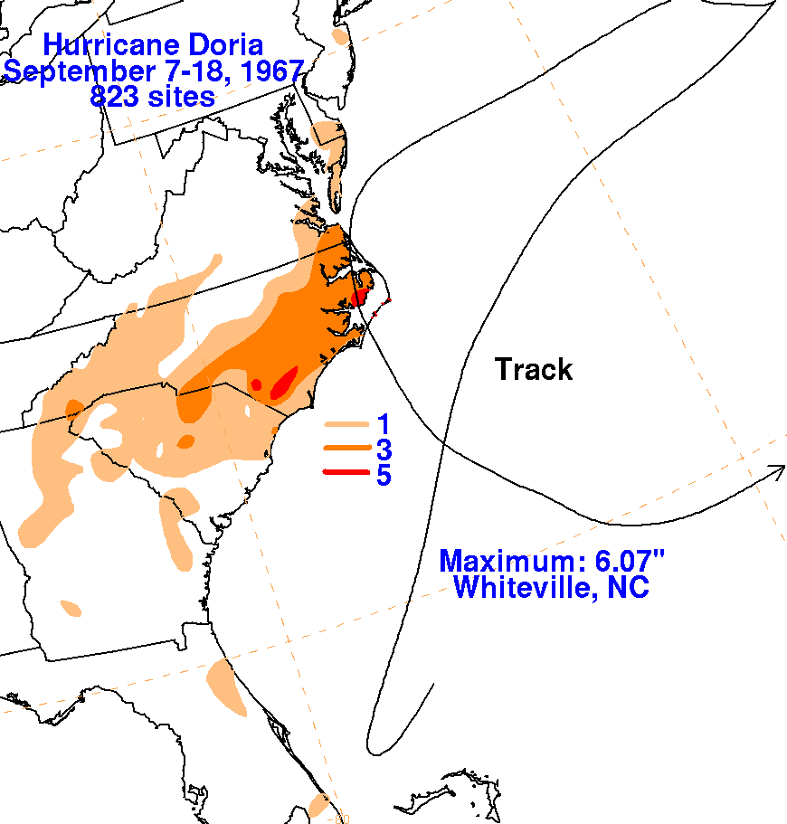
The initial disturbance which evolved into Doria was a frontal wave which developed offshore northeast
Florida on September 4. The low drifted about 250 miles east of Jacksonville for the next few days. Drifting
south, the system developed into a tropical depression just north of Grand Bahama Island on the 8th. Recurving
offshore the Florida coast, the depression strengthened into a tropical storm on the 9th east of Cape Kennedy. As
the system moved offshore the southeast North Carolina coast, Doria strengthened into a hurricane on the 10th. On
the 11th, cool/dry air became entrained into its circulation, weakening Doria as it moved eastward out to sea. On
the 12th, Doria strengthened back into a hurricane once the influence of cool/dry air diminished. A blocking ridge
of high pressure halted Doria's eastward movement and turned the storm back to the west, towards the Mid-Atlantic
coastline. Remaining a hurricane until just prior to landfall in southeast Virginia on the 16th, Doria turned to the
south reingesting cooler air, and weakened quickly while moving through eastern North Carolina. Turning back to
the east between Jacksonville and Bermuda, Doria continued weakening until dissipating several days later. The
graphics below show the storm total rainfall for Doria, using data from the National Climatic Data Center
in Asheville, North Carolina.
 |
 |
 |