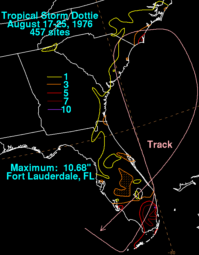
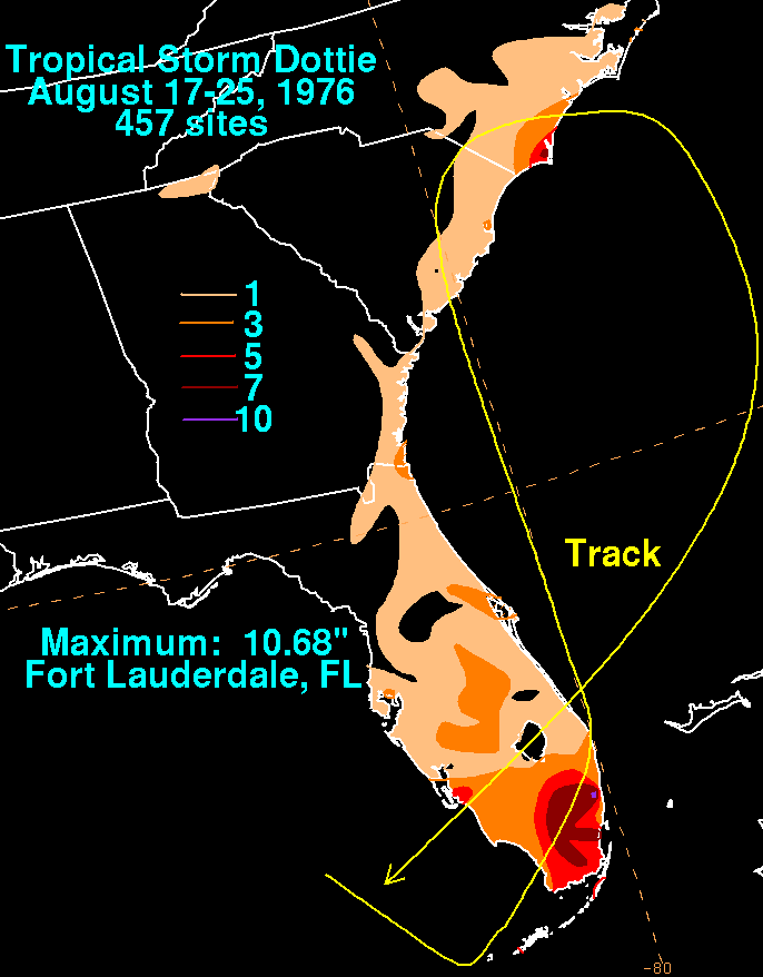
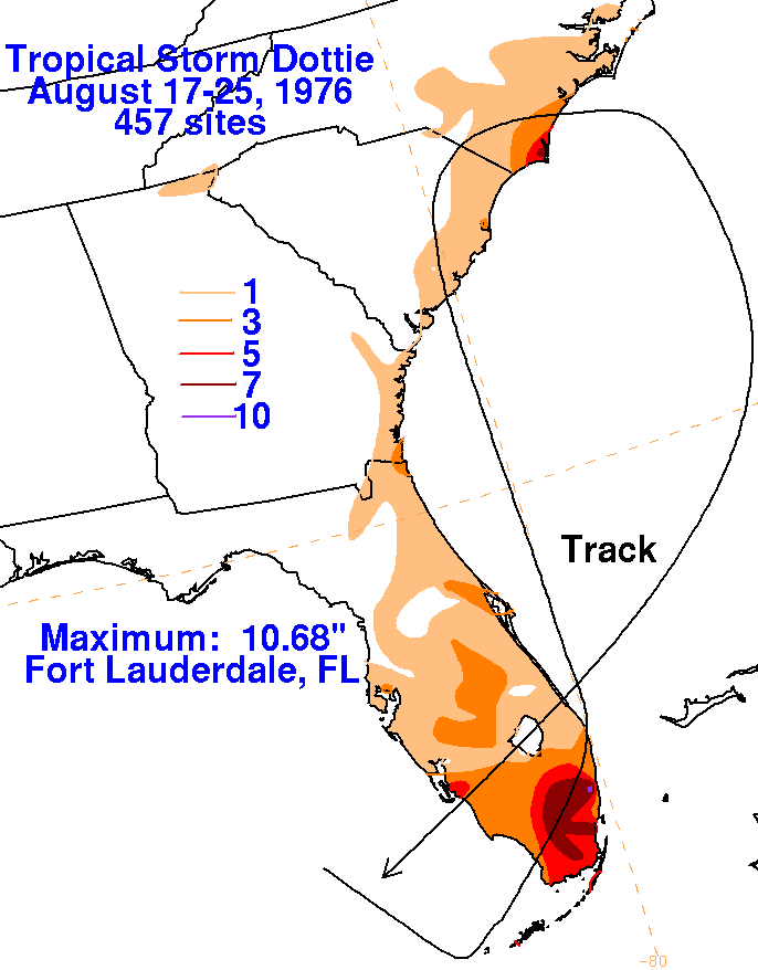
The initial low which evolved into Dottie formed 150 miles northwest of Key West due to a strong upper trough
which had moved southward through the eastern Gulf of Mexico. By the morning of the 18th, a definite center
had formed, and the tropical depression drifted eastward for the next day. During the morning of the 19th, Dottie
accelerated rapidly northeast across South Florida as it became a tropical storm. The system peaked with 50 mph
sustained winds east of Daytona Beach. Vertical wind shear weakened the storm thereafter, and Dottie moved
northward into South Carolina as a weak tropical storm. The remnant low moved eastward back into the western
Atlantic ocean on the 22nd, and completed an anticyclonic loop by the 25th as its center opened up while crossing
South Florida a second time and moving into the Gulf of Mexico. The graphics below show the storm total rainfall
for Dottie, which used data compiled by the National Climatic Data Center in Asheville North Carolina.
 |
 |
 |