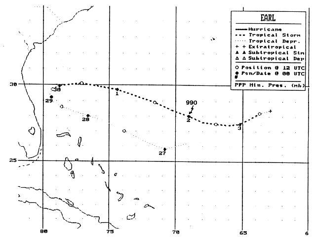
A tropical wave moved off the coast of Africa on the 18th of
September and moved
uneventfully across the Atlantic. It interacted with an upper low
that had previously
provided/been carved out by the outflow channels for Bonnie and
Danielle. A closed
upper low developed in the trough axis, which helped form the tropical
depression
north of Hispaniola on the 27th. The system moved west-northwest
and increased in
intensity into a tropical storm on the 29th. The track shifted on
a more easterly course
ahead of a cold front, and the system eventually weakened in early
October as it
paralleled its prior course, becoming a frontal wave on the 3rd.
Its
track is below,
supplied by the National
Hurricane Center.
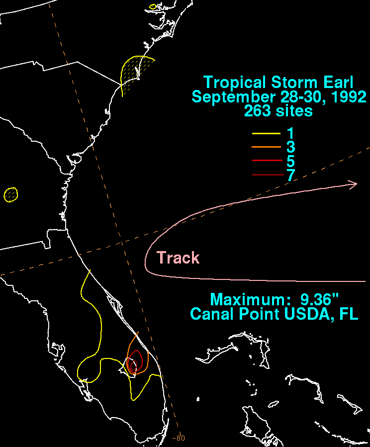
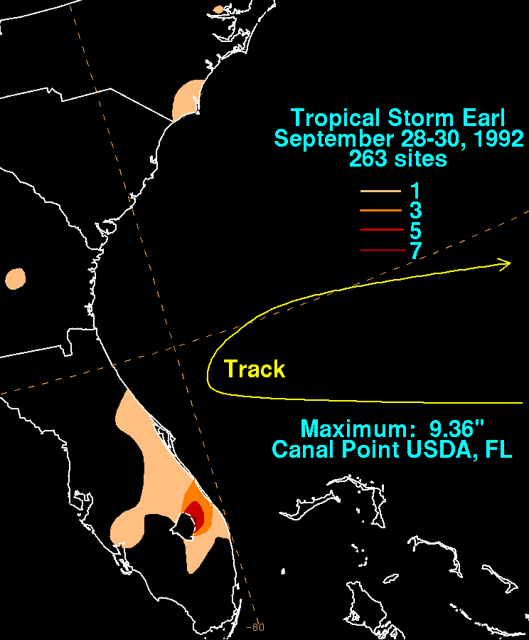
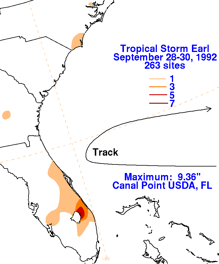
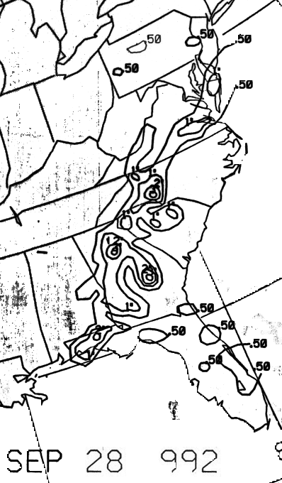
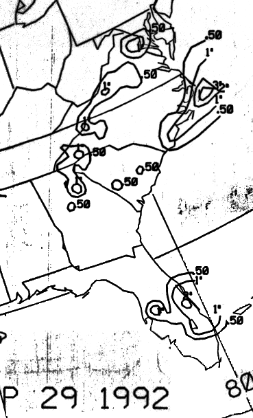
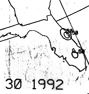
The graphics below show the storm total rainfall for Earl...data
provided
by the National Climatic
Data Center in Asheville, NC. Northeasterly shear induced by an
upper cyclone to its east drew
thunderstorms forming in its southwest quadrant into Martin and Palm
Beach counties.
 |
 |
 |
Below is the calendar for Daily Precipitation Maps. Note that
the 24-hour periods end
at 12z that morning.