An upper level low strengthened as it moved eastward along the
northern Gulf coast on the 4th and the 5th, stalling near
the northeast Florida coast on the 6th and 7th. The system
dropped southwest across the peninsula into the Gulf of Mexico
by the morning of the 8th, spurring the development of thunderstorm
activity near Grand Bahama Island on the morning of
the 9th. A surface low formed with this feature by afternoon and
deepened as it moved northwest into the Space Coast,
creating sustained storm-force winds with gusts above hurricane
strength near its center. Once it moved inland that evening,
the low weakened and coupled with the parent upper level low over
northern Florida on the 10th, with the system stalling into the
11th. The cyclone moved northeast on the 12th, curving northwest
across the central Appalachians on the morning of the 13th
before becoming absorbed by an approaching occluded cyclone across the
Midwest.
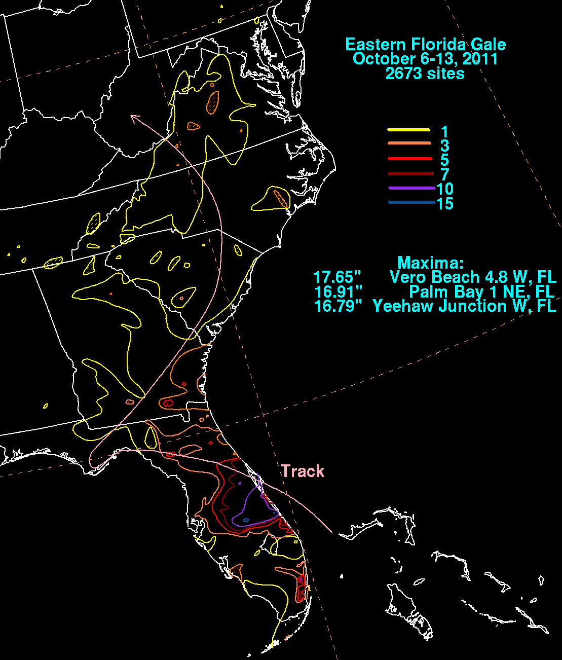
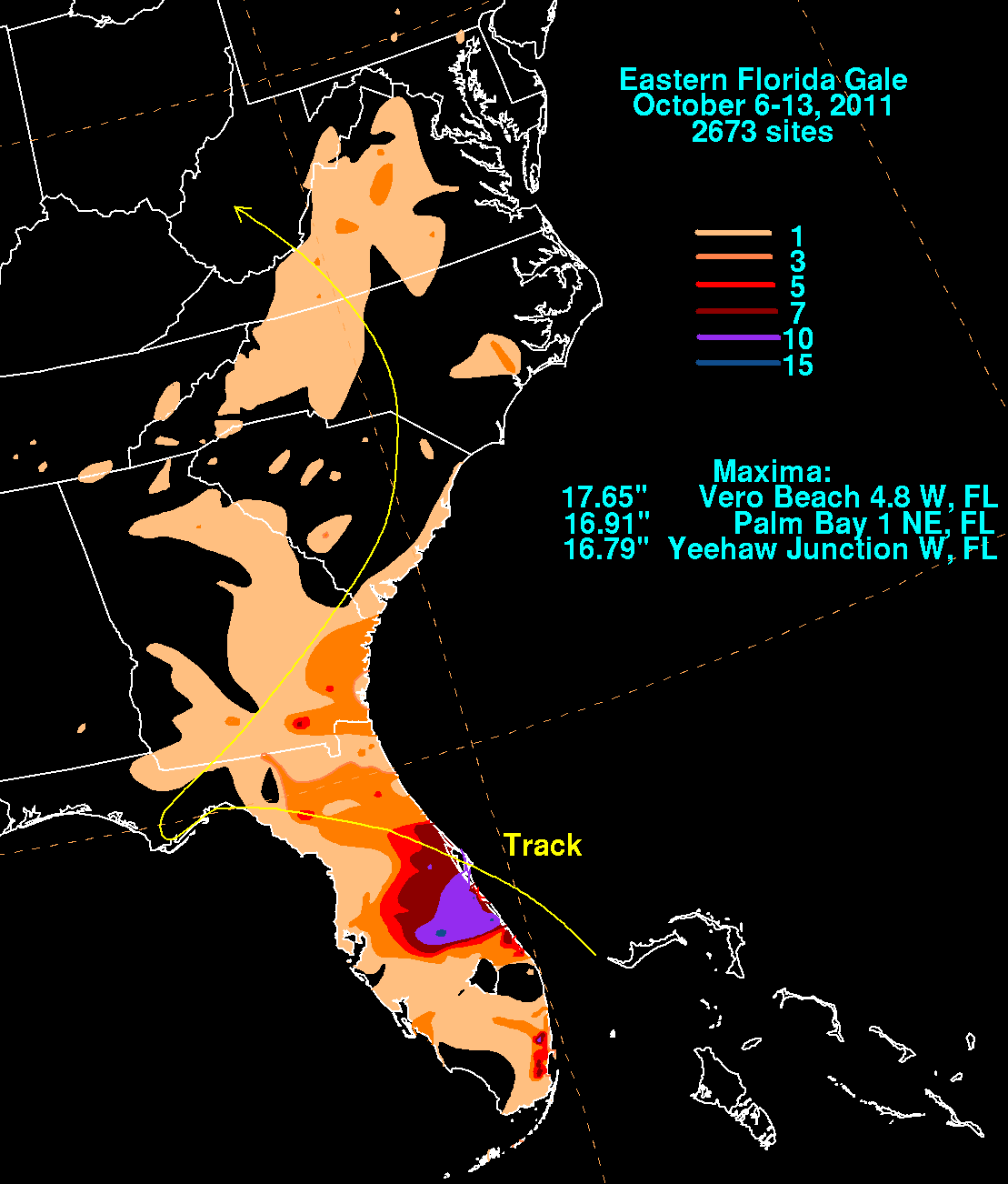
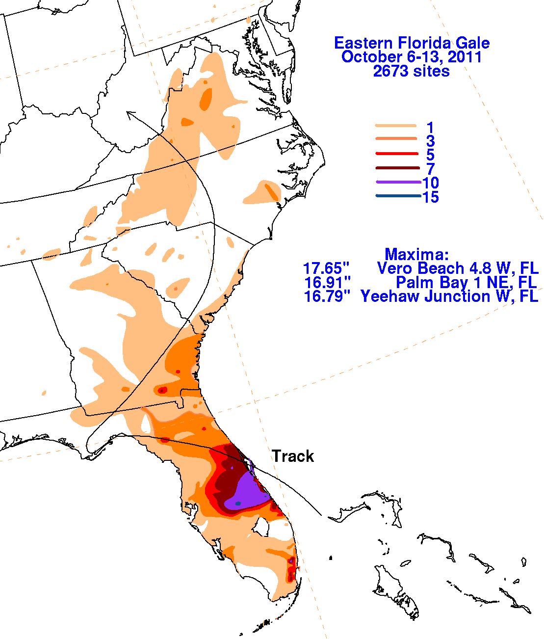
The track within the graphics below was extracted from real-time
surface analyses produced at the Hydrometeorological
Prediction Center and the
National Hurricane Center. Rainfall information was provided by
National Weather Service
River Forecast Centers, public information statements from Melbourne
and Jacksonville, Florida, and CoCoRAHS.
 |
 |
 |