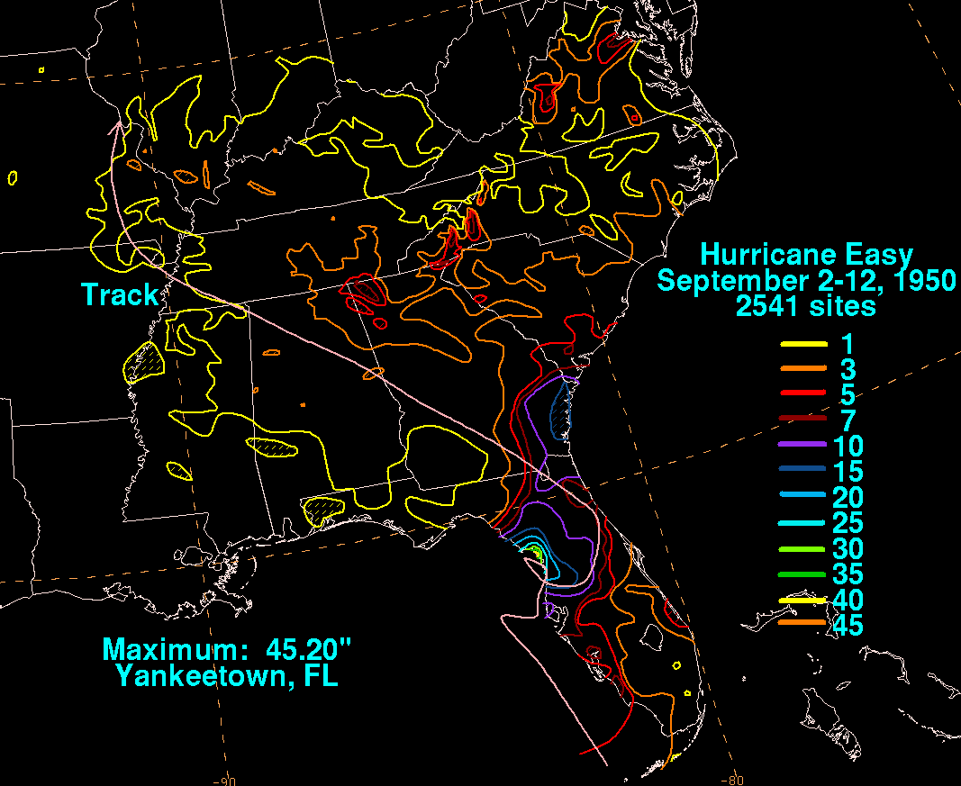
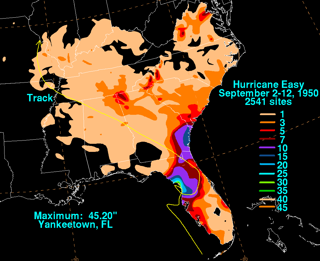
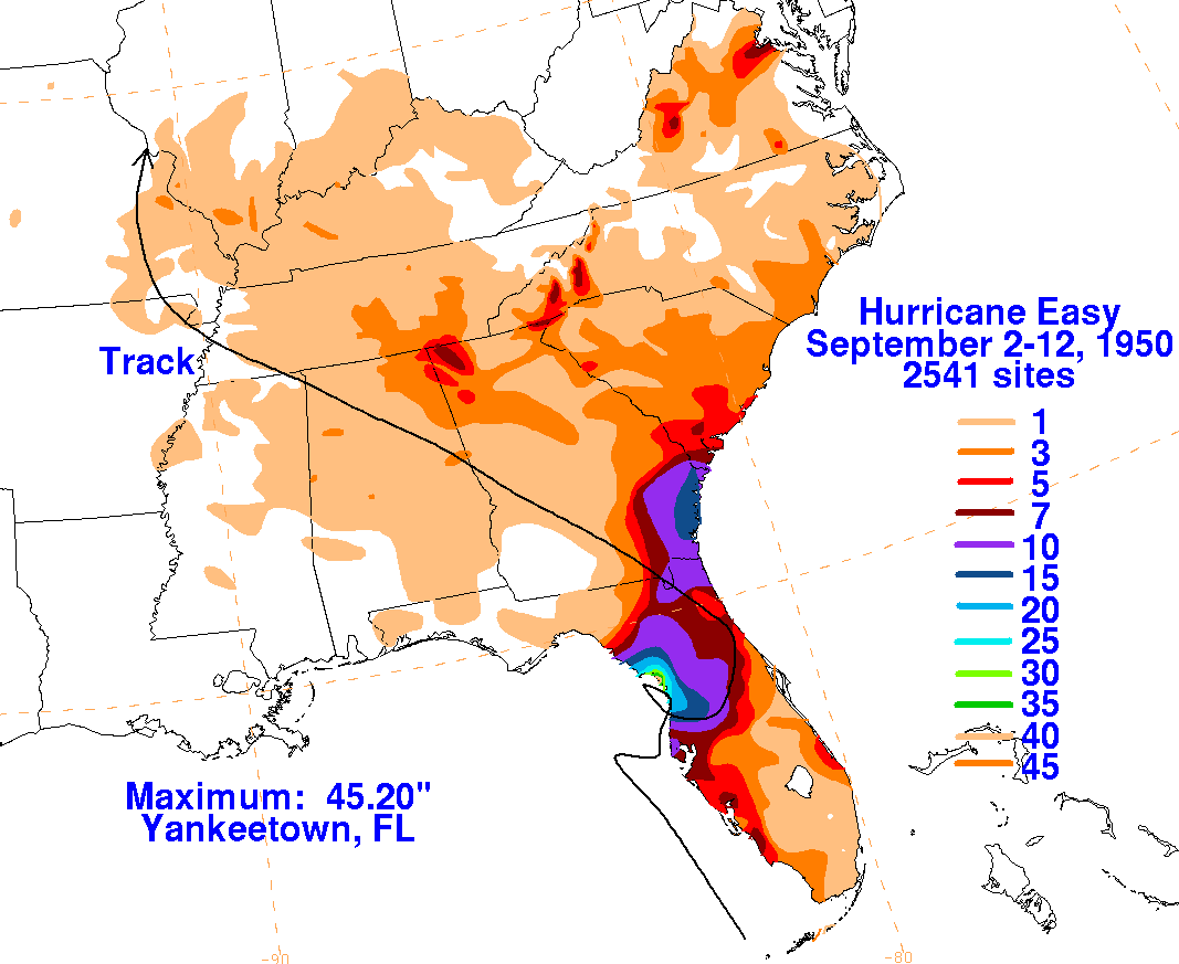
This system developed near the Isle of Youth on September 1st.
Stationary for the first couple days
of its life, the system moved northward through Cuba passing near
Havana. Passing the Florida Keys
as a minimal hurricane, Easy paralleled the Florida coast by around 40
miles on the 4th. Looping as it
moved east to northeast, the center reached the Cedar Keys on the 5th
before moving back away to the
east, which brought the same side of the cyclone to the Cedar Keys
twice. During the first loop, Easy
became a category 3 hurricane. Moving away to the southeast, the
center approached Tampa before
moving across the northern Florida peninsula. While it dissipated
as a tropical cyclone over Georgia
on the 7th, the remaining area of low pressure moved west-northwest
through the Deep South, slowing
its progression as it turned to the north over the central Mississippi
valley on the 10th and 11th. By the
morning of the 12th, a cold front approached from the northwest and the
cyclone was no longer detectable.
Below are the rainfall graphics
for Easy, which used data from the National Climatic Data Center
in Asheville, North Carolina.
 |
 |
 |