On September 2nd, active convection was noted on satellite imagery in the tropical eastern Atlantic. As it
moved westward, the disturbance weakened becoming difficult to locate by the time it reached the 50th meridian.
Reconnaisance aircraft flew into the system as it approached the Windward Islands on the 5th, and found a tropical
depression. By the time it reached the central Caribbean, it had developed into a tropical storm. Deepening continued
as Edith continued moving west, and the cyclone became a hurricane early on the morning of the 8th. Before reaching
Nicaragua, Edith rapidly intensified into a major hurricane on the 9th with an eye only 5 miles wide.
Moving across Nicaragua, Honduras, and the Yucatan peninsula, Edith weakened into a tropical storm. Emerging into
the Bay of Campeche by the 12th, Edith moved west-northwest as Fern helped the cyclone gain some latitude, with Edith
eventually making landfall near Soto la Marina on the 13th as a tropical storm. Barely moving inland, Edith turned to the
north-northeast, accelerating offshore into the Gulf of Mexico by the 15th and strengthening back into a hurricane before
making a third and final landfall in southwest Louisiana. Once inland, Edith slowed down and weakened back
into a tropical storm, and a tropical depression as it moved through Mississippi. The low weakened over the next
few days, fading as it entered western Georgia on the 18th.
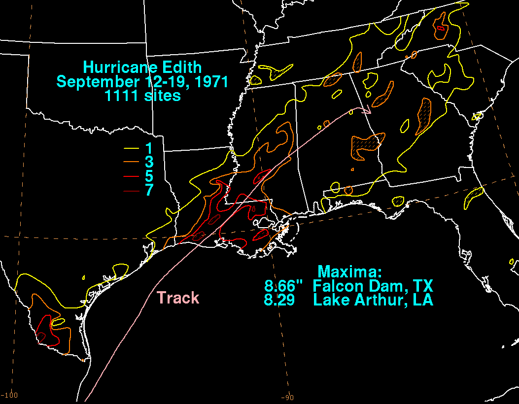
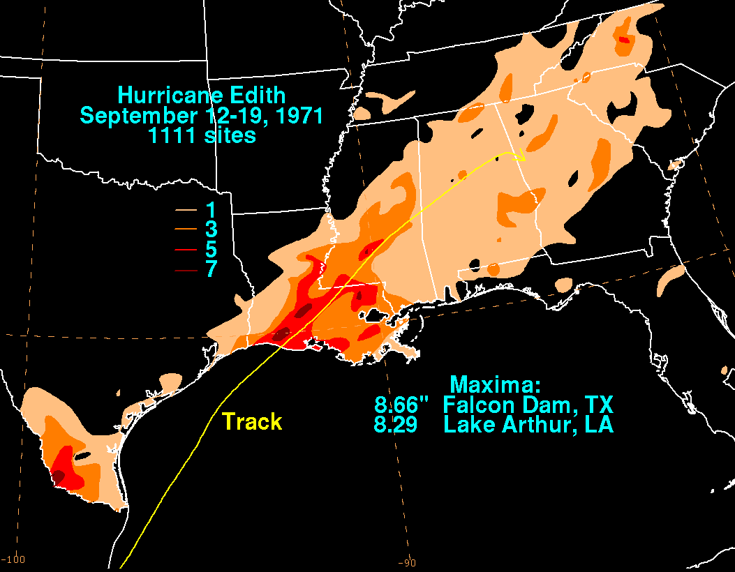
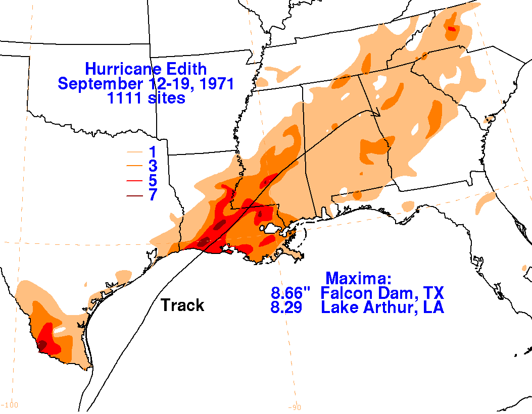
Below is the storm total rainfall graphic and track relating to Edith. Rainfall data was provided by the National
Climatic Data Center in Asheville, North Carolina.
 |
 |
 |