An old frontal zone degenerated into a shear line, which sagged into the Gulf of Mexico. An upper level
disturbance dug southward towards the Gulf coast, spurring a surface low near the western Florida panhandle
on the morning of August 2nd. Initially situated in diffluent northerly flow, the low slowly organized, and
Tropical Depression 5 formed on the 3rd, before becoming a tropical storm that evening. Vertical wind shear
became westerly on the 4th, which caused convection to fire on its eastern side and slowly shift around its
northern periphery. The tropical storm reorganized, slowly strengthening on the night of the 4th and early
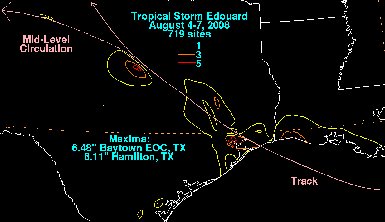
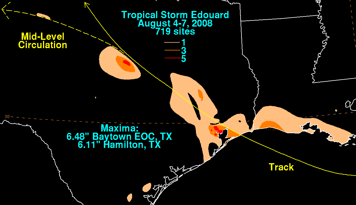
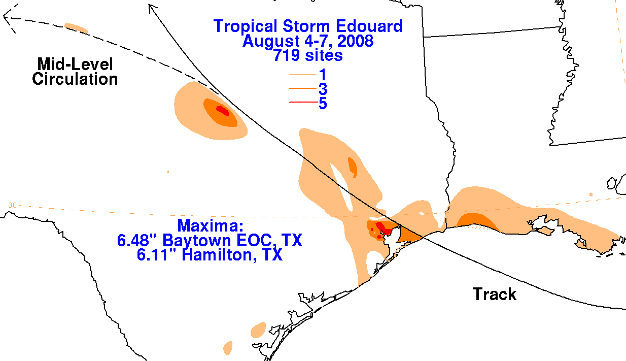
on the 5th before making landfall in southern Jefferson county in Texas. Experiencing easterly shear around
the time of landfall, rainfall maxima shifted to its southwest quadrant and the overall rainfall potential of this
small system was lessened. A flare up of convection on the morning of the 6th led to flash flooding near
Hamilton, Texas and a secondary rainfall maximum. Moving west-northwest, Edouard's surface circulation
dissipated early on the 7th, but its circulation aloft could be followed on radar imagery late into the morning,
before dissipating entirely.
Below are the rainfall graphics associated with Edouard. Data for the first three was compiled from rain guage observations
originating with the National Weather Service River Forecast Centers, and storm reports from the Slidell, Lake Charles, and
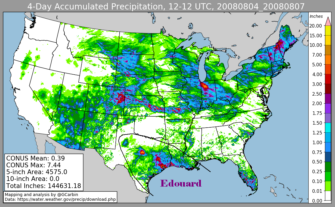
Houston Forecast Offices. The fourth graphic includes radar-derived information.
 |
 |
 |
 |