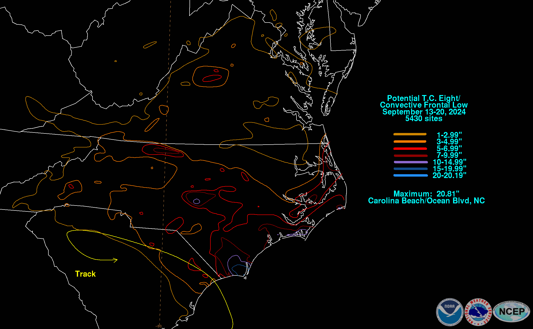
A frontal wave formed offshore northeast Florida on September 13th, a formation which was partially due to Post-Tropical Cyclone Francine to its west. The cyclone moved east-northeast through the morning of the 14th along the front. The low briefly became blocked/stalled thereafter for a time before moving back to the west-northwest late on the 14th into the 15th. Thereafter the cyclone drifted northwest, and because it had some convection near its center and there was a chance for tropical cyclone development, it was designated Potential Tropical Cyclone Eight. The cyclone moved ashore near Myrtle Beach during the late afternoon of the 16th before occluding and weakening thereafter. The cyclone made a portion of a cyclonic loop across northern South Carolina into the 17th before losing its surface reflection. The circulation aloft moved little, and caused a slowly shrinking pocket of heavy rainfall across the Carolinas into the 20th.
The graphics below show the storm total rainfall for Potential Tropical Cyclone Eight, which used rain gage information from National Weather Service River Forecast Centers, xMACIS2, National Weather Service Forecast Offices, and CoCoRAHS.
 |
 |
 |