A well organized cloud pattern moved out of the Sahara Desert and was
first identified on satellite
imagery north of the Cape Verde Islands on the 23rd of August.
The system moved unusually fast;
30-35 mph to the west across the Atlantic. This combined with the
dry saharan air mass around the
system apparently inhibited the formation of a tropical cyclone until
it approached Cuba on the evening
of the 27th. On the 28th, reconnaissance aircraft measured 50-60
mph winds in its northern periphery
while the system was centered over central Cuba, and tropical storm
Elena was born.
After moving into the Gulf of Mexico north of Havanna, Elena quickly
strengthened into a hurricane
on the 29th. A cold front approached from the northwest, which
collapsed the steering currents around
Elena, and the storm began recurvature. It approached Florida,
moving quite close to Tampa Bay and
Cedar Key, before high pressure bridged the frontal boundary and
steered Elena back towards the west.
The cyclone intensified as it accelerated west-northwest, and was a
major hurricane by the afternoon of
the 1st. On the 2nd, the hurricane made landfall near Biloxi,
Mississippi. Bursting convection after moving
inland, Elena brought locally heavy rains to Louisiana, Arkansas, and
Kentucky over the succeeding four
days that the system maintained integrity while it was inland.
After the night of the 5th, the remaining
cloud system became stretched in a north-south axis and quickly faded
while moving eastward across
Kentucky.
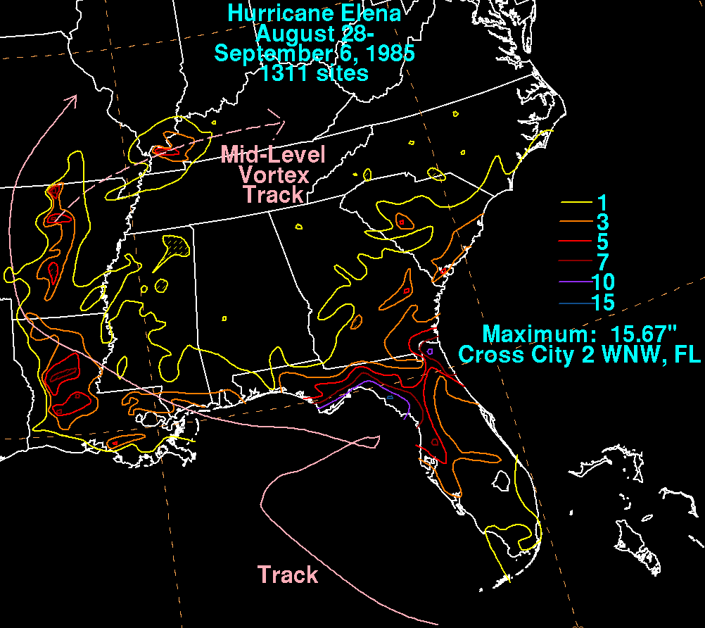
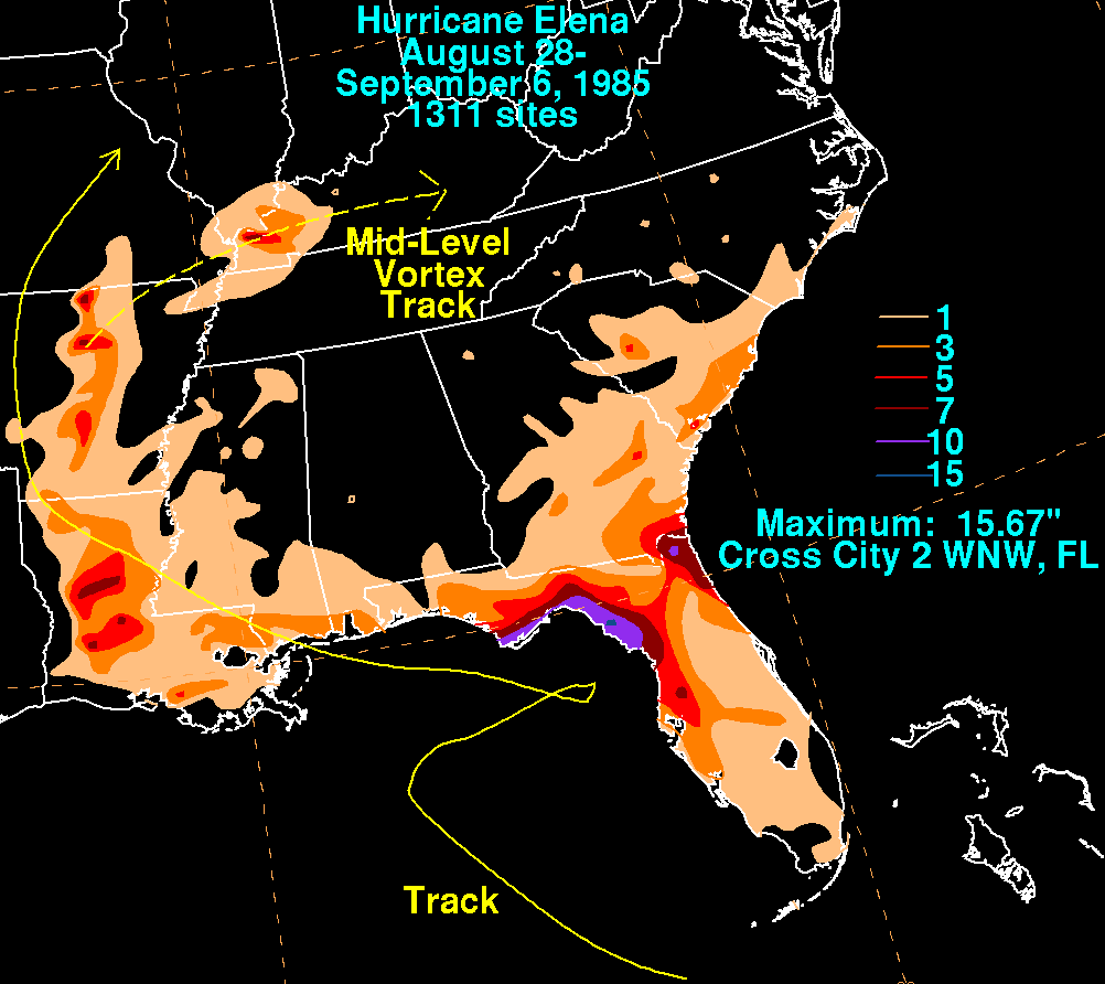
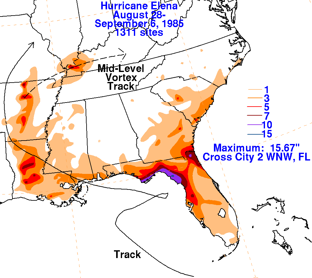
Below are storm total rainfall maps for Elena. Rainfall
information was obtained from the National
Climatic Data Center. Note the maxima shifts from west
of the track to east of the track once Elena
moved inland. This could have been due to
an upper low that remained quasi-stationary in the
Tennessee Valley.
 |
 |
 |