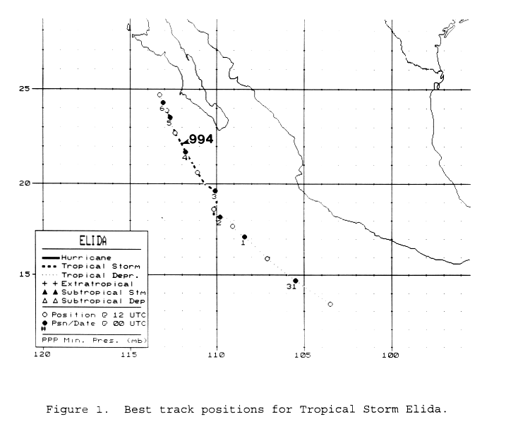
A tropical wave moved across the tropical Atlantic during mid to late August, developing a small
area of thunderstorms each day. After it moved into the Pacific ocean, thunderstorm activity became
more concentrated on August 30th to the south of Mexico. Becoming a tropical depression, the system
initially moved west-northwest towards the 110th meridian. Light northeasterly vertical wind shear
kept development slow, with the system named Tropical Storm Elida on September 2nd. An upper low
moved to the north of the system, slowing its forward movement and shifting its track more northerly
in the direction of Baja California. After paralleling the southern tip of the peninsula, a combination of
vertical wind shear and reduced sea surface temperatures weakened the system to dissipation by the time
it passed Point Eugenia on September 7. Its track, provided by the National Hurricane Center, is below.
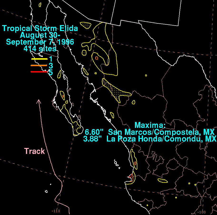
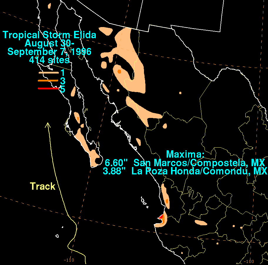
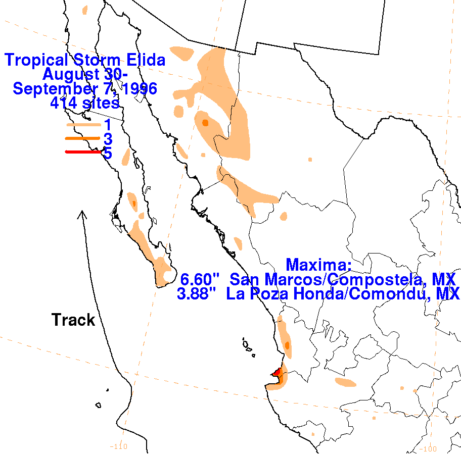
The graphics below show the storm total rainfall for Elida, using
data provided by the Comision
Nacional del Agua, the parent agency of Mexico's national weather
service.
 |
 |
 |