Emily was the first hurricane in the Caribbean Sea since Katrina
(1981), ending a record long hurricane drought
for the region. A tropical disturbance moved off the west African
coast on September 13th, just behind Tropical
Storm Dennis. It remained weak and travelled south of the 10th
parallel across the Atlantic. Slight organization
was noted on the 17th before two more days of nondevelopment. By
the 19th, the system detached from the ITCZ,
and a surface circulation became evident on satellite imagery.
That evening, the system became a tropical depression
near 10N 51W. By the next afternoon, Emily had become a tropical
storm. Moving parabolically around the
subtropical ridge to its north, the system moved west-northwest through
the eastern Caribbean Sea. Hurricane status
was achieved while centered 175 miles south of Puerto Rico on the 22nd,
and the system continued to stregthen rapidly.
Nine hours before striking the Dominican Republic, Emily reached the
borderline between category 3/4, with winds of
135 mph. Recurving rapidly, Emily weakened to tropical storm
strength after passing by Hispaniola before
restrengthening into a hurricane just prior to reaching Bermuda as it
moved at a rapid 45 mph forward motion.
Eventually moving nearly 60 mph northeastward, Emily became a
non-tropical low after passing the 40th parallel.
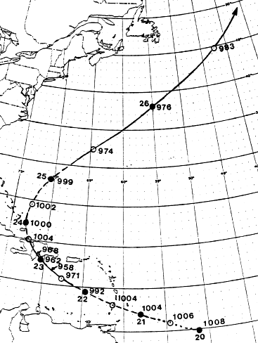
Below is its track, provided by the National Hurricane Center.
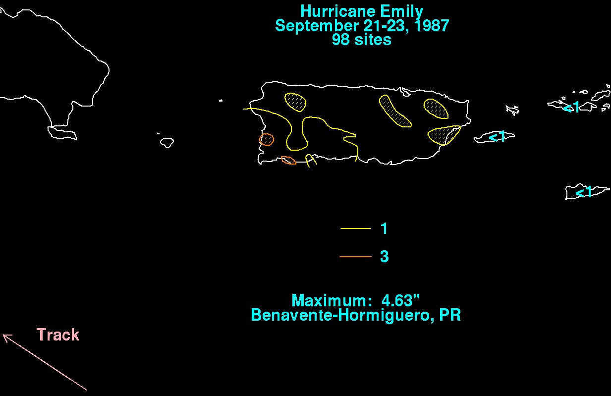
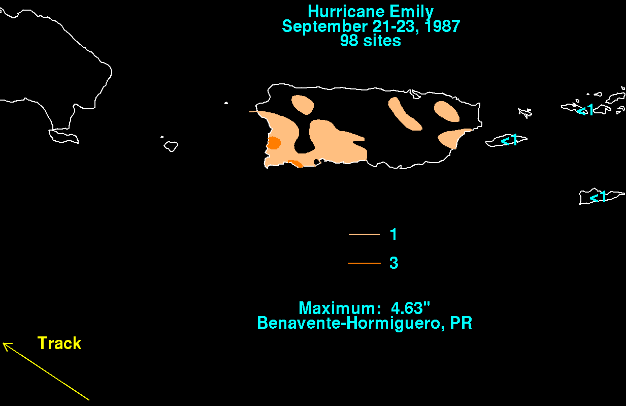
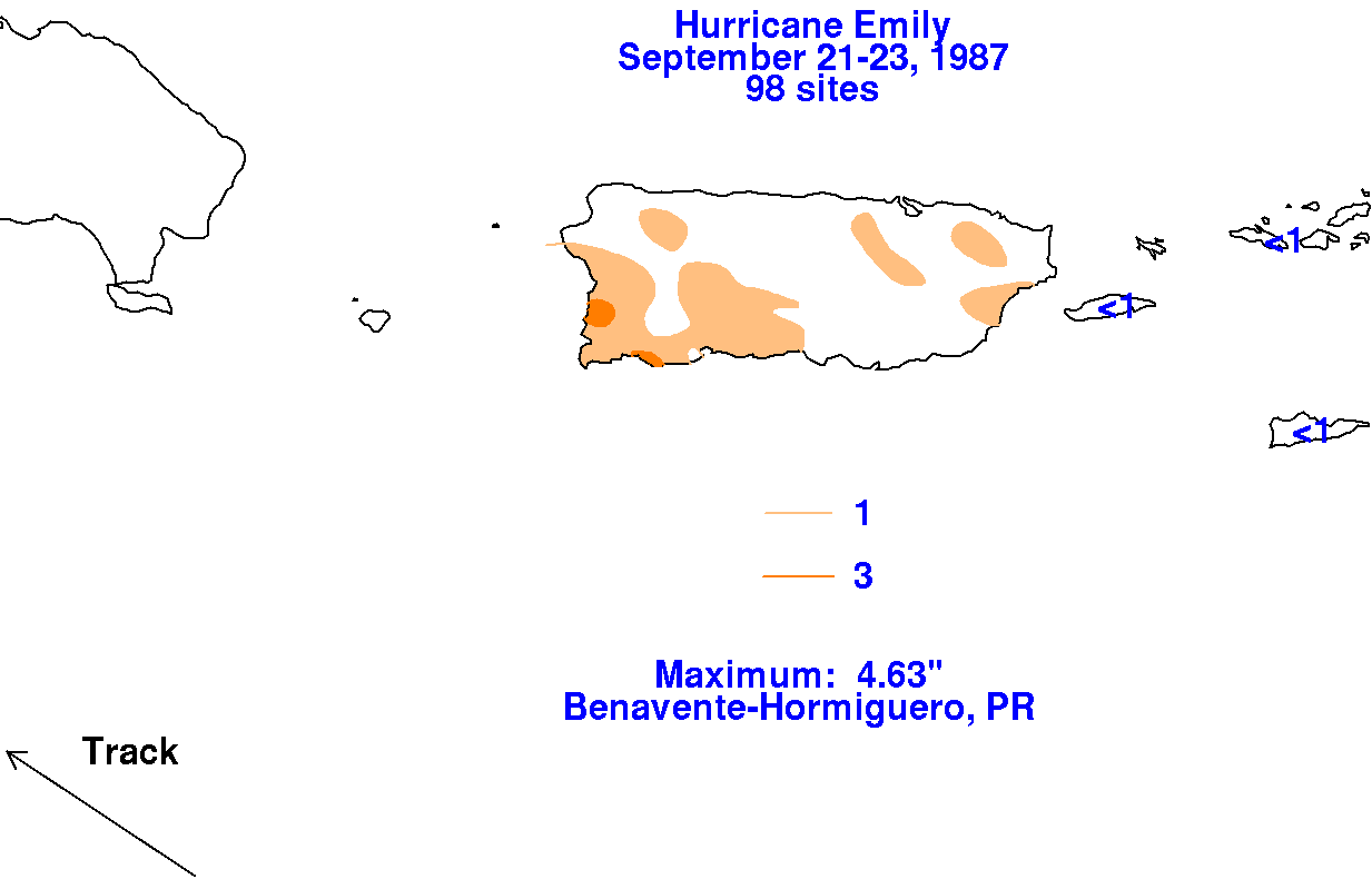
The storm total precipitation map for the northeast Caribbean is shown
below, using data provided by the National
Climatic Data Center in Asheville, NC.
 |
 |
 |