Emily formed from a tropical wave on July 11th about 1300 miles east-southeast of the Lesser
Antilles.  Moving westward, the tropical depression became a tropical storm on the 12th.  As
Emily was moving through the southern Windward Islands on the 14th, it rapidly intensified to
hurricane strength near Grenada, and developed into a major hurricane in the eastern Caribbean
Sea.  Over the next few days, Emily chugged west-northwest, continuing to strengthen, and
reached the threshold of category 5 status...with winds of 155 mph...when located south of
Hispaniola.  Emily passed to the south of Jamaica and the Cayman Islands, before striking
Cozumel as a low-end category 4 hurricane, with maximum sustained winds of 135 mph.  Emily
weakened while crosssing the Yucatan peninsula, but regained major hurricane status in the
southwest Gulf of Mexico.  The hurricane struck Mexico for a final time on the 20th in
northeast Mexico about 75 miles south of the US/Mexico international border with maximum
winds near 125 mph.  Emily rapidly weakened over the terrain of northeast Mexico,
dissipating south of Monterrey.  Below is the track of this cyclone.
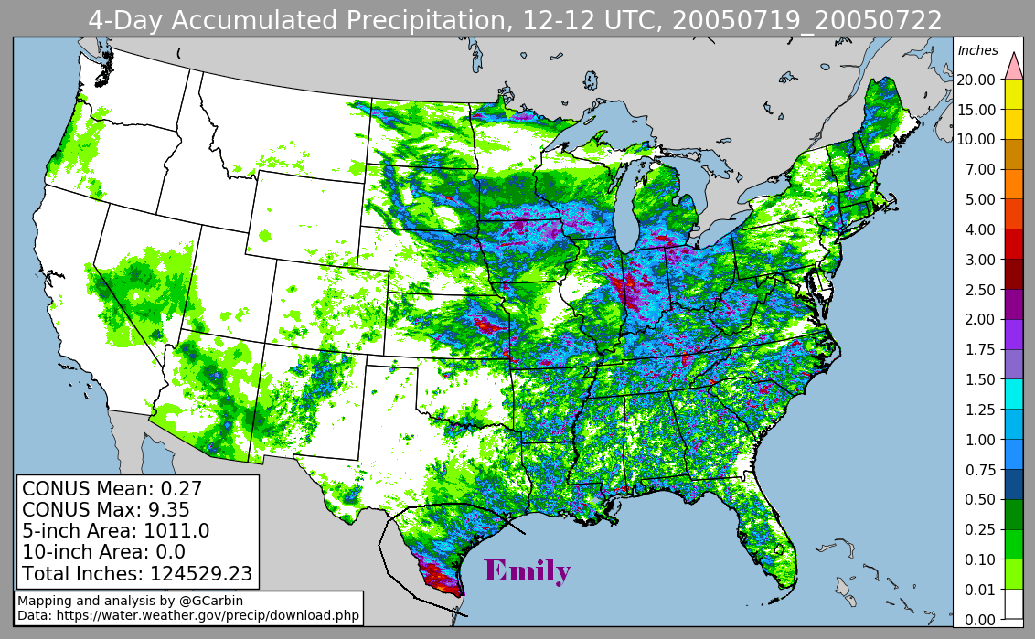
The graphics below show the storm total rainfall for Emily. The first three are based on rain guage
observations while the fourth uses radar estimates. Note the maximum amounts are along the United
States/Mexican border due to the cyclone track lying south of the border inside northeast Mexico.
 |
 |
 |
 |
Daily calendar of rainfall from Hurricane Emily, ending at 12z, or 7
a.m. CDT in the morning.
| Sun |
Mon |
Tue |
Wed |
Thu |
Fri |
Sat |
| 20 |
21 |
22 |