Erin formed from a tropical wave that crossed from the coast of Africa to the tropical eastern Atlantic Ocean
on July 22nd. A large area of disturbed weather and two distinct low-level circulation centers accompanied
the wave. The circulation centers were oriented from northwest to southeast and moved in tandem toward
the west-northwest over the following five days. By the 27th, both circulations generated deep convection
a few hundred miles to the northeast of the Leeward Islands. A day later, satellite meteorologists assigned
Dvorak technique T-numbers of 1.5 to the trailing cloud cluster. These numbers increased to T-2.5,
potentially indicative of a tropical cyclone with tropical storm force winds by midday on the 30th.
In reality, although the cloud pattern was slowly consolidating and surface pressures were falling
ahead of the system in the Bahamas, development was retarded by southwesterly vertical wind shear
associated with an upper-level low that was moving southwestward at 10-15 knots across Florida.
Aircraft data on the 28th, 29th, and again during midday on the 30th indicated that the system did not
have a closed circulation at low levels. Instead it was a very vigorous tropical wave with winds speeds
around 45 mph reported from ships in the northern part of the cloud pattern. Because of the system's
potential for development and its close proximity to the Bahamas and Florida, a special nighttime
reconnaissance mission was flown by the Hurricane Hunters late on the 30th. The first vortex
message was transmitted shortly after 9 pm EDT on the 31st. From that information it is estimated
that the system became Tropical Storm Erin at that time.
The upper-level low near Florida affected Erin's movement and
development.
Associated steering currents
accelerated Erin from
6 to 17 mph and diverted the cyclone around the northeast side of the
low. The
temporary and fairly subtle change of heading from west-northwest to
northwest might have been
insignificant if Erin had not
been so close to land. Instead, the track of the center was deflected
to a course that was over or near much of the Bahama Island chain and
then toward a landfall over
east-central (rather than southeast) Florida. As this occurred, enough
shearing persisted to permit only
slow strengthening. On the evening of the 31st, Erin became
a
hurricane while centered near Rum
Cay in the Bahamas. A ragged-looking
eye appeared on satellite pictures on August 1st. Erin
made
landfall very early on the 2nd near Vero Beach, Florida as a
Category
1 hurricane on the Saffir/
Simpson Hurricane Scale, with estimated maximum one-minute wind speeds
of 85 mph.
Erin's track bent back to west-northwest while the cyclone crossed
the
Florida peninsula during the
morning and early afternoon of the 2nd. The cyclone weakened to a
tropical storm with 60 mph winds
during that period, but remained well-organized. Upon emerging
into the eastern Gulf of Mexico,
Erin reintensified on a track that
gradually swung back to northwestward at about 12 mph. Final
landfall occurred near Pensacola, Florida during the late morning of
the 3rd.
An eye had redeveloped
but upper-level outflow was not particularly impressive on satellite
images. Erin contained 100 mph
winds (Category
2) in a small area of its northeastern eyewall when that part of
the hurricane came
ashore near Fort Walton Beach in the western Florida
panhandle. Erin weakened to a tropical storm
in southeastern Mississippi overnight on the 3rd/4th. It was a tropical
depression
when its track
shifted to the north on the 5th and the east on the 6th.
The depression merged with a frontal system
over West Virginia on the 6th.
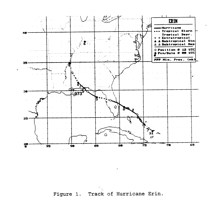
Its track is below, courtesy of the National Hurricane Center.
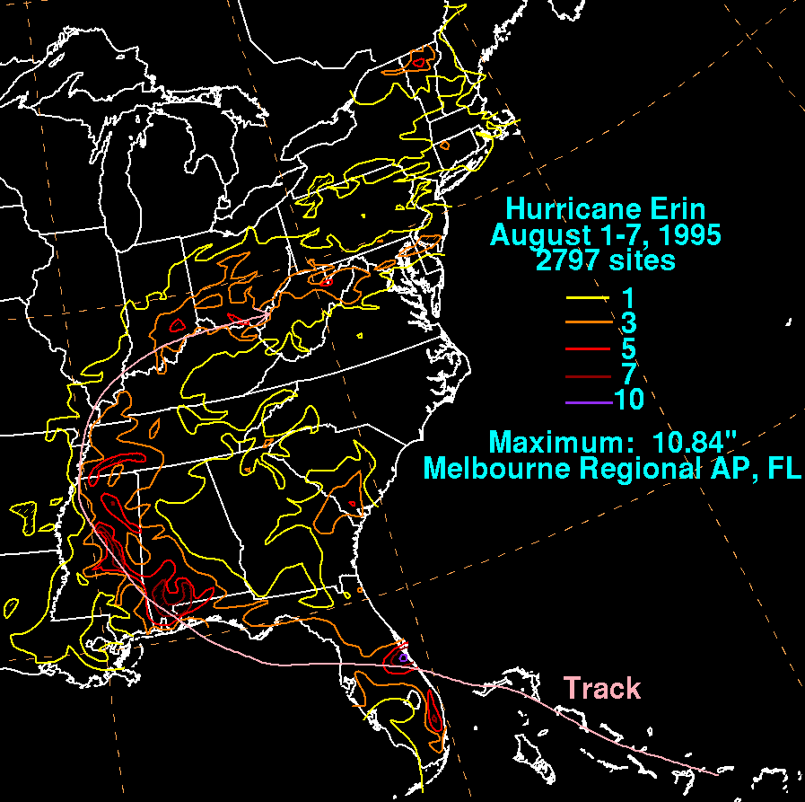
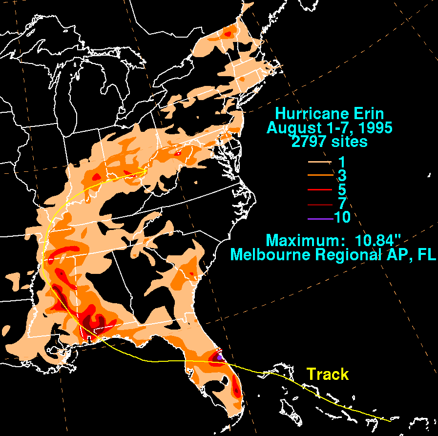
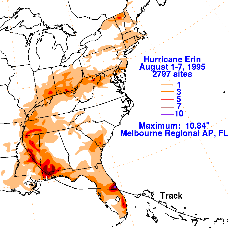
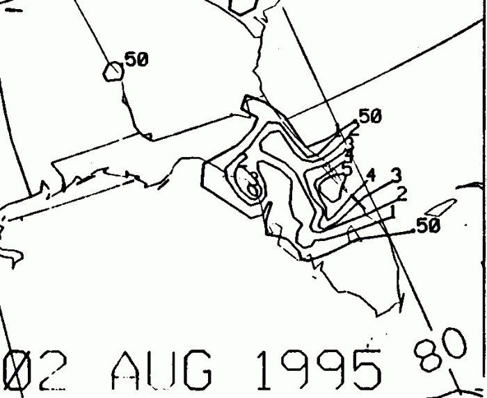
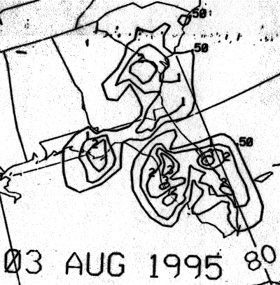
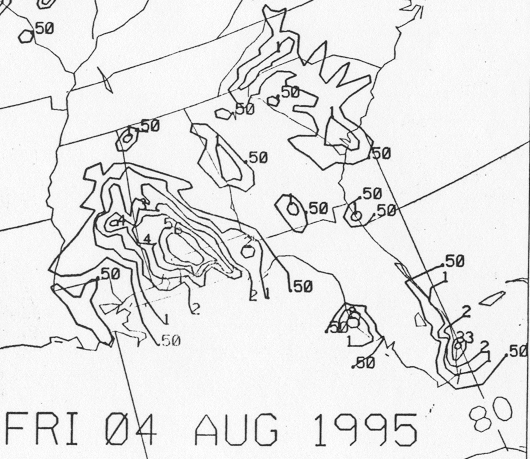
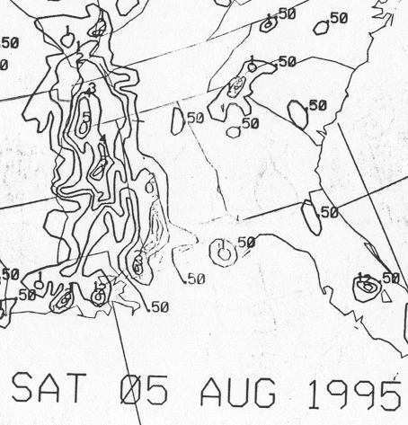
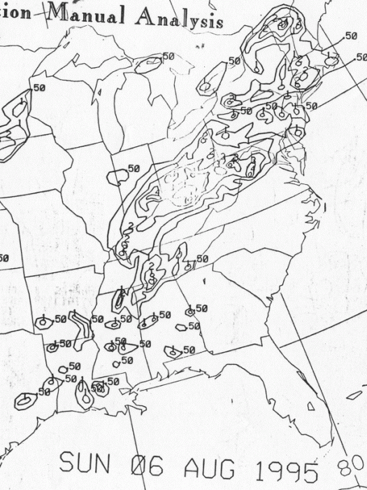
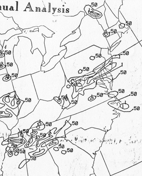
The graphics below show the storm total rainfall for Erin...data
provided
by the National Climatic Data Center
in Asheville, NC.
 |
 |
 |
Below is the calendar for Daily Precipitation Maps. Note that
the 24-hour periods end
at 12z that morning.