A tropical wave moved offshore western Afrian on October 22nd. It moved west for a week with an area of disorganized showers
and thunderstorms. As it approached the Windward Islands on the 29th, it showed signs of organization. On the 30th, while moving
west-northwest, development continued and by the afternoon of the 31st, a tropical depression formed south of the Dominican Republic.
High pressure to the north kept its track west to west-northwest, with Eta becoming a tropical storm late on the 31st southeast of
Jamaica. Intensification accelerated within a favorable environment, with hurricane status achieved late on November 1st south of
Grand Cayman. Eta became a major hurricane on the 2nd and peaked in intensity just offshore Puerto Cabezas, Nicaragua. Ridging
to its northwest increased which forced a southwest turn, with the hurricane stopping a short distance offshore Nicaragua on the 3rd.
A turn to the west-northwest occurred that afternoon, which finally led to landfall. Eta weakened into a hurricane, then tropical storm,
as it moved across northern Nicaragua. Tropical depression status was regained late on the 4th east of Tegucigalpa, Honduras. The
system drifted across Honduras on the 5th and emerged offshore that evening. An upper level cyclone moved towards the system
from the Gulf of Mexico which led to an east-northeast turn. It became a tropical storm again very early on the 7th. Moving
around the upper low, Eta moved across Cuba midday on the 8th before moving into the Straits of Florida. It made landfall
on the Florida Keys very late on the 8th. Moving west into the Gulf of Mexico, Eta made a cyclonic loop north of western Cuba on
the 10th. After starting to move north on the 11th, Eta regained hurricane status briefly. As a tropical storm, the system made
landfall near Cedar Key early on the 12th. It moved northeast into the Atlantic offshore Georgia on the 12th. Slightly reintensifying,
Eta became extratropical in the western Atlantic, becoming absorbed by another low offshore the Northeast on the 13th.
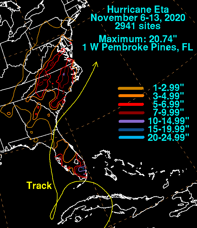
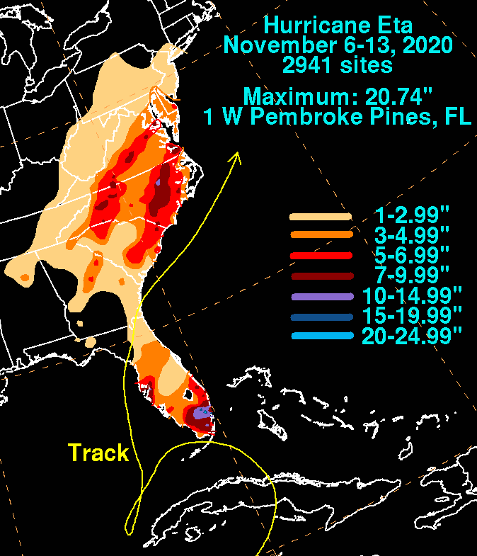
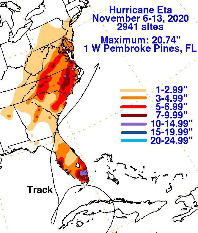
The graphics below show the storm total rainfall for Eta, which used rain gage information from the National Weather
Service River Forecast Centers, Forecast Offices, and CoCoRAHS.
 |
 |
 |