A tropical wave moved across the Atlantic, accompanied by an area of low pressure. The system began to
organize near the northern Leeward Islands and Puerto Rico before it was determined that the system had a
well defined center. The system was then classified as a tropical storm, named Fay, on August 15. Fay moved
westward, crossing southern Hispaniola and across central Cuba before emerging into the Florida Straits. On the
18th, Fay strengthened while passing ove Key West, and then struck Cape Romano as a moderate tropical storm.
As conditions aloft remained ideal, Fay's structure continued to improve after landfall, forming an eye feature.
Observations from South Florida Water Management District reported higher winds over Lake Okeechobee then
any location prior to landfall, which allowed the National Hurricane Center to increase Fay's maximum sustained
winds while crossing central Florida.
Moving north-northeast, Fay subsequently weakened as it moved offshore near Melbourne on the 19th, then stalled,
dropping heavy rains for a prolonged period along the coast of east-central Florida. Fay moved back ashore near
Flagler Beach on the 21st, moving slowly across the northern Florida peninsula before emerging into Appalachee
Bay on the 23rd. Fay made landfall again near Carrabelle, and slowly weakened while finally moving inland.
The system briefly dropped southwest and stalled over Mississippi on the 24th as the tropical depression waited for
the next upper trough and frontal system to steer it back to the northeast on the 25th. Fay became an extratropical
cyclone on the 26th, bringing heavy rainfall to the southern Appalachians. By the 28th, the low pressure area
associated with Fay dissipated across southern Ohio, absorbed by an approaching cyclone from the west.
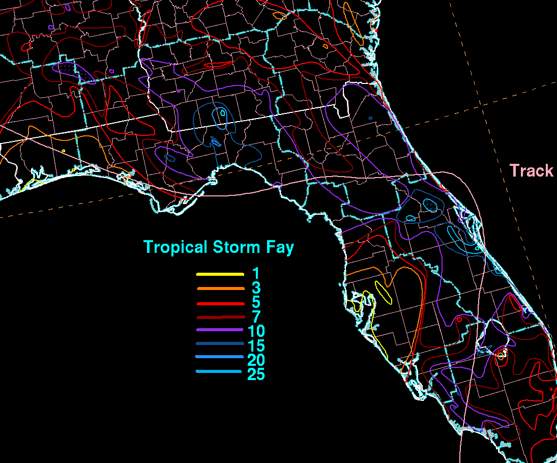
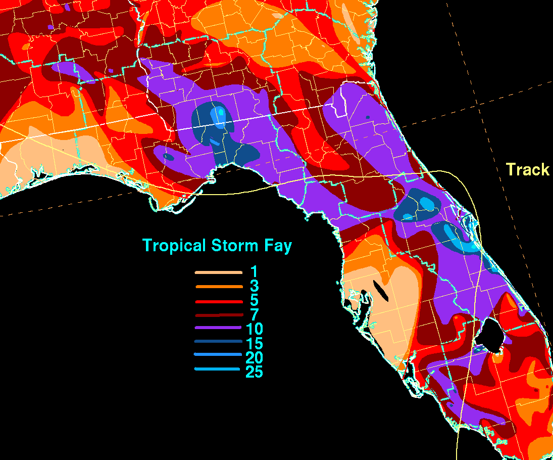
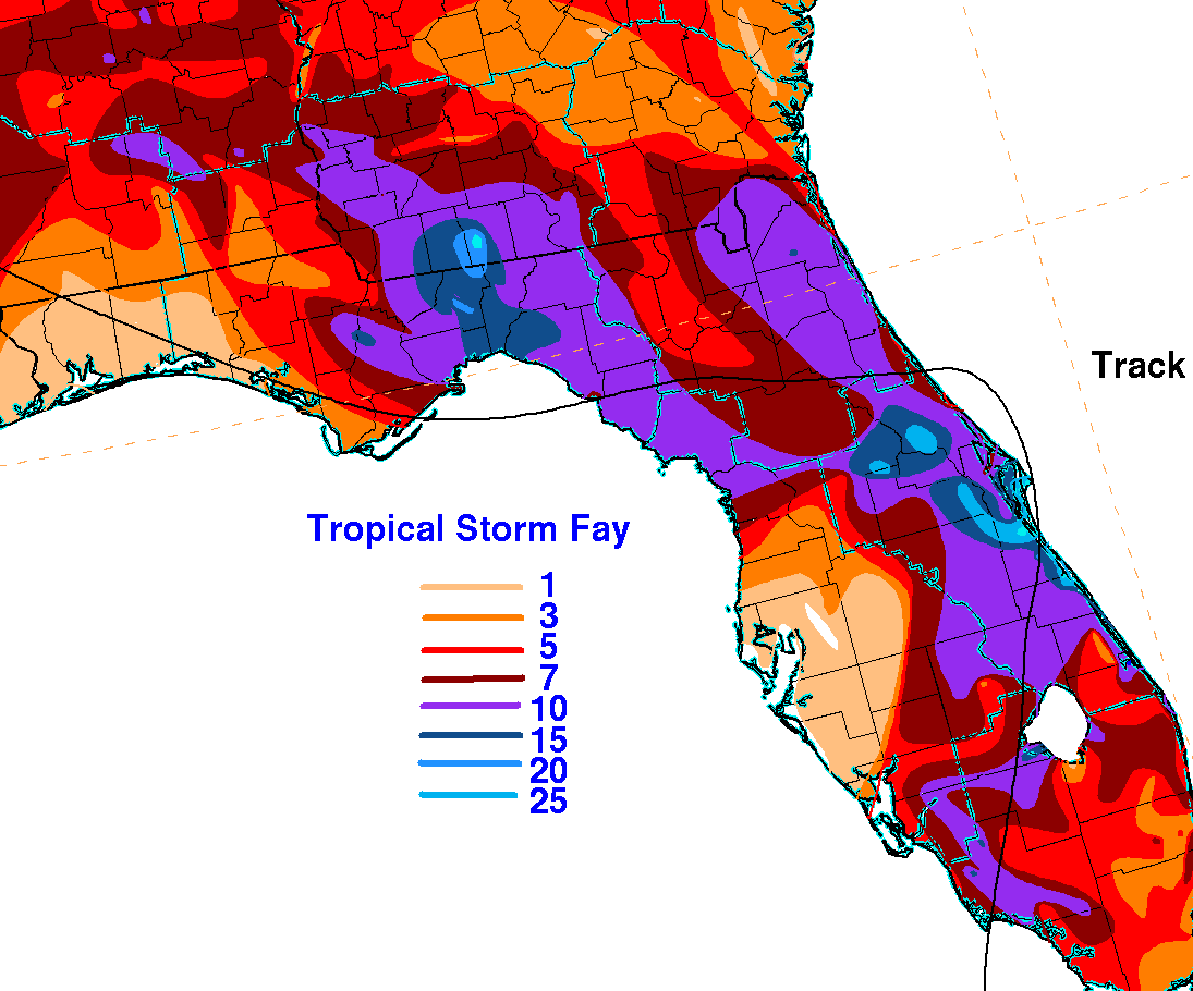
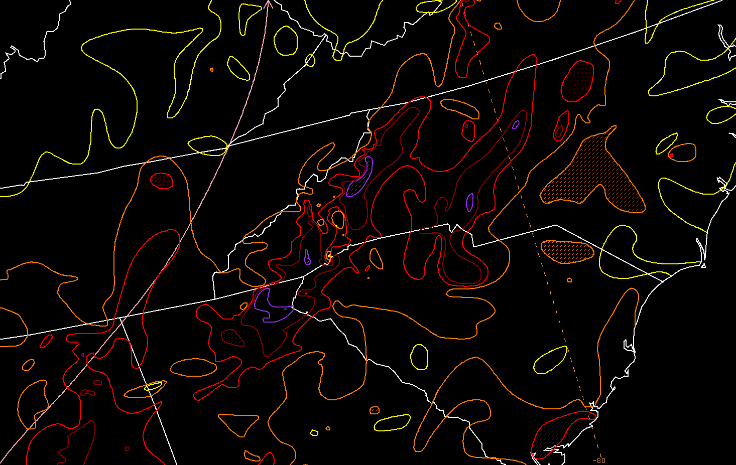
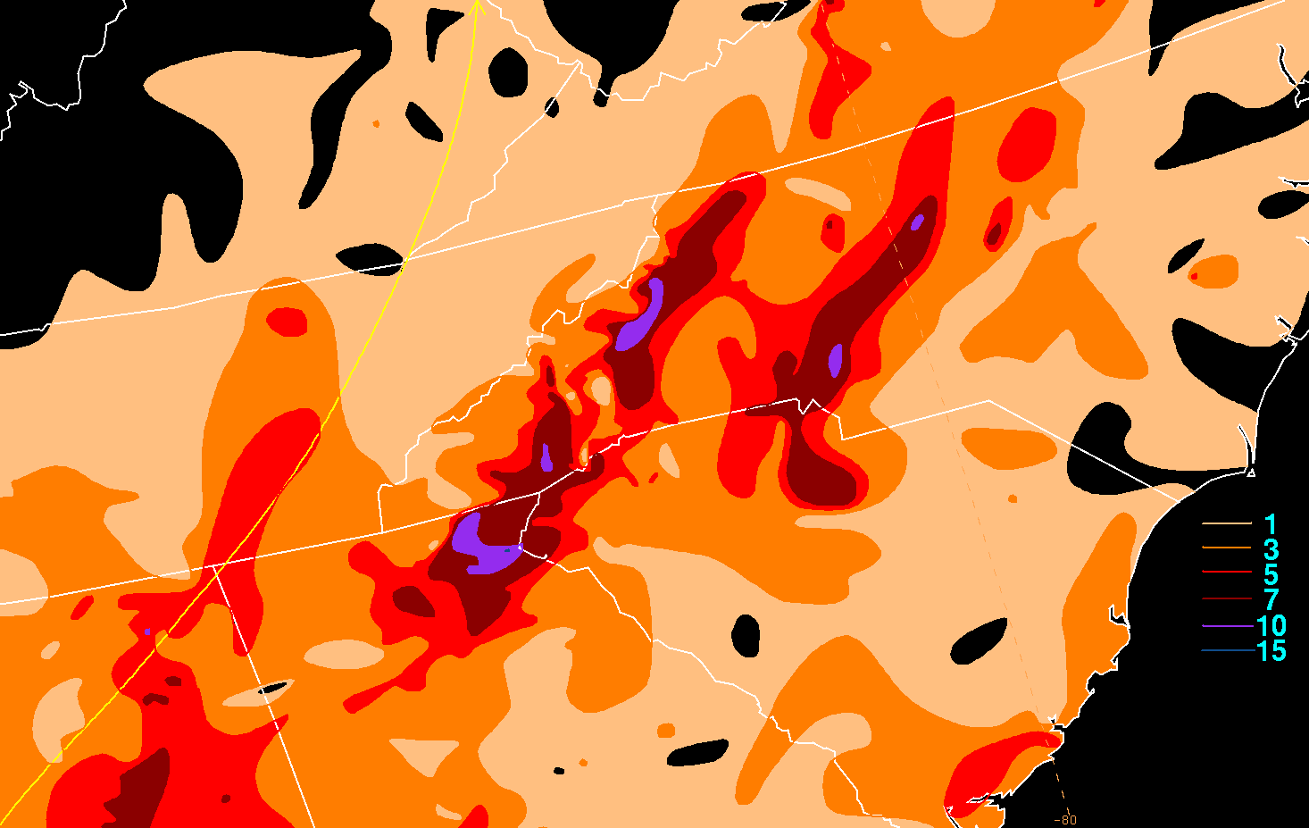
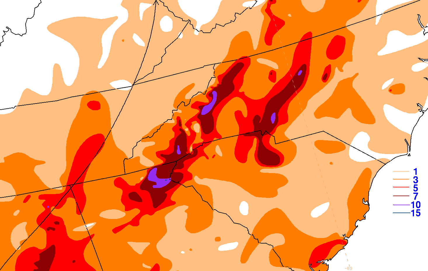
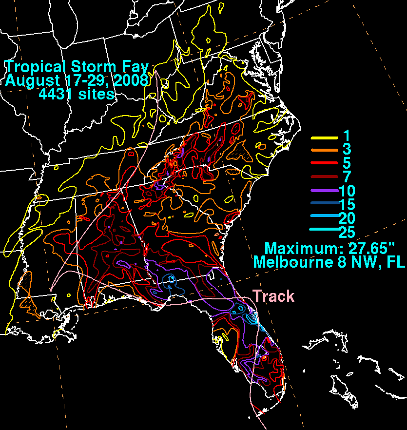
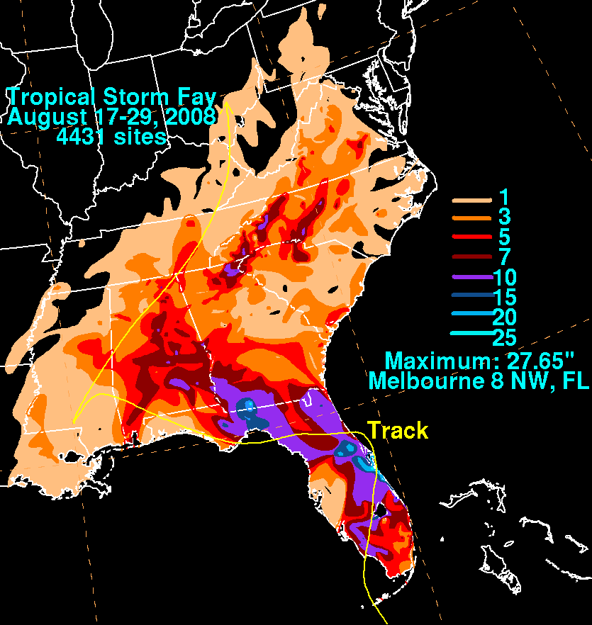
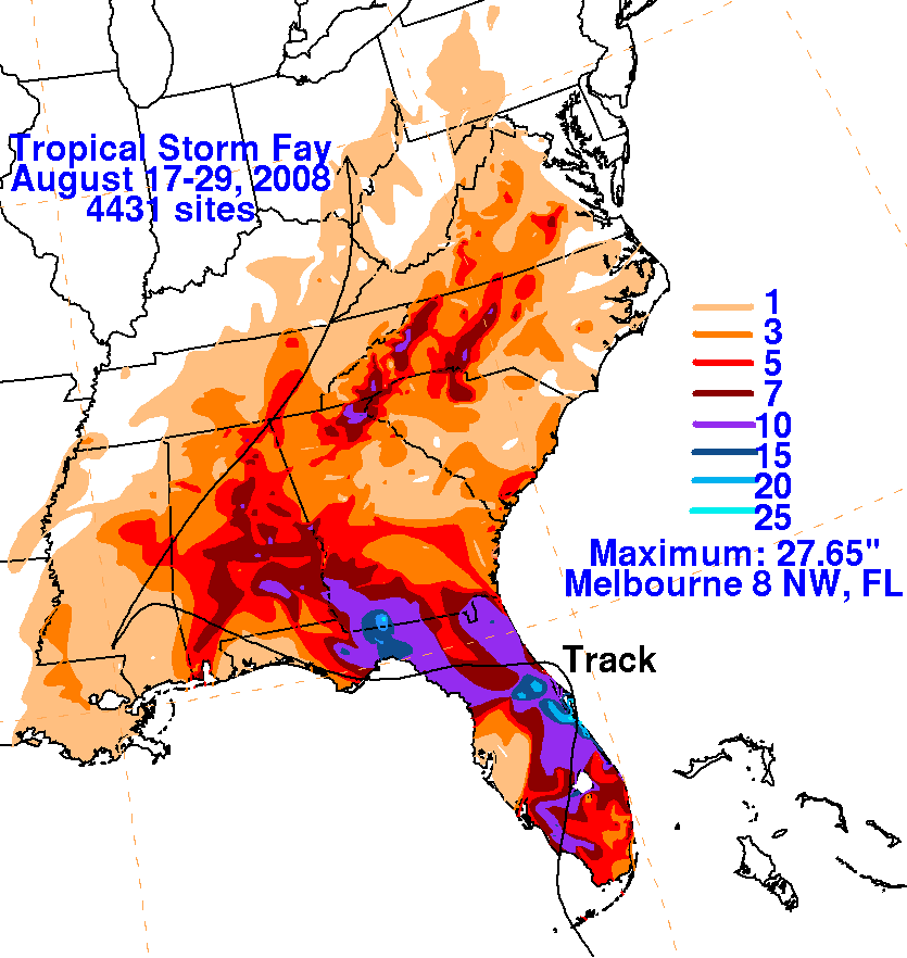
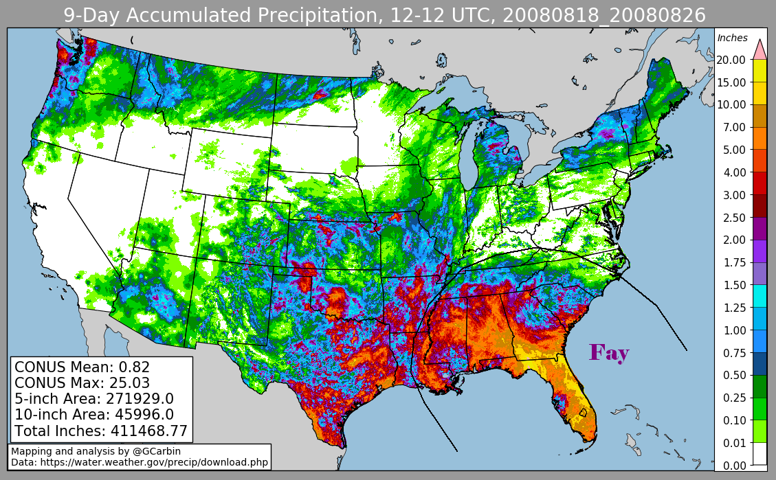
Below are the overall storm total graphics associated with Fay. Rain guage data for the first three was compiled from the National
Weather Service River Forecast Centers, and storm reports from the Miami, Melbourne, Tallahassee, Mobile, and Greenville-Spartenburg
Forecast Offices. The fourth image includes radar-derived information.
 |
 |
 |
 |